
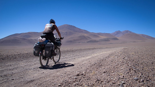
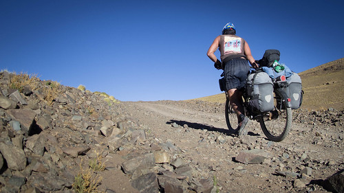
In riding the Puna I feel as if I’ve been first to the bike touring buffet with an Alan Partridgesque big plate. A 180,000 square kilometre (69,000 sq mi) area of arid high plateau averaging 4,500 metres (14,800 ft) elevation the Puna is a dramatic and lonesome landscape of everything that is different from what I used to know. Vistas so seamless and perfect they look airbrushed and with the atmosphere of a confident landscape at peace with itself. Small birds dart about, beetles pootle around the sandy terrain and beyond a certain altitude small clumps of luminous grass dominate the eye. In November the deep blue skies are sometimes accompanied by white clouds and the long evening sun sits serene above vicious winds. But the Puna is changeable, it holds its own rhythms and mystery’s and it is these that riding a bicycle through the area really provides unique access to.

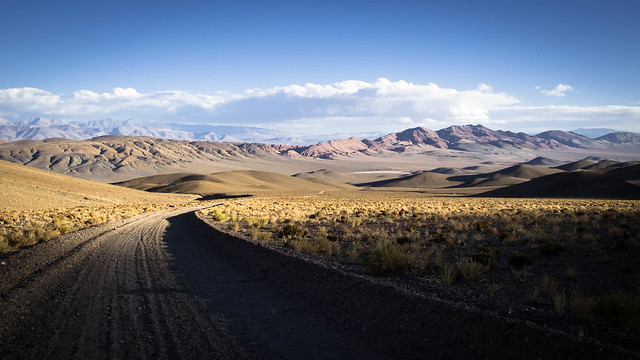
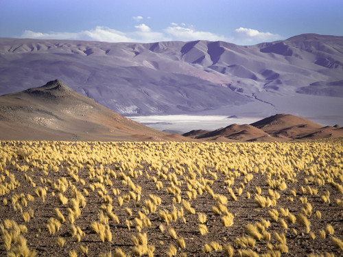
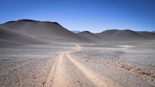
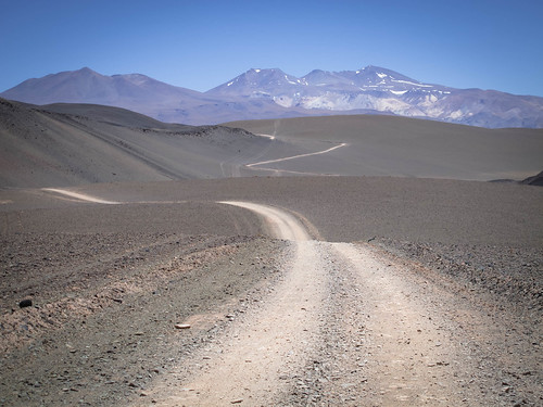
From salt to snow… the undulations and colours of the Puna make it a priviledge to explore. Here looking back on the climb from the Salar de Antofalla
As I mentioned in my last post, the Puna has been on my wish list ever since Neil and Harriet Pike achieved the incredible with their ‘Puna 9’ expedition earlier this year. It is an area I know they love and now having been there I can tell why. The principle reason for my absorption in the Puna is its tranquility, here ‘nothing’ really means nothing; no dickheads taking your picture without permission, no loud trundling lorries to coat you in dust and no campesino’s dogs to ruin your day. There is no fresh water, no villages, no shops, phones, internet or medicine. Everything you think you need is absent, including other people. The Puna demands you take responsibility for everything and this is what tips it over the edge of being a pretty landscape into becoming my kind of paradise.
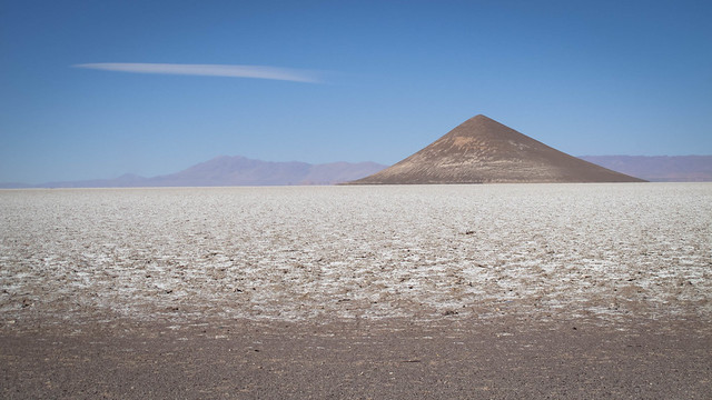
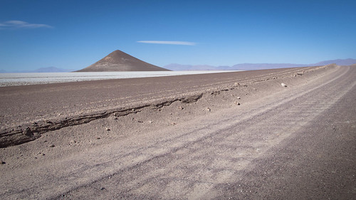
Although lacking the sparkle of the Salar de Coipasa or vastness of the Salar de Uyuni, Argentina’s largest salt flat, the Salar de Arizaro has its own distinct beauty. The 122 m high Cono de Arita is perhaps its single biggest tourist attraction
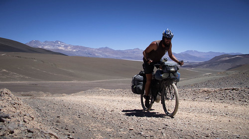
It is the challenge of self-sufficiency above anything else that attracts me to soloing remote routes like these in the Puna. Nothing turns me on like being alone on a bike in a place where only I can guarantee my safety. That feeling drives me to find new and challenging routes and is what has come to inspire me in this phase of my life. I love the commitment of complete personal responsibility, it sharpens my being and makes me feel incredibly alive. Riding alone and so completely independent releases me to just focus and feel. With nothing and nobody to cloud my mind or blunt my synapses I’m free to in-hail fresh landscapes and become one with what feels like every tick of my being. As with other routes, the climbs still open up new exciting vistas and the descents still thrill, but when out surfing solitude all these things gain purity and significance. With no sharing, no compromise and nothing to distract intensity, the whole experience can become almost spiritual.
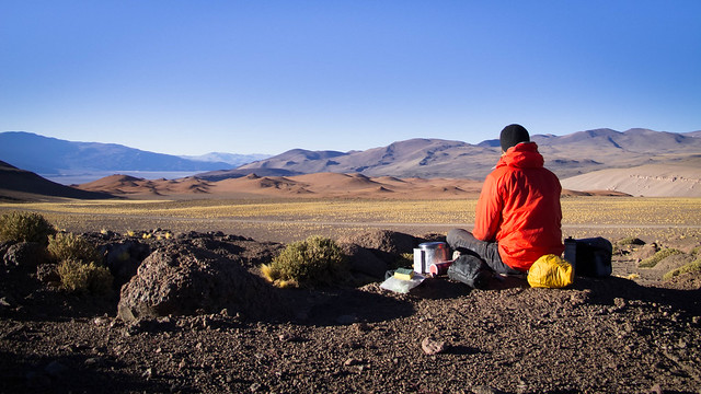
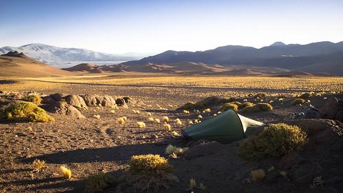
Morning often (but not always) brings a different world to the one I make camp in. The afternoon winds are extremely strong making shelter a necessity rather than choice when it comes to pitching camp. The stillness of morning by contrast brings a welcome tranquility. Here eating breakfast before descending down to Antofalla
Aside from the remoteness I’d say the Puna winds are the areas biggest challenge. These switch on about 11 am and continue to crank up throughout the remainder of the day. Often by mid afternoon and always by camp o’clock I’ve found them to be ferocious, easily the strongest I have ever encountered. In a land with no trees, few bushes and no people the wind is hard to see, you can not see it in photographs. But it is there, sometimes helping and sometimes hindering your progress. In the Puna, when looking for a camp spot it is the wind you want to hide from, not people. These winds may not be too cold, nor particularly harsh but they can be very persuasive.
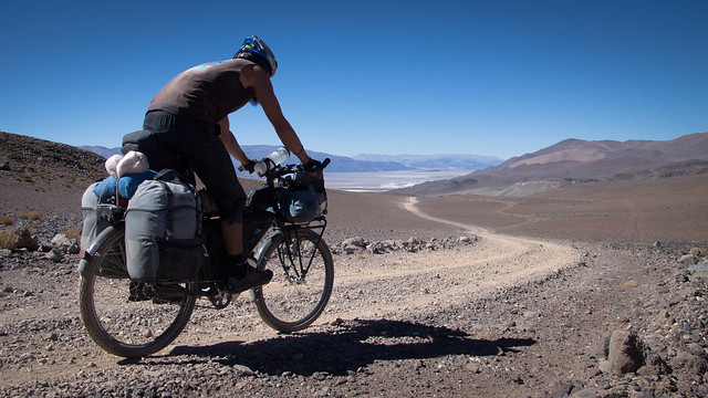
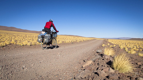
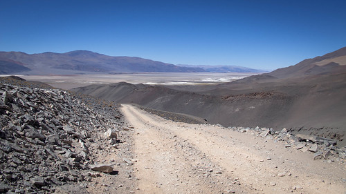
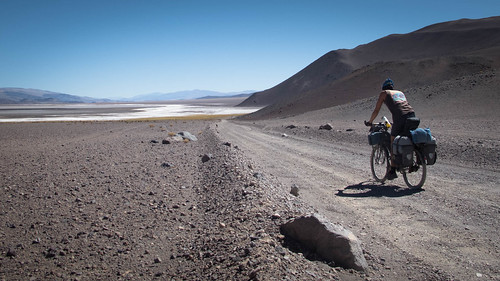
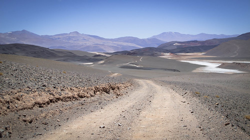
I like my routes to have climbs, they bring an exciting change of landscape that keep the cycling fresh and inspiring. Here descending down to the Salar de Antofalla
Arid, windy and intensely sunny, outwardly the Puna sounds like a harsh place to ride and in many respects it is. But humans are adaptable and I find myself quickly absorbing the natural rhythms of the environments I choose to explore. In extreme places there is no choice but to adapt your routines and expectations to suit the surroundings. In the Puna this comes incredibly easily as somehow it manages to burrow into your emotions. I think I’ve molded to the demands of the Puna more efficiently than in any other area I’ve cycled. I’ve ridden through rainy seasons where I’ve been forced to abandon my day by about 3 pm and I’ve spun through the sharp ups and downs of Peru’s finest Andes. But the subtle eccentricities of the Puna have grabbed me. Sure it’s a drag carrying three days of water, but by the third day the bike feels great. And yes the road conditions are near universally tough, but a slight tweak of expectations can make that challenge really fun.
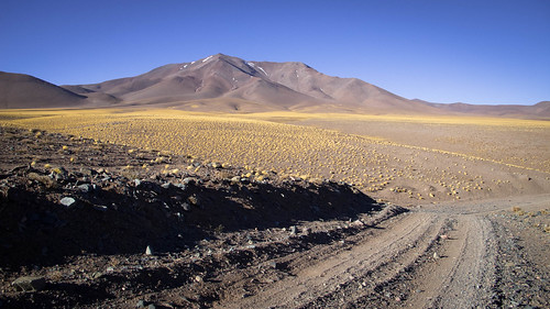
Shapes, textures, shadows and shades of colour are what the Puna are about. Camped up just off the edge of the Salar de Antofalla
But environmental factors aside, I suspect the biggest challenge for most people and the principal reason why so few cyclists explore the Puna is the almost complete lack of people. Not seeing anybody all day has become quite standard during my time there, which fortunately for me is a very positive situation. Whilst other cyclists might search out culture and society, I seek solitude. Lonesome and solitary wanderings are for me the purest form of cycle touring. There is no ego, nor is there fear, just a series of incredible ‘moments’. On the better routes, like those of the Puna, these ‘moments’ can blend together in a very special way.
When evening arrives and the sun sinks the Puna comes alive. High altitude grasses shimmer and deep dark chasms open up all over the place. On the descent from Quebrada del Diablo
Somewhat counter-intuitively I also find it easier to tour remote areas alone than with a partner. When soloing routes I manage to sustain a level of positivity that I cannot even find when riding with another. Keeping a positive state of mind means that potential excitement needn’t become possible trepidation and the complete reliance on myself loses its scary side. This has helped give me the complete confidence necessary to enjoy solitary remoteness. Such confidence is vital and has been hard-won with experience, preparation and through many previous mistakes. The fact is that when you know you know what you’re doing, there is no reason to get intimidated. With no worries, solid routines and proven processes, it becomes easy to let loose and start sucking the sexy side out of solitude.

Route from Tolar Grande to Antofagasta de la Sierra… click here to view the fully interactive map, elevation profile and download the GPX track
Tolar Grande to Antofagasta de la Sierra Route elevation profile
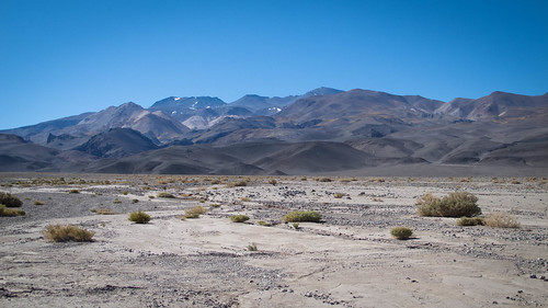
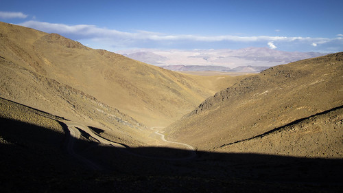
In only a thousand vertical metres in the Puna you can be transported from stark and dry salt flat through a myriad of colored rock strata and desert sands, up narrow winding valleys of salt marsh and greenery into a striking yellow world of clumpy grasses. There is a kaleidoscope of colors to keep your attention and always undulations to hold your curiosity. Riding there is incredibly exciting and it is hard to do the experience justice with pictures but even so, here is the story of my 5 day, 270 km ride south from Tolar Grande to Antofagasta de la Sierra…
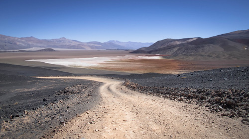
I leave Tolar Grande back down the road that delivered me there. After an initial burst through some humpy bumpy hills I approach the Salar de Arizaro…
… where the road surface deteriorates into hard and annoying corrugations
Riding around the south side of the Cono de Arita it comes as a relief to turn east out of the headwind that has been haunting me
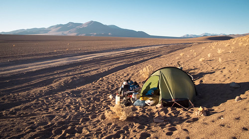
By camp o’clock I’ve left the Salar de Arizaro behind and have started to climb. It takes a while but eventually I find a hollow by the road that offers up just enough shelter to camp
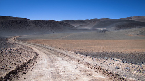
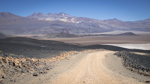
The next day is a climbing day…
… delivering me gradually up…
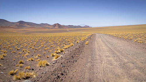
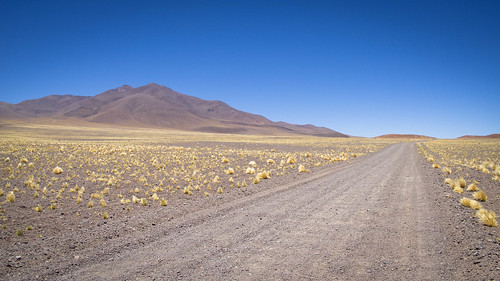
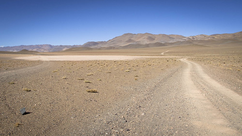
… into the higher altitude world of striking yellow grass…
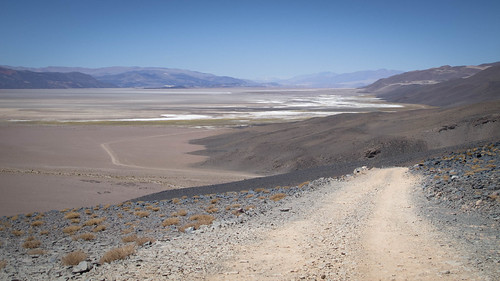
… towards my first distant views of the Salar de Antofalla
The sandy and rocky road means I’m in the saddle 6.5 hours before finally reaching the high point (4,275m)…
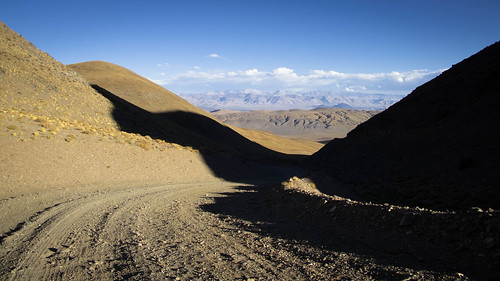
… and start descending through a magnificent evening light
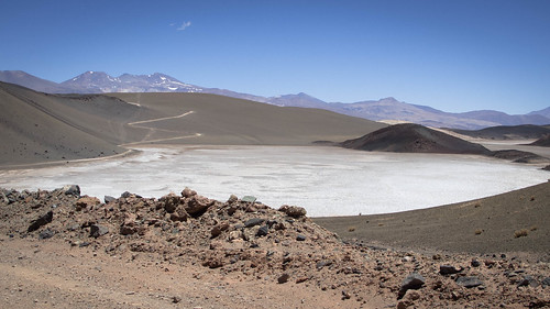
With the Salar de Antofalla stretched out below my choice to camp high really pays dividends come breakfast time
On routes like these you have to get your head around the fact that descents will not necessarily be quick. Not quick but still a thrill…
… the landscape evolving quickly…
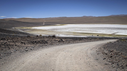
… as I drop onto the Salar de Antofalla
A quick detour into the hamlet of Antofalla for water…
… and I spend the rest of the day skirting the west side of the salar
A couple of short climbs inject some interest into the afternoon…

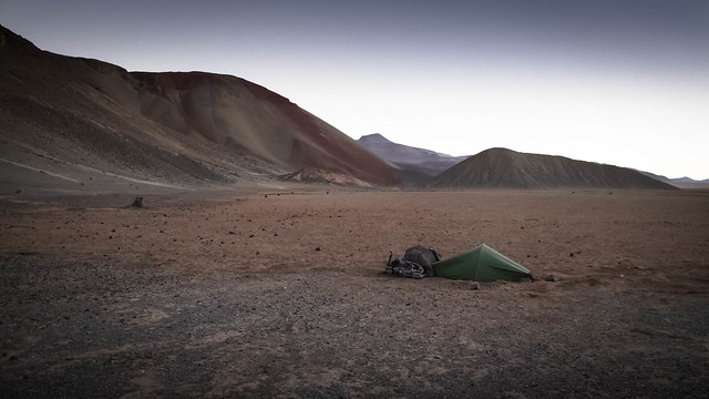
… before the clock once again strikes camp time and I set about finding a home for the night. With the wind whipping off the salar and precariously hanging rocks all over the place it’s a tough spot to find. Eventually I settle behind this cone and brace myself for a windy night
With morning I turn my back on Volcan Antofalla and head across the salar…
… to begin the climb up to Quebrada del Diablo
As the Salar de Antofalla shrinks below…
… and Volcan Antofalla becomes an increasingly distant friend…
… I thank my lucky stars that I’ve finally got a good run of decent road surface
I’m riding with a huge smile as the climb undulates past patches of salar…
… on a swooping course…
… up, then up again…
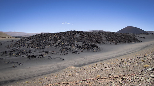
… through a starkly volcanic landscape…
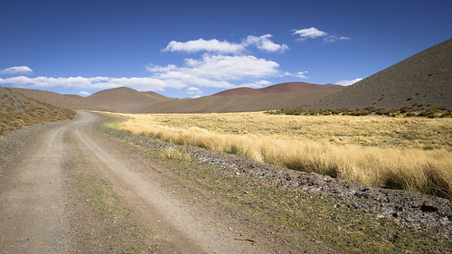
… into what feels like a different world. The topography slowly closes in before eventually sandwiching the road into tight valley. Here it is full of life, I see a donkey, the plants thrive and clouds of flies hover annoyingly around me
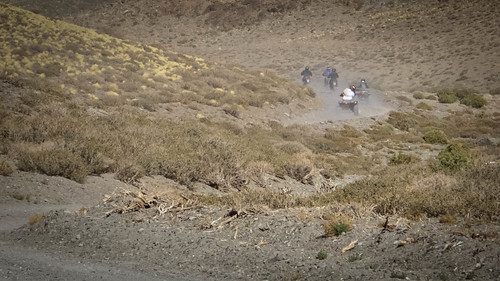
The final few kilometers ascent are tough and I’m embarrassed to be caught pushing by a convoy of local petrol heads
But I have no choice, the bike is heavy, the road slippery and the gradient steep
With the sun quickly dropping cresting the pass (4,227m) comes as a bit of a relief
The views from the top are terrific and I’m excited to see a Peruvian style descent…
… down through the cold shadows…

… and glorious evening sun…

… into camp. Initially pleased to have found a gully to shelter in my glee quickly disappears as the wind switches to spend the rest of the night channeling directly down towards my defenseless tent
As usual in this part of the Puna, tomorrow is a another day and the windy battles of the previous evening forgotten with the arrival of more sedate blue skied morning riding
Having descended from camp I enjoy a fun little stretch of climbing that drops me down to Laguna Colorada…

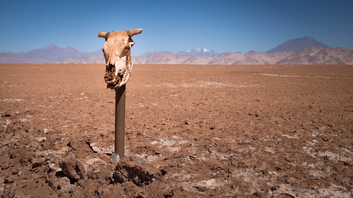
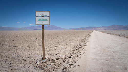
… where signs proudly proclaim the way to the Devil’s Ravine…
… and then to within sight of the green oasis that is Antofagasta de la Sierra
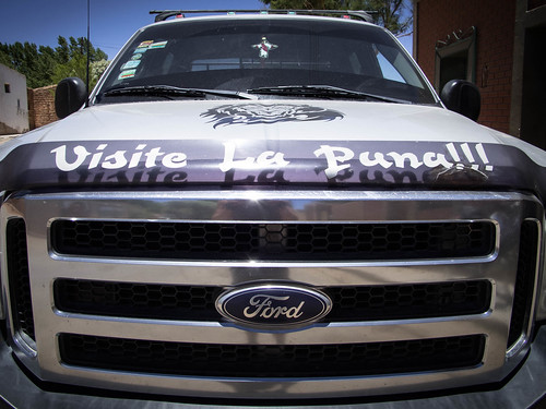
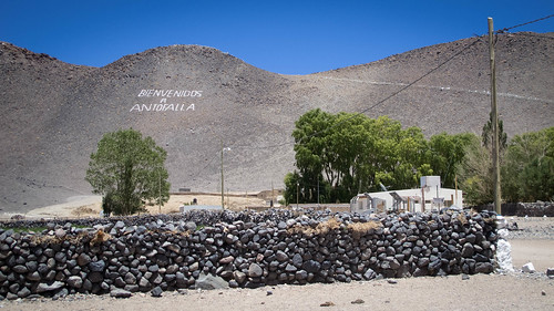
A small town of big trucks, Antofagasta de la Sierra is proud and growing. Following another fantastic leg of out of this world Puna riding, I can’t help but agree with this slogan. Having seen my pictures how can you not want to visit the Puna?
Route Tips
5 days, 270 km (168 miles), 2,950 m (9,680 ft.) of climbing
Although generally glorious this route contains a mixed bag of riding. The roads are in universally poor condition, usually corrugated and often sandy. So expect to be putting in a lot of hours and a bit of pushing. The exception is the first day out of Tolar Grande during which it is easy to lay down some distance on the Salar de Arizaro. Despite the challenge I’d highly recommend riding this way from Tolar Grande to Antofalla and then up over Quebrada del Diablo to Antofagasta, to anyone with previous remote road or desert riding experience. The section of road from Tolar Grande to Antofalla is seldom cycled due to the easier route option that lies to the east, running south from the Salar de Pocitos down through Antofagasta de la Sierra. There are two routes from the tiny 15 family hamlet of Antofalla over to Antofagasta de la Sierra. The commonly used one is a bit shorter and easier than the route I chose down the Salar de Antofalla and over Quebrada del Diablo. Thus the Diablo route has hardly been ridden before, if at all.
But be warned, this isn’t the kind of route you can freestyle off someone elses route notes. Even with the aid of mine and others notes you should be doing your own TRIP (thoughtful research and intelligent preparation). Study satellite images, become acquainted with the route beforehand and figure yourself out a game plan. From experience you should know how well you ride on hills and bad roads, use this to figure out how much food and water you should be carrying. This is entirely your responsibility so don’t rely on what I say here. These routes aren’t for any old clown to jump on with inappropriate amounts of gear or experience. Route notes are only ever a guide and never a gospel, so don’t come crying to me when there wasn’t the popsicle stand you were expecting at the top of every climb.
Food
This is a remote route through the Puna de Atacama so don’t expect any services. That said it is possible to get meals made, find a bed and connect to wifi in Antofalla. You’ll need to stock up with all the food you think you’ll need in Tolar Grande. There are a couple of decent tiendas between which you can easily find everything you need. In such a sunny region I’d also recommend taking the Pikes advice and sun drying yourself some moral boasting fruits and vegetables.
Water
Water is heavy but necessary (1 litre being 1 kg). I chose to carry my full complement of 2.5 days water out of Tolar Grande because I knew the riding would be initially flat and didn’t fancy having to detour to a mine. You needn’t do this if you’d prefer to collect water from Camp. Mansfield Minera or Camp. Reguius which lie just up hill from a turn about 74 km from Tolar Grande (on the southern side of the Salar de Arizaro). Not one to take chances with water I also left Antofalla with a full load, enough to reach Antofagasta de la Sierra. I was told in Antofalla that there is water on the way up to Quebrada del Diablo and there was water there (in the region of 72km from Antofalla). However, to me it tasted quite saline and made me glad I’d made the decision to haul.
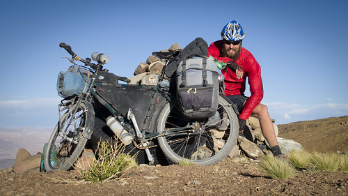
If you are intelligent with your water then 5 litres a day will be adequate for everything (cooking and on bike). My carrying capacity was 15.5 litres spread over a 10 lt MSR dromedary bag, my usual 1 litre bike bottle and 1.5 litre Nalgene. In addition I secured two 1.5 litre Coke bottles on my front rack shelf. Generally keep an eye on how much you have and conserve water with easy steps such as drinking your washing-up water or cleaning things with toilet paper.
Preparation
It goes without saying that you should be doing a lot of navigation and map work before you leave. I would also recommend completely servicing your bike as a mechanical catastrophe could really ruin your ride. As with all fun routes it is also advisable to stay as light as possible. You’ll be adding a lot of weight to your load in food and water so post on anything you know you won’t be needing. A good first aid kit is also recommended. Include antidiarrhoeals in this as if you do experience stomach problems out in the heat with limited water it could become dangerous.
People & Traffic
I encountered five or six mine and tourist trucks on the initial 87 km spin over the Salar de Arizaro. This section seldom feels particularly remote due to the presence of the mine facilities on the south side of the salar. After branching off right (87.4 km from Tolar Grande) up the hill I didn’t see any people or vehicles until I arrived in Antofalla. After Antofalla I saw one private tourist vehicle (an adventurous Swiss family with two young girls) and then nothing again until just before the top of the climb up to Quebrada del Diablo. Everything changed then when I was overtaken by a noisy convoy of 10 motorcycles, 2 quad bikes and 6 support trucks! It was Sunday and some locals were out on a jaunt.
Although not as lonesome as the route over Paso Socompa to Tolar Grande it is still safe to assume on this route that if you get into difficulties there will be nobody around for a while to bail you out. For this reason I programmed the Custom Message on my Spot satellite messenger to alert a few people in the event that I should need help in a non life threatening trouble. Always let people know of your plans before travelling out into remote areas.
Route Information
Here are my route notes for the first half of the route from Tolar Grande to Antofalla:
- 0km (3,522m) – Tolar Grande
- 15.5km (3,495m) – Turn left towards the south
- 73.4km (3,530m) – Stay straight (not right which will take you towards Estacion Caipe)
- 73.9km (3,550m) – Turn left (straight continues to Camp. Mansfield Minera or Camp. Reguius which are clearly visible above)
- 87.4km (3,550m) – Fork right and start to climb
- 114.4km (4,115m) – Stay straight (not right)
- 115km (4,125m) – Stay straight (not right)
- 130km (4,275m) – High point
- 149km (3,380m) – Continue around to the right (left is the other way to Antofalla)
- 149.3km (3,385m) – Continue straight for Antofalla (you’ll return to take the left turn)
- 150.2km (3,384m) – Antofalla
Antofalla is a small hamlet of about 15 families. There are no shops. The first building on your left as you enter the village should be obvious as a community building. Outside of this there is a tap with slightly off-colour but drinkable water. Apparently there is WiFi in this building (I didn’t use it) and if you ask they can organise meals and accommodation for you (again I didn’t use these options).
Here are my route notes for the second half of the route from Antofalla over Quebrada del Diablo to Antofagasta de la Sierra:
- 0km (3,384m) – Antofalla
- 0.5km (3,385m) – Turn right, signed to ‘Las Quinuas’
- 12.5km (3,390m) – Building ‘Puesto de Onas’ on the right
- 18km (3,400m) – Small shelter and potential camp spot on the right
- 26.8km (3,505m) – Top of a small 105 verticle m climb
- 35km (3,300m) – Stay straight (left goes out onto salar and right up to Paraje de Botijuela
- 38.75km (3,300m) – Turn left onto salar at Pinto de Encuentro ‘El Cruce’
- 45km (3,300m) – Stay straight (not left)
- 49km (3,310m) – Start to climb
- 72.6km (3,840m) – Building remains on the left could make a possible camp. There is water around this area
- 82km (4,227m) – High point, Quebrada del Diablo
- 90.6km (3,573m) – Start climb
- 97km (3,748m) – High point
- 107km (3,435m) – Turn right (left signed to Cortaderas, Calalaste and Antofalla)
- 113km (3,368m) – Antofagasta de la Sierra
Antofagasta de la Sierra is a village with many accommodation options, WiFi (albeit very slow), petrol station, shops and restaurants. There is an ATM but it wasn’t working during my stay. My asking suggested there is someone there who will change dollars but he was out of town while I was there. Despite the number of accommodation options I struggled to find a bed when I first arrived. I ended up staying at Comedor Dona Cirila for 80 pesos a night. I’d recommend it, the elderly couple there are hilarious (just don’t get her talking about money). The municipal hotel is decent and 150 pesos a night.

Awesome Nathan! Another well written piece, cheers for all the details.
Pingback: Puna Dreams Pt.3: Rolling with the punches | Velo Freedom - Cycling South·
Pingback: The Salt Road: Trails through the Argentine Puna – It's downhill from here·