
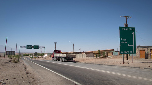
There are three options open to the cyclist sat in San Pedro de Atacama, Chile pondering their way to Argentina. Furthest north is Paso Jama, reaching up to 4,836m this is the high route, it’s also entirely paved and thus often considered the easy option. South of Jama rises Paso Sico (4,458m), reputedly the most attractive choice and fashionable amongst the slightly more adventurous cycle touring set. It is Sico that Cherry “I’m free like [my] wind” Fitzsimmons left me to scale. Then further south still sits Paso Socompa, the runt of the three. Lower than it’s counterparts and all but completely ignored by cyclists, Socompa hasn’t even been ridden enough to have a notable reputation.
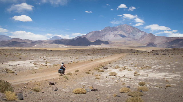
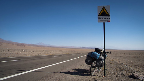
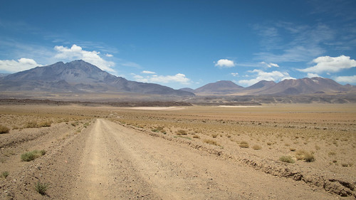
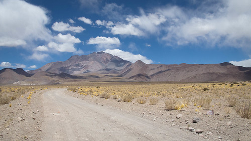
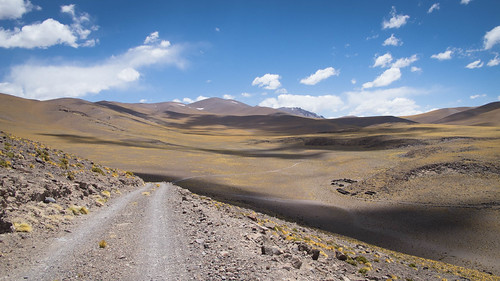
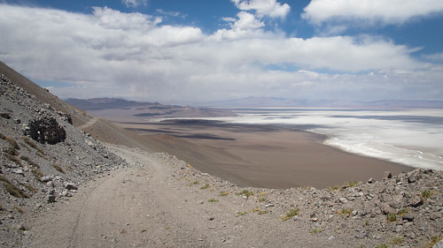
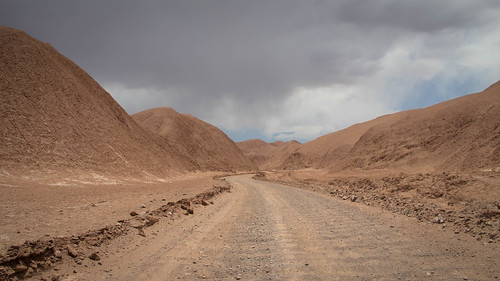
Approaching Volcan Socompa, at this point I haven’t seen another person or vehicle for over 50 hours
Which ever of the three options cyclists choose they enter the Puna de Atacama, the boundary to which runs the same line as the national frontier if crossing Sico or Socompa. A 180,000 square kilometer (69,000 sq mi) area of arid high plateau averaging 4,500 metres (14,800 ft) elevation, the Puna has been high on my wish list ever since Neil and Harriet achieved the incredible with their ‘Puna 9’ expedition earlier this year. Their photos really set my bike juices flowing, portraying an enchanting nothingness of impossibly big and boldly colored landscapes. In my mind the ride over Paso Socompa to Tolar Grande, although enticing, was only ever a warm up for my own Puna route. I saw Socompa as the gateway to some ‘real’ fun in the Puna.
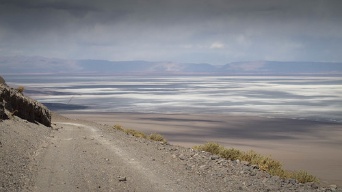
The tonal contrasts in the Puna make it one of the most beautiful places I have ever experienced. Here looking back at Volcan Socompa from Laguna Socompa in the Argentine Puna de Atacama
There are a few obvious reasons why the Socompa route is shrouded in a bit of mystery, namely its remoteness and inaccessibility. I’m sure if there was a story surrounding the Socompa pass it would involve a sensationalism of lonesome tracks through a desert void where there is no one to hear you scream. I think most people mistrust solitude enough to presume it lunacy to haul three days of water at a time and seven days of food through punishing desert heat up into frigid high altitude nights. That might be why you can count on your fingers the number of people who have cycled Socompa in recent years and why it doesn’t have an easily discernible identity. It might also be why I find such promises of lonesome adventure too much to resist.
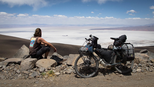
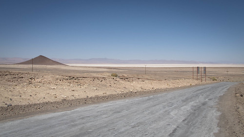
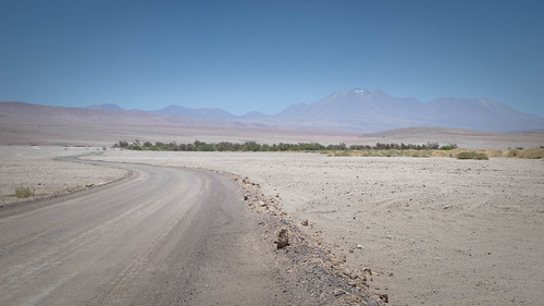
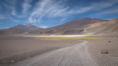
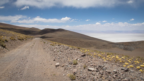
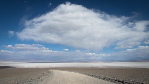
The first views of the Salar de Arizaro definitely provided the money shot moment of this route
I stayed in San Pedro eighteen days to research my route over Socompa and onwards south through the Puna. Pissed off and dejected by the huge disappointment that was riding Bolivia’s classic routes I wasn’t just scouring Google Earth for tracks but also searching my soul for the departed feeling of true bicycle adventure. Bolivia highlighted to me how little interest I have at this point in following well trodden routes. I cannot help but feel a little blunted when knowing of the hordes that have preceded me or disheartened at the sight of others tracks in the dirt. I knew Socompa would offer something different, an intermediate between popularity and adventure. As the person I am, stuck between the desire for companionship and need for solitude, I desperately craved some space. I figured that riding Paso Socompa might offer that and I wasn’t wrong, the solitude was bliss.

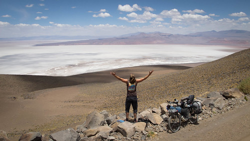
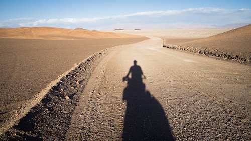
Breakfast by the Salar de Arizaro. The solitude of such landscapes combined with the focus of independent remote riding brings me almost complete inner peace. This is where I am happiest and this is why bicycle touring is so special to me
Despite exhaustive research I had no real idea on leaving San Pedro of the essence of what stretched out ahead. A good route has a distinctive character and comes together in a way that makes you forget how many days you’ve been riding. This Socompa ride is one of those. Like the tracks on a fine LP each days riding compliments the others contributing to a whole that flows together with captivating intrigue. The days build naturally on top of each other, each bringing their own distinct flavors to an already mouth-watering mix. There are definitely memorable moments: The rush of endorphins, the whoops of unadulterated joy that accompanied the dramatic appearance of the Salar de Arizaro, Argentina’s biggest salar. And the gentle dawning that I was onto something special on the final approach to Socompa itself. Yet those headline grabbers are undoubtedly built on a strong foundation of quality and involved riding.

Route from San Pedro de Atacama, Chile over Paso Socompa to Tolar Grande, Argentina… click here to view the fully interactive map, elevation profile and download the GPX track
San Pedro de Atacama to Tolar Grande Route elevation profile
If you’ve gotten the impression I like this Socompa route from San Pedro de Atacama (Chile) to Tolar Grande (Argentina) then you’d be right. I am very much in love with this seven day trundle through desert wilderness, it totally suits my sensibilities. I saw no people or vehicles for about 53 hours before reaching the international frontera and then only one truck a day for the remaining two and a half days. I found the surroundings to be bigger and more striking than on the famed routes of Bolivia and the riding to be more involving. Over these 394km I discovered all the things that attract people to such awe-inspiring environments without having to suffer any of the bullshit that popularity and accessibility brings. Here is the story of what I currently consider to be one of my top five South American rides…
After more than two weeks enjoying the kind hospitality of Guilherme, Katia, Sariri and Catchupin it’s time to say goodbye to the sedating sun of San Pedro de Atacama
After a confusing visit to the immigration office I hit the highway…
… cutting through the heat to lunch in the shade of the next town, Toconao
Flat, paved and into an unforgiving headwind, the first afternoon back gives me my biggest test of the entire route

But by the next morning, as the sunrises on the Salar de Atacama I’m more than ready to start my adventure
A quick spin uphill to Peine to stock up with water…
… followed by lunch in the shady oasis of Tilomonte…
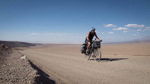
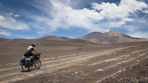
… and it’s time for business. Fully loaded with 3 days of water and seven days of food the first climb up away from the Salar de Atacama comes as quite a shock
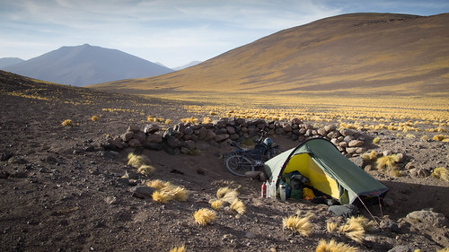
A heavy bike, heat and the vicious afternoon winds make for a weary slog up to camp. With nothing to shield me from the wind I construct a rudimentary (and frankly rubbish) wind break
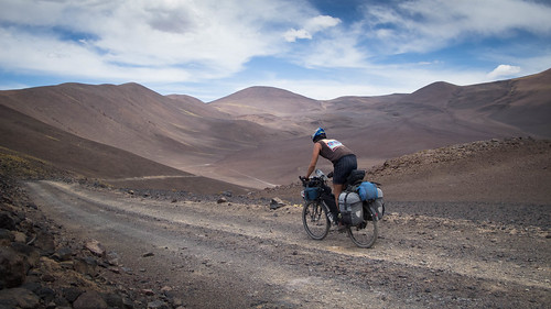
Fully refreshed, the next morning I’m battling curiosity more than fatigue
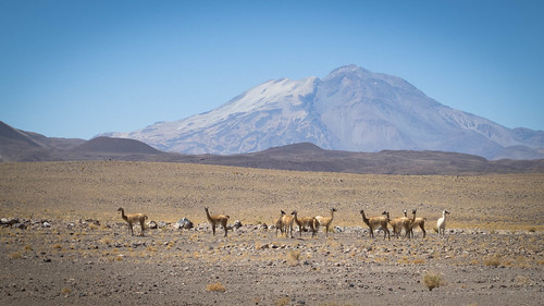
With only vicuña for company…

… I wind my way up through the arid landscape…
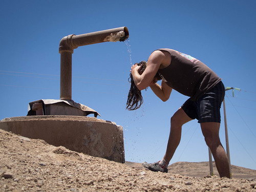
… to lunch by this pleasant little surprise. A bit too saline to drink but plenty wet enough to cool and refresh

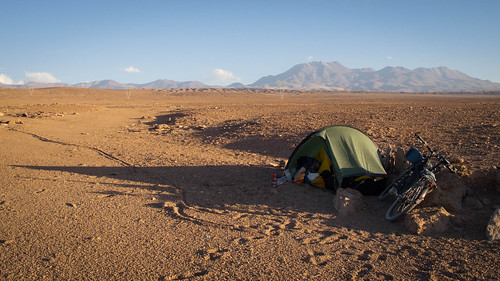
A bit of afternoon climbing and I make a tactical decision to camp in a sheltered spot before the start of a notable climb

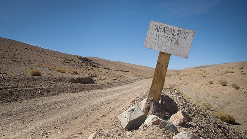
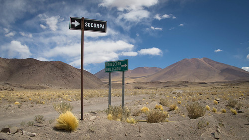
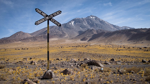
If I’d been worried about missing the turn onto the Carretera Internacional I needn’t have been, it’s quite well signposted!
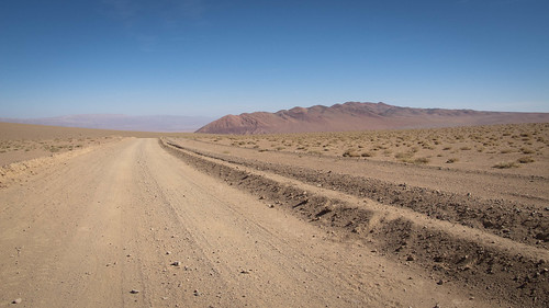
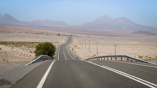
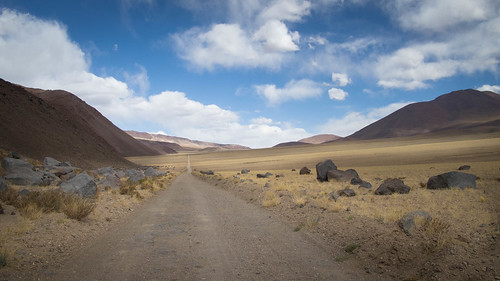
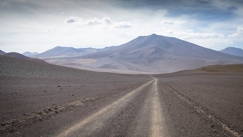
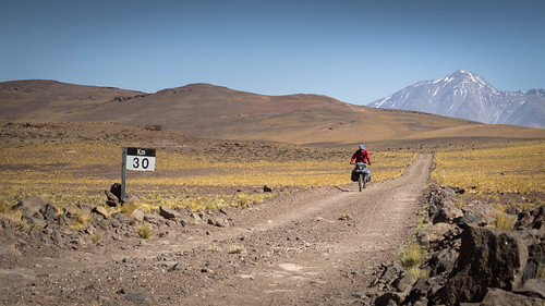
From the turn I climb…
… to within 40 km of Argentina…

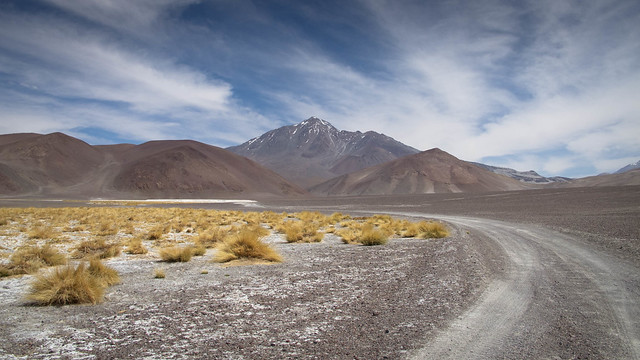
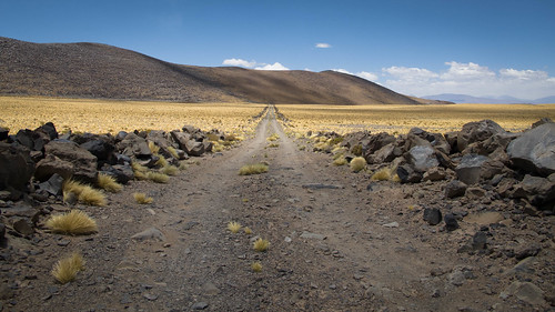
… and up to terrific views of Volcan Socompa
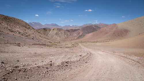
After the fun little morning ascent comes the inevitable descent…
… as I close in on Socompa
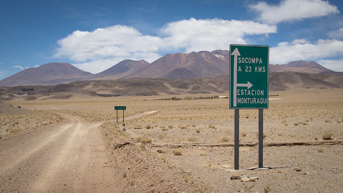
To someone used to the wilds of less developed American countries, the plethora of signposts prove a bit of a novelty…

… forever pointing me in the right direction…
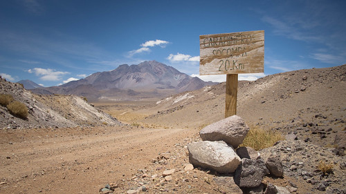
… and counting down the kilometers… only 20 to go
As the afternoon wares on I’m grateful for the appearance of clouds…
… their dancing shadows provide a welcome distraction from a tedious stretch of pushing through sand…
… which ends with the final climb up to Paso Socompa
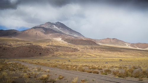
With Chilean border facilities in my sight Volcan Socompa gets suddenly enveloped in brooding clouds…
… that unleash a dumping of snow…
… that bares no relation to the sunny weather I experience on the pass
Confusion reigns on the Chilean side of the border as the officials try to work out what to do about the fact I had stamped out of the country in San Pedro de Atacama. A long tedious wait ensues after which I’m released into a cold Argentinian evening. While the eight Chilean officials are all dressed in military style uniforms with very prominent weapons on their hips, the one Police officer on the Argentine side is slightly more relaxed. Victor insists that I stay the night in the Argentinian immigration offices. Having been regaled with stories of a puma that has recently moved into the immediate area, I’m more than happy to accept the delicious free meals, piping hot shower and comfortable bed
Fully fed, rested and extremely excited about entering the Argentine Puna, I turn my back on Volcan Socompa…
… to speed down through cold morning air to…

… the magical Laguna Socompa
Leaving the Laguna the serious stuff starts… an often sandy climb…
… followed by a short descent…
… before mounting the final big climb of the route

With a full complement of three days water on board and a dicky tummy, it’s an exhausting spin uphill. But the feeling of looking back onto views of my road snaking through vast nothingness is inescapably inspiring…
… and leads me into camp feeling overwhelmingly positive
From there it’s only a short way…
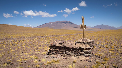
… up past the grave of the dead German to 4,337 m and the high-point of the route
On the pass I join the old disused railway…
… that I shadow…
… all the way to Tolar Grande
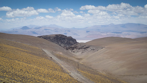
After a series of undulations I crest the final climb…
… to be hit very hard by the magnificence of the Salar de Arizaro. Argentina’s largest salt flat has me whooping and hollering like a lunatic. It is a while since I’ve been overcome with such pure emotion
After a long relaxing lunch I set out on one of the most visually impressive pieces of road I can ever remember riding. Poor road conditions make for involving riding as the edge of the road drops sharply down to the Salar de Arizaro. This is full on impact riding… a stretch of road I shall never forget
Dark clouds freak me out for a while…
… before quickly evolving into something a little less threatening…

… and before long I’m approaching the salar…

… onto which I roll…
… for a lumpy evening trundle into camp

From my camp it is only a half day sprint to Tolar Grande. Within minutes of starting my day I become captivated by the colors in this salty pool, quite a shock after days out in the desert

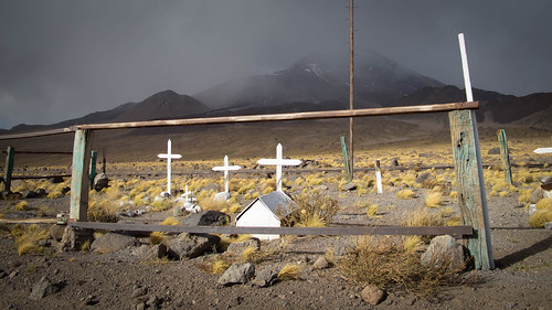
Riding across the Salar de Arizaro I encounter these graves. For some reason the message “Buen viaje” (‘Bon Voyage’) really tugs at my emotions

As I push east across the salar the number of animal carcasses dramatically increases…
… a grim accompaniment to the final few kilometers…
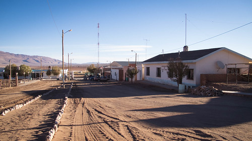
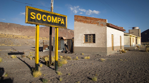
… to the quiet little village of Tolar Grande
Route Tips
6.5 days, 394 km (245 miles), 4,600 m (15,092 ft.) of climbing
If you are an experienced remotest or dirty tourer than I feel this is an unmissable route. The entire ride had a buzz about it that comes from being away from people in an ever-changing environment where you probably shouldn’t be. But be warned, this isn’t the kind of route you can freestyle off someone elses route notes. Even with the aid of mine and others notes you should be doing your own TRIP (thoughtful research and intelligent preparation). Study satellite images, become acquainted with the route beforehand and figure yourself out a game plan. From experience you should know how well you ride on hills and bad roads, use this to figure out how much food and water you should be carrying. This is entirely your responsibility so don’t rely on what I say here. These routes aren’t for any old clown to jump on with inappropriate amounts of gear or experience. Route notes are only ever a guide and never a gospel, so don’t come crying to me when there wasn’t the popsicle stand you were expecting at the top of every climb.
Food
Staying fed and watered is obviously the biggest concern on such a remote desert route. Between Peine, the last village on the Chilean side and Tolar Grande, the first in Argentina, there are no shops or services. Since the ride from San Pedro de Atacama to Peine is a straightforward day and a half of mostly paved riding I elected to stock up with my full haul of seven days food in San Pedro. This will provide you the best options but alternatively you could grab provisions in either Toconao (half day from San Pedro) or Peine. In such a sunny region I’d also recommend taking the Pikes advice and sun drying yourself some moral boasting fruits and vegetables.
Water
Water is heavy but necessary (1 litre being 1 kg). It goes without saying that water can be picked up in San Pedro and Toconao. After that Peine marks your last chance (there is a slightly saline stream in Tilomonte but it’s so close to Peine you’re best of stocking up there). If you are intelligent with your water then 5 litres a day will be adequate for everything (cooking and on bike). My carrying capacity was 15.5 litres spread over a 10 lt MSR dromedary bag, my usual 1 litre bike bottle and 1.5 litre Nalgene. In addition I secured two 1.5 litre Coke bottles on my front rack shelf. Thus I had plenty to get me the 2.5 days riding from Peine to the international border. There is some water about after crossing under the pylons (138.4 km), most notably a running pipe up to the right at about 168km, but it is universally saline and in my opinion best avoided. At the border you should restock for the remaining 2.5 days riding to Tolar Grande. This can be done with either the Chilean or Argentine officials. Although I didn’t take the 5km detour to the Caipe station, I have it on good authority that you can find water there too (about 77km from the border). Generally keep an eye on how much you have and conserve water with easy steps such as drinking your washing-up water or cleaning things with toilet paper.
Immigration
Note that there are both Chilean and Argentine immigration facilities at the Socompa border crossing so all related formalities can be completed when you cross. When I set out there was a lot of confusion as to whether there are Chilean immigration facilities at the border, there are. On the morning I left San Pedro de Atacama I went to the immigration office there to ask. Unbelievably the guy there had never heard of the Socompa crossing even though it is listed on the Difrol website. I therefore felt it prudent to get my exit stamp there. This backfired when I reached the border 4 days later as it took the Chilean Police well over an hour to establish I’d definitely left my tourist slip in San Pedro. The Argentine official insisted that I stay the night in their building claiming there was a Puma in the area. This way I landed an unexpected hot shower, bed and free meals. Watch out though, they gave me an exit instead of an entry stamp to start with and obviously don’t get much practice at their jobs.
Preparation
It goes without saying that you should be doing a lot of navigation and map work before you leave. I would also recommend completely servicing your bike as a mechanical catastrophe could really ruin your ride. Go and visit Guilherme at BBikes in San Pedro de Atacama (198 Calle Gustavo le Paige), not only is he an excellent mechanic but he has also ridden the Socompa route in reverse. As with all fun routes it is also advisable to stay as light as possible. You’ll be adding a lot of weight to your load in food and water so post on anything you know you won’t be needing. If you are planning on staying in Tolar Grande then get some Argentine pesos in San Pedro (I took 2,000 pesos to get me through the Puna).
People & Traffic
One of the beauties of this route is that there isn’t much of either. There will be very light traffic between San Pedro de Atacama and Peine but after that it dies completely. I saw a couple of people and a truck in Tilomonte but after that absolutely no traffic or people for 53 hours until I reached the border. From the border I saw one truck a day but no other people in the 2.5 days it took to reach Tolar Grande. Basically it’s safe to assume that if you get into difficulties there will be nobody around to bail you out. For this reason I programmed the Custom Message on my Spot satellite messenger to alert a few people in the event that I should need help in a non life threatening trouble.
Route Information
Route notes for the first part of this ride, from San Pedro de Atacama up to the border can be found on Neil and Harriet Pikes AndesByBike website here. Things to note in addition are:
- The road west from the 23 that you turn onto after 71.3 km is now paved
- The right turn at Tilomonte branches off about 1km before actually reaching the oasis and runs around the west side of the hamlet. Tilomonte is most definitely inhabited but don’t expect to find any services there.
- At 168km (3,180m) there is a potential water source up hill to the right. It is a pipe that runs warm slightly saline water. Not the best to drink but a good emergency solution
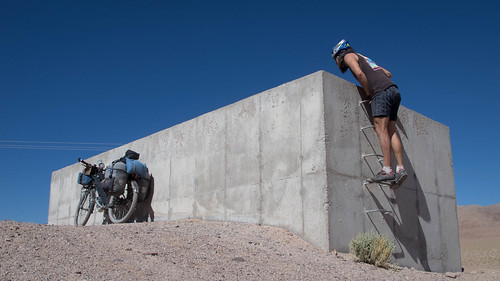
- At 198km, on the climb up the Carretera Internacional there is a walled enclosure that could make a good camp spot. Again at 200km there is abandoned buildings that could offer good wind shelter for a camp
Here are my route notes for the section from the border at Socompa to Tolar Grande:
- 0km (3,881m) – Argentine immigration building
- 10.1km (3,570m) – Follow the right fork towards Laguna Socompa
- 12km (3,565m) – Laguna Socompa
- 14.3km (3,570m) – Stay left at the fork
- 21.7km (3,770m) – Stay left
- 24km (3,854m) – High point
- 26km (3,692m) – Stay straight and start to climb (right goes towards Volcan Llullalliaco)
- 39km (4,140m) – Stay left (right goes to Salar de Llullalliaco)
- 45.75km (4,300m) – Aleman Muerto, grave on left
- 46.6km (4,337m) – High point
- 47km (4,300m) – Stay left
- 49km (4,270m) – Cross the railway
- 55.3km (4,290m) – Top of the last climb
- 71km (3,820m) – Turn right at the remnants of disused buildings
- 71.7km (3,784m) – Cross the paved road. To visit Estacion Caipe take the unpaved track up to the left about 5km
- 77km (3,476m) – Salar de Arizaro – stay straight (not right)
- 103.5km (3,476m) – Stay straight (left goes to mine)
- 104.7km (3,476m) – Turn onto Salar de Arizaro
- 124.6km (3,471m) – Stay straight (right goes towards Antofalla)
- 139km (3,522m) – Tolar Grande
Although small and quiet Tolar Grande has restaurants, a couple of tiendas and accommodation. Expect to pay 100 pesos in the village bunk house or about 135 to 150 if you stay with a family. There is currently no internet or WiFi in town.
Camping in the Puna is largely an exercise in escaping the wind. Therefore I made a note of all the shelter that could make for good camping. Most of these are the walls of old buildings:
- 0km (3,881m) – Argentine immigration building
- 10.3km (3,570m) – On the right
- 12.5km (3,570m) – Disused building on the right by Laguna Socompa
- 35km 94,150m) – Sheltered hollows with walls on the right
- 40.6km (4,180m) – On the right
- 46.6km (4,337m) – High point and excellent sheltered camp spot
- 47.4km (4,265m) – On the right
- 51.25km – 51.75km (4,280m) – Estacion Chuculaqui and lots of shelter opportunities
- 54km (4,245m) – On the right
- 58km (4,190m) – On the right
- 60km (4,160m) – On the left with great views of the Salar de Arizaro
- 62km (3,995m) – On the left
- 71km (3,820m) – Disused buildings
- 71.7km + 5km (3,784m + ?) – Take the unpaved track up to the left 5km to Estacion Caipe (has water)
- 77km (3,476m) – On the left
- 103.6km (3,476m) – On the left
- 106.6km (3,476m) – Shelter on the Salar de Arizaro

Pingback: Puna Dreams Pt.2: A land of many worlds | Velo Freedom - Cycling South·
Not sure what’s most impressive, Nathan: the route, which looks glorious, or the fact that you lasted 18 days in San Pedro de Atacama without going out of your mind…
I see you finally figured out how to carry all the water. looks like it’s been worth the days and days of planing. 😉
Great pics too.
Pingback: Dust Guzzlin’, Monkey Puzzlin’ Perfection | Velo Freedom - Cycling South·
Pingback: The Puna Double Cross: Pt 2 Paso Socompa | THE RIDE SOUTH·
Pingback: An Argentinian gateway (Paso Socompa) | Fatcycling·
Great Info thanks, Im going to cycle Tolar Grande – Llullaillaco – Tolar Grande or hitchhike back.
Pingback: Crossing the Andes by Foot via Paso Socompa – 250 km of Desert Solitude | Dominik Birk·
Splendidly done, photos and write-up. Your work has caused me to add this ride to my A-list for next month (though I’m 5000 road-kilometres from the pass at the moment). Very valuable observations. Thank you for your efforts.
Pingback: The faded glory of Paso Socompa – It's downhill from here·