
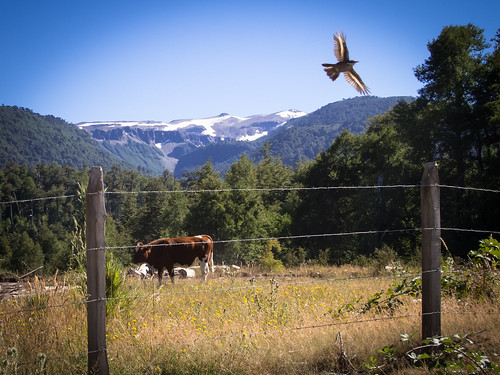
Regular readers will know that I am not a fan of other people getting up inside my cycle space. I appreciate the complimentary thumbs up or cheerful toots from passing motorists as much as I notice the haters who swear at me on the road (a peculiarly Argentinian trait it seems). In all instances I usually wish people would just leave me be to go about my insular little adventure in peace. It frustrates me beyond all reason when strangers pull out their cameras and freakerise me through photos and it angers me intensely when others disrespect the pristine landscapes I wish for by garnishing their artistically laid turds with a clump of soiled toilet paper. Other people, or ‘others’ as I collectively categorize them, sometimes well-meaning but usually ignorant, are always finding ways to get in my face and pollute my space. But I share the world with these ‘others’ so accepting or avoiding them has become an essential touring skill. Some embrace ‘others’, I try to accept and choose to avoid them. Fortunately over the past few years I have become quite an adept avoider.
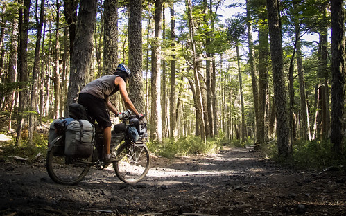
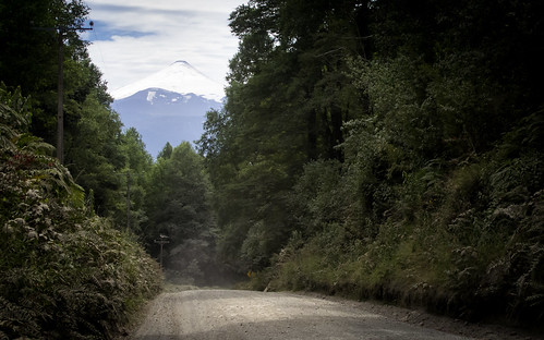
Avoiding the Chilean tourist centres of Pucon and Villarrica led me onto a gorgeous little track running over the shoulder of Volcan Villarrica, through a National Park of the same name
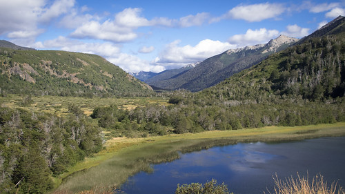
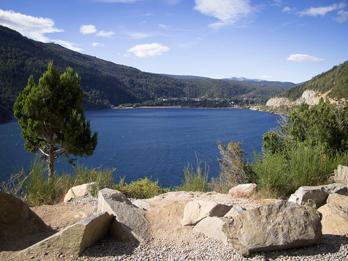
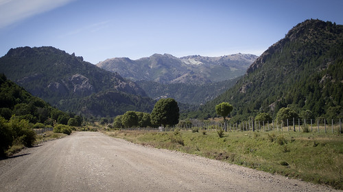
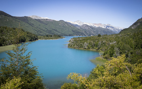
The Chilean Lake District was an area that I expected to embrace; I rode south for it knowing it would be my kind of place. The world is so well documented these days that I had a very clear picture of what I wanted to find; a tranquil oasis of pungent forests and picturesque lakes. I also had a frighteningly real fear of what could be; too many tourists, traffic, fences and private land. Two opposing versions of the same space created from the experiences of others. My job was to ensure that I found the Lake District I wanted and avoided the alternative. With more than a little smugness I report that my route finding efforts in this respect were met with massive success. I managed to manufacture a route through the region that meandered past gorgeous lakes, rose sharply over attractive climbs all the while avoiding the touristic slew that inundates the area at this time of year.
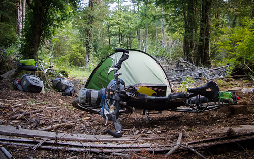
This leg really enabled me to indulge my love for cheeky wild camping. Why would you pay US$7 for a shitty campsite if you can find spots like this one by Lago Traful for free?
In Chile I won, I left the country on a rainy day via Paso Carirrine, my romantic visions intact and experiences unsullied by the negativities I feared. Then I entered Argentina and everything changed. The roads deteriorated, traffic increased, piles of toilet paper appeared everywhere and the unexplained attitude I’d previously developed against the country started to flourish. The scenery was beautiful, bigger, more traditionally national parky than in Chile and extremely reminiscent of Canadian British Colombia and Alberta. But the lorries were bigger too and the numerous tourists apparently keener to piss me off. So this snaking ride through the Lake District in many senses became a tale of two halves, two countries and two attitudes. Yet, in other senses and as a whole, it remains a darn fine spin through a particularly gorgeous part of the world.
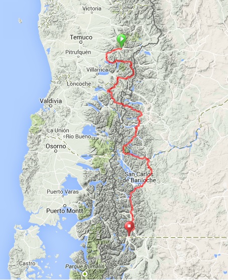
Route from Melipeuco (Chile) to El Bolson (Argentina)… click here to view the fully interactive map, elevation profile and download the GPX track
Melipeuco to El Bolson Route elevation profile
I relearned a lesson on this 704 km ride back into Argentina, one that crops up time and time again; everything is only as good (or bad) as the way you see it. I was also reminded of my passions, my intense likes and dislikes, factors I must always keep in mind when planning my routes. This route has prompted me to reassess where I’m going next and flung me into nostalgic throws for where I have already been. Here is the story of that ten-day ride through the Lake District and my introduction to Patagonia…
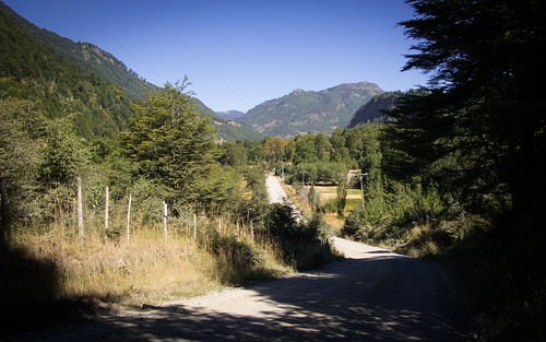
A decent paved road quickly takes me out of Melipeuco, through Cunco and onto the Ruta Interlagos. After a generally quiet ride along Lago Colico…

… I swap the water for trees and climb the small hill over to Lago Caburgua
From Lago Caburgua there’s a fun bit of climbing through forest and farmlands…
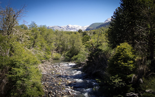
… before descending past crystal clear streams…
… on a bumpy course…
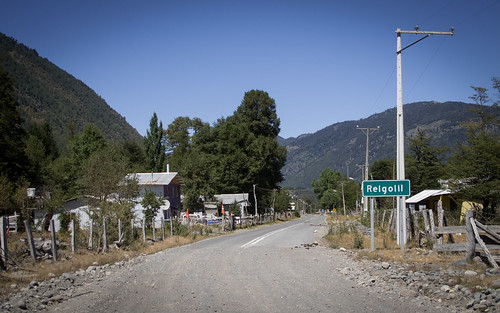
… down to the Mepucha village of Reigolil

From Reiglil a pleasant afternoons riding takes in dramatic waterfalls…
… and lots of short sharp climbs…

… before dropping into Curarrehue. Suffering with a bit of a dicky tummy I make the uncharacteristic decision to pay for camping. It’s US$3 worth spent as I have the site (and its toilets) to myself
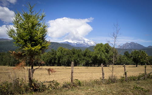
Plugged with anti-diarrheal drugs, the next day I speed past impressive view of the cloud smothered Volcan Villarrica…
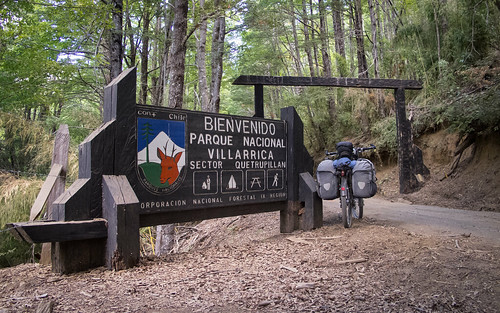
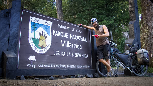
… to the start of the climb up into Villarica National Park
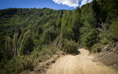
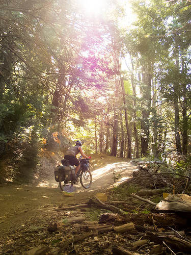
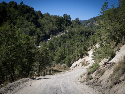
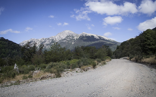
The higher I climb the more rustic the road becomes…
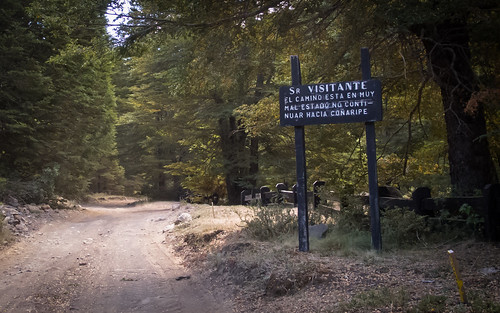
… until it’s barely a road at all. This sign by some Park Ranger buildings reads ‘Tourists, this road is too bad for you to take over to Conaripe. You will die if you try. Go back to Pucon, spend your incredible wealth and then bugger off home‘. I ignore it…
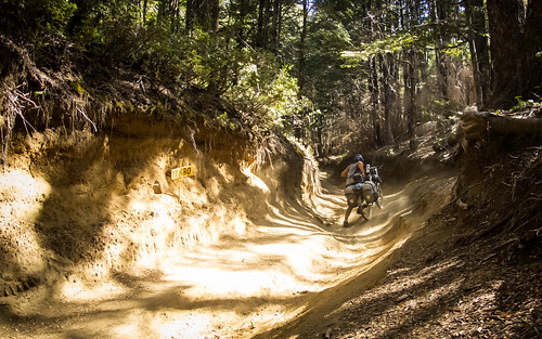
… to be quickly rewarded with some more technical riding…
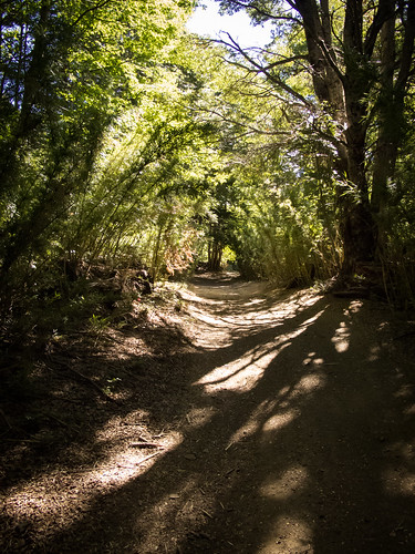
… and a bit of pushing, through a shady tunnel of forest fun
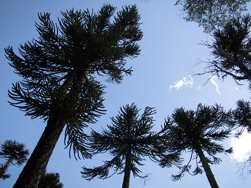
Peaking at 1,290 m elevation in a Monkey Puzzle forest on the shoulder of Volcan Villarrica…
… the climb leads into a thrilling descent down a better conditioned road on the north side

It’s a beautiful place to be as the sun drops into late afternoon. Wild flowers…
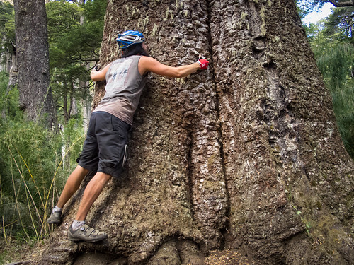
… and massive Monkey Puzzles tease out my inner hippy…
… and cement my love for Villarrica National Park
After a night pitched by a roaring glacial river…

… I descend past a few enticing views of Volcan Villarrica into the tourist hell of Conaripe. Battling a sea of short shorts and the resultant disturbing/tantalizing forest of Latina legs I try to focus on resupplying…
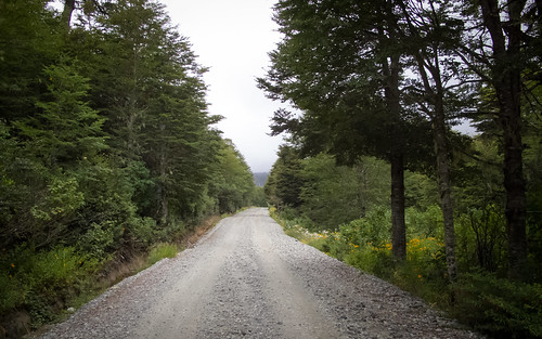
… before escaping onto a dusty stretch of busy ripio
By the time I’m approaching Liquine the day has turned cloudy and a bit miserable…

… a mood briefly alleviated by William from Santiago who cuts an intriguing figure riding through the dust with his long locks flowing behind him
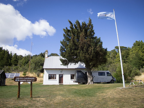
With rain threatening I decide to cut my day short in Liquine. A relaxing stay in Residencial La Frontera gives me time to repair some pannier holes ready for rain

Sure enough, the next day is a wet one. I climb through cold showers…
… up to Chilean border control, where the heavens really open
As the rain subsides I spin up the remaining 3km to Paso Carirrine (1,223m)…

… say goodbye to my new friend Chile…
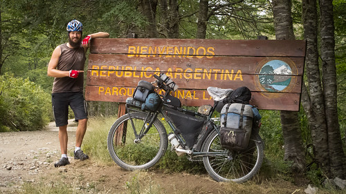
… and hello to Argentina
I’m more than happy to swap Chilean ripio for Argentine dirt…

… and decide to ride a long day…

… deep into Lanin National Park
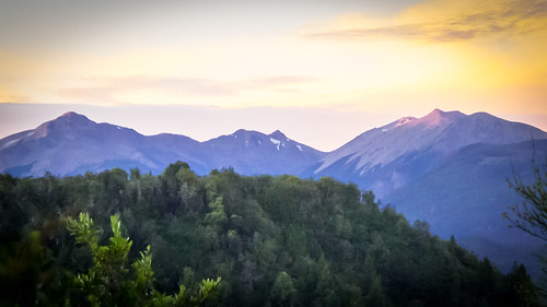
Fortunately the rain subsides overnight and I wake to bluer skies
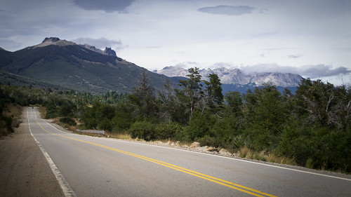
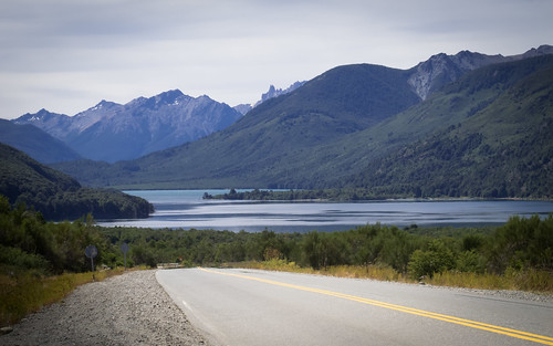
The Argentine side of the Lake District is significantly higher in elevation than the Chilean side which lends it a more remote wilderness feel
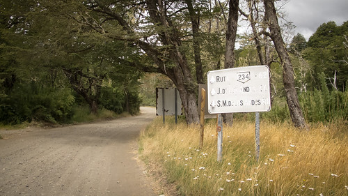
50km from the border I pass through Argentina’s charming little border control cottage…
… and turn into the hills towards San Martin de los Andes
As I get closer to San Martin the day gets progressively colder and the tourist fueled traffic increasingly frustrating

A brief stop in San Martin to restock with food sends me into shock… this is a VERY expensive part of the world. There is absolutely no incentive to stick around so I head out along the shores of Lago Lacar
Leaving San Martin behind I climb the 500 m hill out of town and find a quiet camp spot in the forest
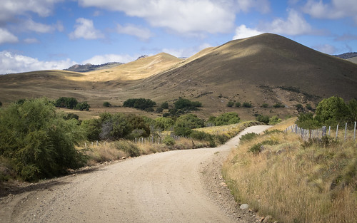
The Route 66 of Argentina, the Ruta 40, takes me from camp on a quick and easy ride…
… through tourist infested scenery…
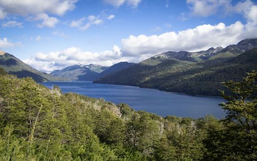
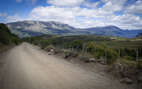
… onto the unpaved road to Villa Traful

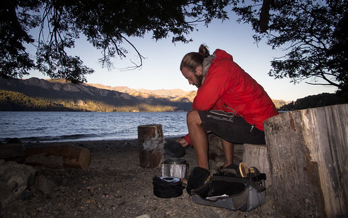
An afternoon of choking dust takes me into the most delightful wild camp by Lago Traful. My own personal beach gifts me a tranquil evening…
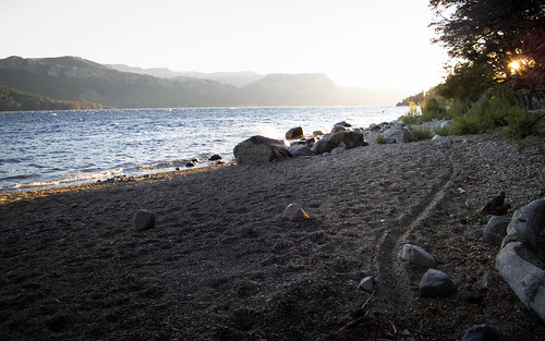
… and inspiring morning watching the sun rise…
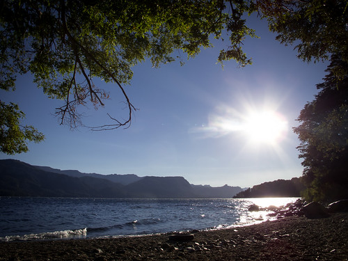
… into a vibrant blue sky
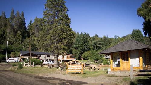
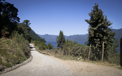
3km from camp I pass through the strange little tourist village of Villa Traful…
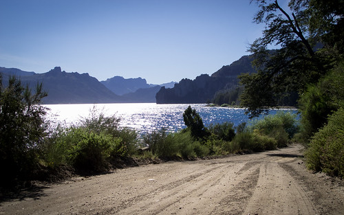
…before escaping out along the lake…
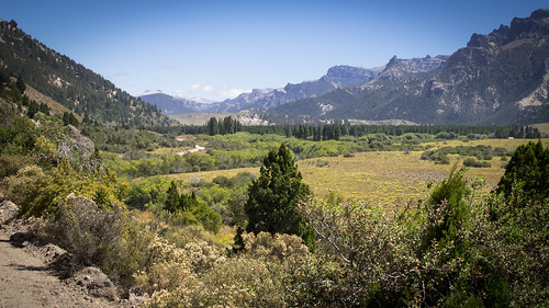
… into some stunning scenery…
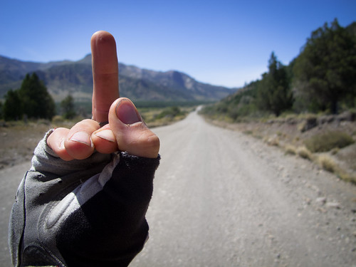
… but really bad riding. The road is so stubbornly corrugated I quickly get frustrated. Combined with tourists driving too fast and a couple of idiots intent on taking my photo without permission, this turns my mood very dark. Having made a pledge to myself to stop sticking my middle digit up at cars that annoy me, I’m left with no choice but to take my anger out on the road. That road won’t be messing with me again!
It’s amazing how even the most attractive things…
… can get ugly with the wrong mood or atitude
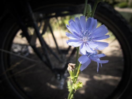
By the time I reach the paved Ruta 237 I am ready to kill. When I stop for lunch only to be quickly joined by a middle-aged couple in a fume belching camper van who insist on starting a fire next to me to cook, I think I will kill. I don’t. Instead I take time out to breath deeply and look at the flowers

After lunch my mood lifts as I find other things to think about. The main thing that takes over my thoughts is trying to stay alive. Ruta 237 is narrow…
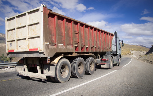
… and populated by large lorries and buses. Driven by people who couldn’t give a flying whatname if I live or die, these vehicles reward me with the scariest stretch of riding of my whole tour

Employing a ‘safety first’ survival tactic that involves getting the hell off the road when anything sounding remotely big approaches from behind, I make it out of the afternoon alive…
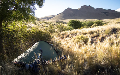
… and find the cheekiest of stealthy camp spots to relax in
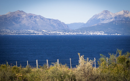
The next morning Ruta 237 becomes Ruta 40 and the traffic increases further. As the popular tourist destination of Bariloche appears across the water I decide to ride the bypass around town…
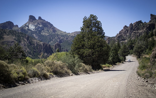
… and ease stress-free into an afternoon of threading between stunning lakes…
… and imposing peaks
Another fine camping find gives me awesome evening views and sets me up nicely for a quick morning cruise into El Bolson, the end of this route and the start of the next
Route Tips
9.5 days, 704 km (437 miles), 9,655 m (31,680 ft.) of climbing
Chile: 4.5 days, 278 km (173 miles), 4,710 m (15,450 ft.) of climbing
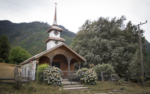
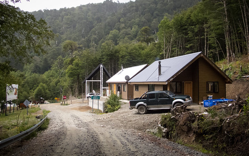
This is a route I’d highly recommend to everyone. Great scenery and with three significant climbs, some fun and involving riding. It is seldom necessary to carry much food as the settlements of Melipeuco, Cunco, Reigolil, Curarrehue, Conarie and Liquine can sell you everything you’ll need. All these places also offer accommodation. There is also plentiful streams and thus never any need to carry more than 1 litre of water. Wild camping is easy over the entire route, although might require a little patience in some areas.
The jewel in the crown of this ride is definitely the ride up through Villarrica National Park over to Conaripe. The road up the south side of the peak is generally in good condition until the final few kilometres (after the sign in my photo). From there it is likely you’ll have to push a little, but not much. The road down the other side is in good condition. It may be the case that if you enter the National Park from the Conaripe side you’ll have to pay an entrance fee. Possibly not though and the park staff leave at 18:00. Thanks to Anna for putting me onto this road.
Chilean passport control is 3 km before the border.
Argentina: 5 days, 426 km (265 miles), 4,945 m (16,225 ft.) of climbing
Argentine passport control is 50 km from the border.
Again, the towns of San Marin de los Andes, Villa Traful and Bariloche mean you shouldn’t have to ride with much food. Water is everywhere so you should be light on that too. All accommodation (including campsites) are expensive in the area so I’d recommend being intelligent about figuring out some wild camping opportunities.
I took the unpaved road through Villa Traful over the alternative route along Ruta 40 through Villa La Angostura to Bariloche. This was a winner on the scenery front but was dusty due to the large amount of tourist traffic and in terrible condition at the eastern end. Ruta 237 was downright scary to ride and there wasn’t much space on the Ruta 40 towards Bariloche either. After Bariloche I didn’t find the traffic to be such a problem and the drivers a bit more courteous.
Hostel Ankatu offered the best value when I was in El Bolson (Arg$110 a night).

Pingback: Following the bread trail. (A stunning hike a bike through Villarica national park) – Fatcycling·
A friend was extolling the amazing amount of info in Google maps these days down dirt roads and foot trails. I decided to check it out from what I had done in 1990 in Argentina and Chile when it was almost impossible to get any info or good maps. At the time in 1990 I did buy this amazing tourist book the “Turis Tel” and it showed a road between Conaripe to Pucon so this took this “road” . I was beginning to question my memory so I googled it online and found your account.
haha I love this “until it’s barely a road at all. This sign by some Park Ranger buildings reads ‘Tourists, this road is too bad for you to take over to Conaripe. You will die if you try. Go back to Pucon, spend your incredible wealth and then bugger off home‘. I ignore it…”
awesome!
I then dug up my old journal and some of what I wrote is more believable with the above info.
from Conripe “headed up the road to Pucon. Hot and I was sweating like a pig. The worst road I’ve seen in Chile” which is saying a lot because I did 3500 miles of the smallest crap I could find at the time. ” Had to walk parts and took some chutzpa” which is again saying alot. I mountain biked up to the ice on Orsorno, to the Cerro torro base camp etc. “After first 2000 feet ” ( in elevation) ” road got beter but still horrid- just not as much rocks. Biked a couple of hours and ran into a flat bed strong truck that took me up to the road to the parque. Don’t know if I would have found it myself because of the forks. He went through a few gates which I don’t know if I would have gone through. Soon I was at the park and soon at the entrance to the refugio where I slept.” next morning “up hill to 4200ft to a sign said Guardiaparque 4km on trail. Passed nice campground and refugio then at ranger house then down to main road to Pucan.”