
He who dares, wins… sometimes. My ambitious plans of riding through the deepest part of the world’s second deepest canyon, the Colca Canyon, Arequipa had disappointingly proven fruitless. Weary from a tough few weeks of riding and flat from route failure, Cherry and I found ourselves stranded in the warm little canyon town of Ayo. A friendly place surrounded by pre-Incan ruins and blessed with a climate so good they even boast a local wine, there are far worse places to have your dreams shot down. Still, with only two weekly buses out and neither coming any time soon, we were for all intents and purpose trapped in the Colca canyon. The good people of Ayo had made it very clear there was no way for us to cross the Rio Colca and dismissed the possibility of climbing out the hiking paths the other side, up to Humabo. Ordinarily I wouldn’t give up on such an exciting route without at least trying but the consensus was absolute, so much so that a guide even refused to try. On top of this Cherry and I had no time to hang about and enjoy our temporary release from cold high altitude climes. My six month Peruvian visa was fast running out and more significantly, Cherry had a friend arriving in La Paz, Bolivia. We had to get out.
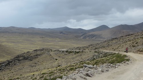
Grey clouds dogged our ride up, over and around from Andagua further east in the Colca canyon to Yanque. Here on the descent to Tolconi
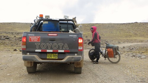
It took us just under three and a half hours to descend the dramatic rocky track 5,670 ft (1,730m) down from Andagua to Ayo. Transporting us through enormous choppy lava fields and beautiful desert, that ride had been incredible, but neither of us had any motivation to repeat it in reverse. Even if we had, we didn’t have the time or energy to do so. Fortunately the Ayo town plaza was under reconstruction and a work team scheduled to drive out of the canyon the next morning. We bagged a place in the back of their truck and waited anxiously for morning, chuffed at our good fortune but dreading what was to certain to be an extremely uncomfortable ride. As we waited in the building site of a town plaza the next morning we got talking to the smooth talking, gold toothed Alcalde (mayor) we’d been speaking to the evening before. Thankfully he was able to organise a more comfortable alternative. And so we found ourselves hoisting the bikes up into the back of a dump-truck and climbing up into the cab alongside our driver, Tomas. Trying my best to ignore the little bottle of pure alcohol that nestled down with a small glass in a cubby hole on the dashboard I focused my efforts on relaxing into the journey. Two very bumpy hours of worrying as the Shermster got tossed helplessly around, we arrived back in Andagua.
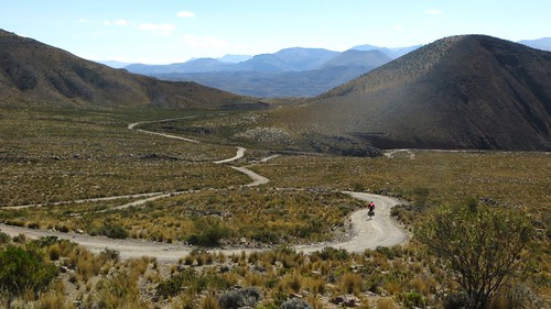
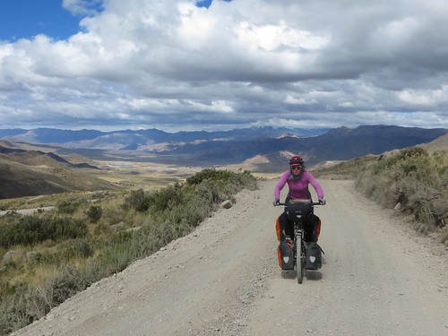
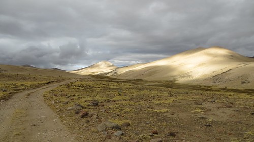
Riding the Peruvian Andes always gifts fun climbs, but on this stretch we also experienced some uncharacteristically flat riding. Here on the way from Caylloma towards Abra Chungara (4,727m)
Our goal was to reach Yanque, a small town with a big warmshowers house in the Colca Canyon just a few kilometers from the main tourist hub of Chivay. We’d have to ride out of the canyon north and around to get there on roads that we don’t suppose to have been cycled much if at all. The most direct and interesting route went through the town of Chacas, cutting north-east up over 5,000m landscape to Caylloma to join the more major road south to Chivay. But after weeks of tough riding and with no let-up close on the horizon, we were both tired, the idea of camping so cold again any time soon did not appeal. We therefore agreed on a route up through the mining town of Orcopampa (know to us as Orcy-P), to connect with a road running east to Caylloma, detailed by Neil and Harriet Pike in their Caylloma to Quiñota route. Having been devoid of internet for two weeks and not expecting to have been turned around we found ourselves riding out into the unknown sure of only one thing… when you’re looking for a fun ride, Peru seldom lets you down.

Route from Abdagua around to Yanque… click here to view the fully interactive map and elevation profile
Andagua to Yanque Route elevation profile
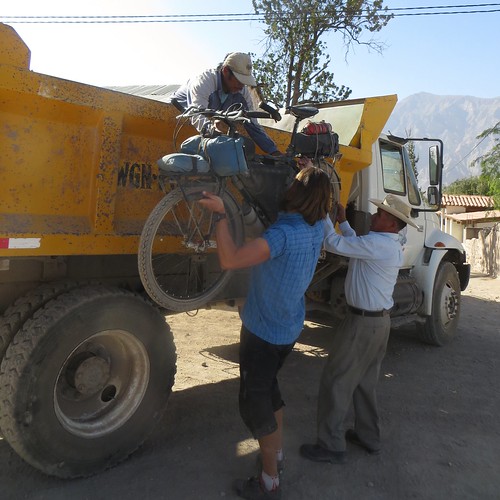
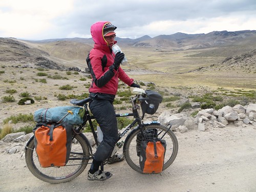
The morning after arriving down in the balmy climes of Ayo we’re getting ready to ship out. With only two buses a week we’re fortunate that the town mayor (pictured next to me) is able to snag us a ride in a dump truck
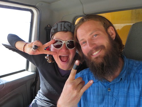
Relieved to have found a quick and easy way back up to Andagua things get a bit silly. A few minutes later the smile has been well and truly wiped off my face as the bumpiness of the ride kicks in… I spend the next two hours worried sick about Shermy being thrown around in the back of the truck
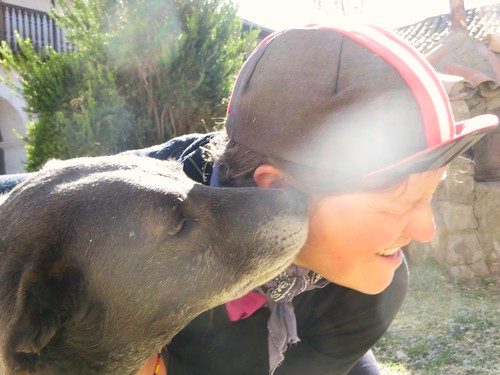
Arriving back in Andagua by lunch we agree on taking the remainder of the day off, spending the time cleaning gear, servicing bikes and playing with ‘Juan’ the dog
Relaxed and primed for our burst around to Yanque, the next morning we climb out of Andagua and begin threading our way between small volcanoes…
… through tiny tumbledown settlements…
… beside picturesque rivers…
… down faint tracks…
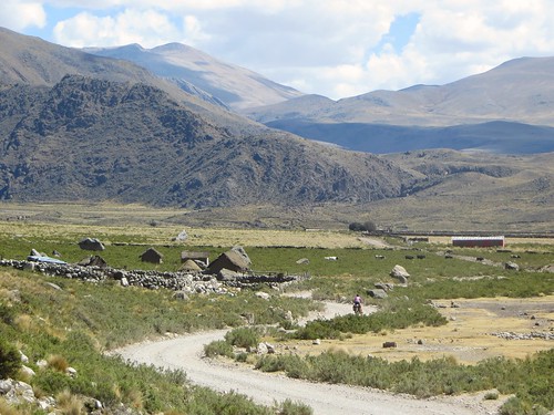
… in and out of remote villages (Chapacoco, 3,745m)…
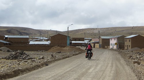
… and on to Orcopampa. Sat at the end of a windy plateau, Orcy-P is a utilitarian concrete turd laid sinking and steaming by the surrounding mining industry. Every business from snack bars to hardware stores are advertised using degrading pictures of (predominantly) white women and it’s darn cold. That said, having run out of money the ATM was useful and close to running out of cooking fuel the appearance of Bencina Blanca was also not far off a god send… dark clouds with silver linings and all that!

Escaping Orcy-P as quickly as possible we forge on an easy 6km to Huancarama… maybe not funny to some but hilarious to us

Not long after passing the thermal baths of Huancarama weather quickly starts to funnel in towards us. Fortunately we’re near a great camp spot and quickly pitch up only to see the dark clouds disperse
After a restful night we get out early, straight on to a gentle climb up to 4,692m
Despite the gentle gradients head-winds, heavy lorry traffic, dust and washboarding reduce the final part of the climb to a miserable slog…
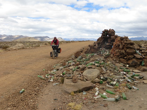
… but we get there, to the large cairn where passing vehicles routinely give offerings of alcohol to the gods
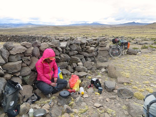
It’s a cold, windy and grey day that holds a constant threat of rain or snow. Finding some welcome shelter from the elements we settle in for lunch…
… before getting back out into the bleakness
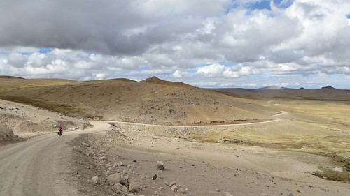
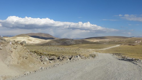
Fed up with mining traffic I’m overjoyed with the opportunity to turn off the main road and onto a tougher but deserted alternative. I’m not sure Cherry is so impressed, the depressing weather and cold temperatures burrowing into our cores
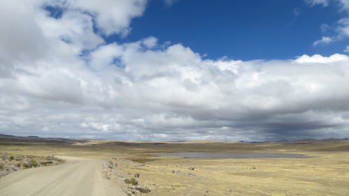
Still bleak but still beautiful too… and now quiet and traffic free
Neither of us use GPS, so riding roads not on our maps we rely on help from passing motorists and local people… not always easy when there are few folk around and only one mining truck passes all afternoon
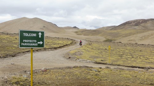
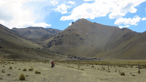
After a fair bit of messing around trying to find the way to Tolconi a signpost appears and our confidence returns
As we work our way up towards what we presume to be final pass before Tolconi the clouds that have been threatening all day start to thicken. It seems foolhardy to climb higher, so we pitch up by a stream
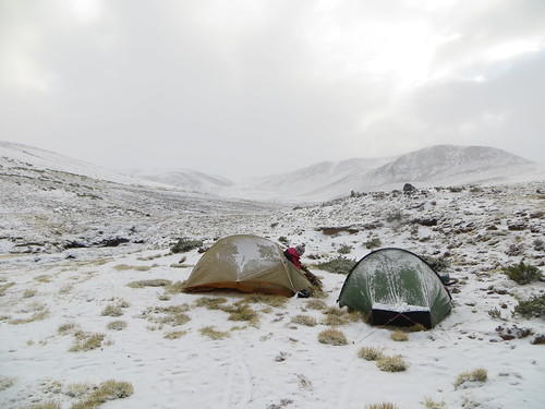
No sooner do we pitch up than the clouds open, dumping a load of snow. Abandoning dinner plans we ‘treat’ ourselves to some sandy oats before jumping into the tents. Snow continues throughout the night…
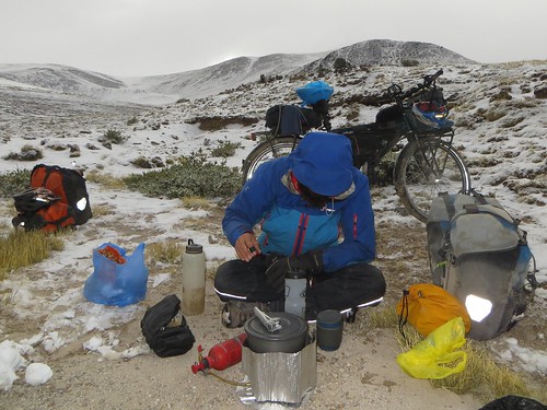
… and the clouds persist into the morning. It’s an uncomfortably cold morning in camp, our morning ablutions being the toughest things we’ll do that day

With neither of us able to feel our extremities we make short work of the remaining climb, soon toppling the 4,810m pass…

… and finding our way back onto the main road to Tolconi
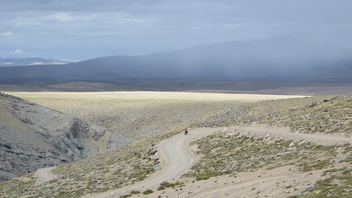
A quick downhill burst on smooth ripio…
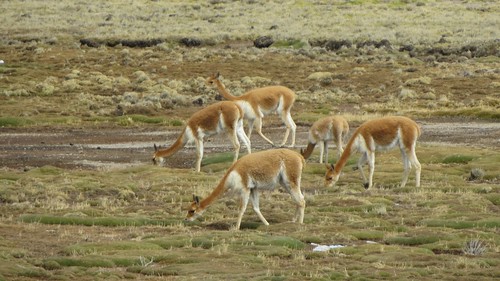
… past small herds of Vicuña, an endangered species particular to this part of the Andes…
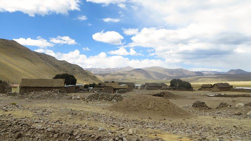
… and into the isolated little pueblo fo Tolconi where a welcome second breakfast awaits
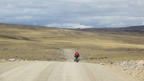
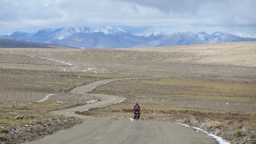
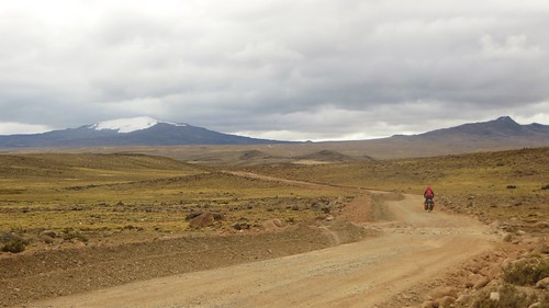
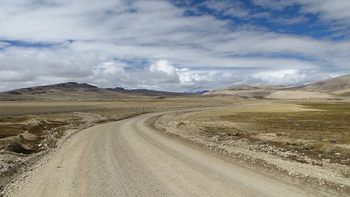
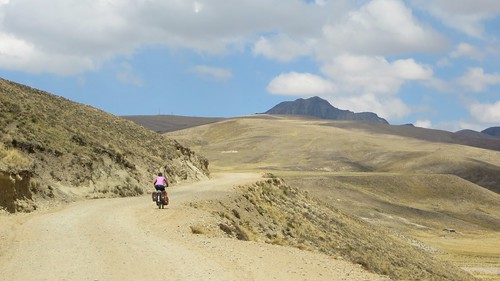
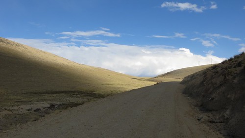
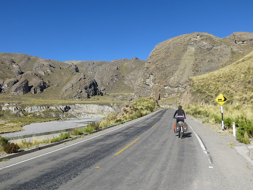
From Tolconi the landscape opens up and the riding becomes quick and easy
On the subtle climb up to Abra Tolconi (4,860m) we have the privilege of watching weather systems swirl and develop around us…
… before enjoying the long but fast descent…
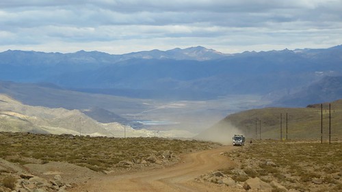
… down into the clutches of rain clouds…
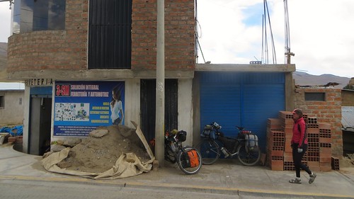
… towards a night in the cold mining town of Caylloma

From Caylloma the heavily washboarded roads prove a pain in the arse (literally) before some accompanying single-track appears. Unfortunately the tracks don’t last long enough, leaving us a bumpy ride through predominantly flat lands
Just before lunch we mount the days climb…
… an easy spin up to Abra Chungara (4,727m)
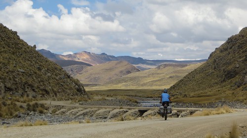
From Abra Chungara (4,727m) a few ups and downs lead into a downward trend…
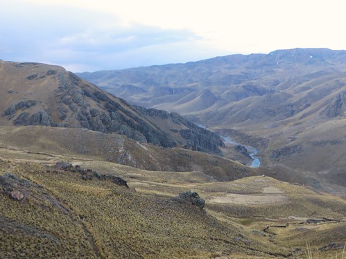
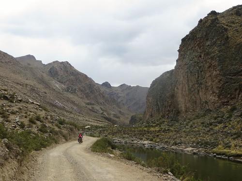
… and evening views of the Rio Colca
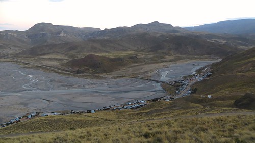
The light has almost left us by the time Sibayo appears below but sticks around long enough for us to enjoy the dramatic views
An unfortunately restless night in Sibayo leads us into a short day of pavement
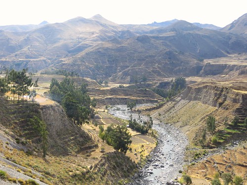
The riding is dull but the scenery incredible…

… as we speed into the tourist hub of Chivay…
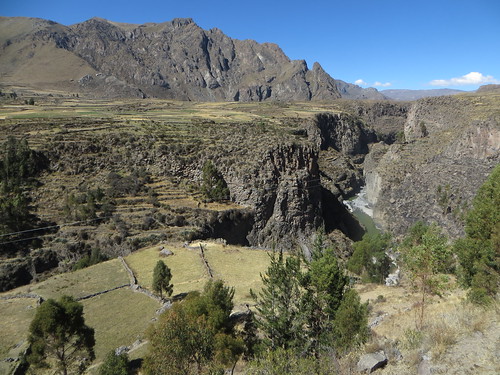
… and out again. Riding west down the world famous Colca Canyon is a treat of terracing, every available slope seemingly flattened and farmed
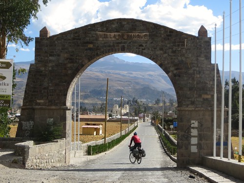
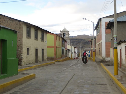
Before long we’re rolling in to Yanque, a quiet little town…
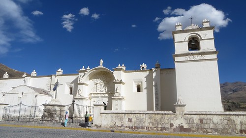
… with a big colonial church.
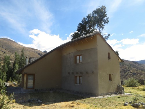
Just outside of Yanque, right on the lip of the canyon we find our new home. Listed on Warmshowers, this incredible four bed-roomed house is seldom used by its owner who has generously made it available to passing cyclists. I settle in for a couple of days rest as Cherry buses into Arequipa for the last of her rabies injections
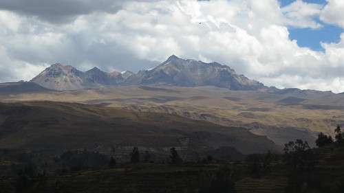
Blessed with awe-inspiring views of Ampato (6,310m) and the Colca canyon, I can’t imagine a more relaxing place to avoid the rain and recharge the batteries for the final Peruvian push around Lago Titicaca
Route Tips
Be aware that distances and elevations are taken from my bicycle computer and barometric altimeters, thus they are in some ways an approximation.
Andagua to Caylloma
3 days, 91.5 miles (147 km), 8,369 ft. (2,550 m) of climbing
- Andagua (3,587m) – A friendly laid back little town with 3 accommodation options (I’d recommend Casa Grande for its friendly owners, hot shower and spacious courtyard). Although there are no banks or ATM, nor Internet the shops are well stocked. The east side of the plaza houses a good restaurant and useful shop that includes petrol, bicycle rims, pedals, tires and numerous other (low quality) bike parts among its repertoire.
- Not far out of Andagua there is a right turning that is the main route to Orcopampa. We suspected it might be but there was nobody around to ask so we continued up to a second turning that we were already familiar with.
- 4.4km climbing from Andagua turn right at the junction (3,819m). This will take you over to a short descent and in 3.3km the other (before mentioned) road will join from the right. 1.3km after this (3,669m) you’ll start following a river.
- 6km from the joining of the Andagua road (3,686m) the road forks. Both forks end up in the same place but going right is more direct. 1.8km down this right fork turn right at the junction. The road then leaves a section of open pampa, curving around to the left into a short stretch of valley riding.
- 8.5km from the previous junction fork right onto the track heading directly towards the village ahead. Stay on this for 1.1km where it then rejoins the road (3,726m), go right and within a km is the village of Chapacoco (3,745m).
- From Chapacoco 8km of flat riding brings you to another short-cut track. Go right (3,794m) onto the track in order to bypass Chilcaymarca. 1.4km on this track brings you back to the main road (3,783m). Continue straight/R. Follow the signage over the bridge and around towards town. 2.3km after rejoining the main road take a left and arrive in Orcopampa within a km.
- On this route Orcopampa is about 38.5 km from Andagua.
- Orcopampa (3,800m) – The town and surrounding area is very much mine country. Concrete boxes of workers housing, images of scantily clad gringas advertising everything, bleak, windswept and cold. Orcopampa is not particularly seductive. However, it serves a purpose, having plenty of accommodation options and all services including an ATM and Internet (neither of which we’d encountered for weeks). We were also able to stock up with bencina blanca for our stoves.
- 5.7km from the northern edge of ‘Orcy-P’ is the delightfully named village of Huancarama (3,885m), a small place with a couple of tiendas. Just through the village take the left turn signed towards the Banos Termales. 6.6km from Orcopampa are the Huancarama hot baths (3,912m), a reasonably sized complex offering possible accommodation.
- From just before Huancarama the road climbs at a steady and gentle gradient. Not long after the baths it starts to switchback, eventually straightening out to hit the pass (4,692m) at about 14.7km past the banos termales. The road is generally in decent condition but deteriorates nearer the top. The amount of mine traffic (mostly large articulated lorries) combined with a dusty road surface and strong headwinds can make the final third of this climb a tad miserable.
- 4.8km from the pass (marked with a large cairn and lots of bottles) take a right (4,616m). Then again 1.7km later take the right turn (4,635m), signed Marcani and Conococha. Continuing straight here on the main road is the more direct and flatter route to Tolconi via Abra Ares (4,817m). But I suggest taking the turn in order to lose the mine traffic (we had no traffic at all until rejoining the main road just before Tolconi).
- 2.2km from the junction (4,524m) stay straight (left goes to small hamlet). 0.2km later you’ll cross a stream and be able to see the settlement above. 9.3km from the junction (4,514m) stay straight (not left) and descend to a stream 0.3km later (probably not wise to drink as it’s from a dammed lake in mining country). Climb 0.4m uphill and take the main road left over the bridge with yellow railings (4,524m). 1.3km from the bridge is a signposted junction (4,556m). Stay straight following the sign to Tolconi (not right to Proyecto Pariguanas). This will have you climbing alongside a clean stream which is crossed at about 4,700m and marks the start of the final push up to the pass at 4,810m (6.2km from the signposted junction).
- At the high point take a left turn (right just goes to a mine) and descend 3.6km to rejoin the main road (4,733m). Go right, signed ‘Tolconi, Caylloma, Arequipa’ (left goes to ‘Ares, Arcata, Orcopampa). Just over 10km later is the village of Tolconi (4,603m), complete with accommodation shops and restaurants.
- Things get easier after Tolconi following the well conditioned main road all the way to Caylloma. The first 20km from town involves and gently undulating climb up to Abra Tolconi (4,860m). 3.7km from the pass (4,760m) continue straight (not left towards Cedimin SAC). 15.3km of mainly descent then takes you to another junction (4,410m). Continue straight, following the river (not left to Mina Caylloma). From there it’s 7.6km on an annoyingly washboarded surface to Caylloma (4,350m).
- Caylloma (4,350m) – Decently sized village with numerous accommodation options. There is an impressive collection of well stocked shops and a couple of decent restaurants. Although without an ATM a shop on the plaza does offer Internet. Hostal Yenny is possibly the sweetest smelling hostal in Peru and a good place to stay.
Caylloma to Sibayo
1 day, 41 miles (66 km), 2,559 ft. (780 m) of climbing
- The road leaving Caylloma is in terrible condition with heavy washboarding. However, after a few km dirt tracks peel off first to the right and then left, these are what the motorbikes ride. Taking these singletracks down the slight descent can make for a lot of fun.
- 10.9km from Caylloma (4,217m) stay straight following the sign to Arequipa (not left to Suyckutambo and Espinar). Just over 2km later the road will curve around to the right (4,197m) and start to climb.
- 19.8km from Caylloma (4,264m) is Pusa Pusa, a small hamlet with one tienda. The surface continues to be heavily washboarded. 7.9km from Pusa Pusa (4,331m) the road bridges a river and the start of the climb up to Abra Chungara comes into view. 3.2km from the bridge (4,414m) stay straight following the sign to ‘Arequipa, 175km +500’ (not left to ‘Presa Angustura , 17km +710). The road surface improves slightly after the bridge but gets notably better after the village of Foroctaya/Condorcuyo (4,446m), 5km from the bridge. Here there is a tienda and restaurant. Now the climbing really starts, ending 7km later after a winding valley ascent at Abra Chungara (4,727m).
- From Abra Chungara (4,727m) the road undulates, putting in a few notable climbs before maintaining a downward trend. 6.7km from the pass is an intermediate high-point of 4,613m. Then 7.4km later, when the road has started to descend more steadily, it passes through a tiny hamlet (4,437m) of just a few houses and a tienda. From there the main descent soon starts, dropping down to Sibayo (3,840m) within 12km of the hamlet. Upon reaching Sibayo there is accommodation, restaurants and shops both left and right of the junction. Go left 1km for the main plaza.
Sibayo to Chivay
Half day, 21 miles (34 km), 1,450 ft. (440 m) of climbing
- The undulating route from Sibayo to Chivay is now entirely paved. Thankfully it is still relatively quiet of traffic which makes for a quick and easy ride. Distances from the edge of Sibayo.
- 11.2km (3,939m) – stay straight (right goes to Mismi 26km and Ran Ran 10km)
- 14.7km (3,841m) – stay straight (left goes to the large village of Tuti)
- 18.3km (3,813m) – stay straight (left goes to Cannocota 2.5km)
- 19.5km (3,839m) – Mirador Canon de Lunta
- 32.9km (3,683m) – left to Chivay (right goes to Lari)
- 34km (3,657m) – Chivay central plaza
- Chivay is a tourist oriented ton with all services including ATM’s. The traditional launching point into the Colca canyon for many tourists the town itself doesn’t feel to be in canyon land.
- Yanque is about 8km further down the road towards Cabanaconde.
