
The Colca Canyon cuts a deep scar across the high mountain Peruvian state of Arequipa. About 3,400 metres deep, this incredible natural feature is more than twice as deep as the Grand Canyon and dictates the nature of the world that surrounds it. Only its northern neighbor, the Cotahuasi canyon is deeper, dropping a massive 3,354 metres this little beauty is widely regarded as the deepest canyon in the world. So it seems painfully obvious that riding from the bottom of one to the deepest part of the other could be fun. Having plunged down into the Cotahuasi canyon with our last leg of riding, Cherry and I had little choice but to climb out again, our eventual goal being a route I thought I’d discovered down into the deepest darkest depths of the Colca canyon and hopefully back out again up the other side.
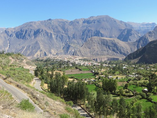
A voyage into the Colca Canyon involves a journey through layer upon layer of geology and history
Canyons have stolen my heart on this tour. First came the mighty Grand Canyon, Arizona, USA and then the deeper Copper Canyon that nestles among the Tarahumara mountains, Chihuahua, northern Mexico. It is no exaggeration to say that the Grand Canyon changed my life. The most incredible piece of landscape I have ever seen (to this day), this iconic piece of mega-erosion humbled me to the core, sending me careering into an unscheduled life reappraisal. The Copper Canyon managed to have an equally profound effect. The riding there accelerated the evolution of my biking mindset towards the rough and rewarding while illness, bike mechanical issues and a chance meeting with the legendary Micah Truth (RIP) strengthened my soul against what’s expected. The route I sweated down to Urique in the bottom of the Copper Canyon and then back out the other side remains the toughest stretch of riding of my life. Beset with bike and health problems, the arid dusty conditions combined with remoteness, difficult roads and an overloaded and inappropriately set up bicycle to make this route a personal right of passage. Those days inspired me onto challenging routes and are a constant reminder of why a lighter bike is a funner bike. Since then the Colca Canyon has been sitting proud in my bucket list of places to ride.

Irrespective of my obvious happiness, this is a lesson in how not to set up your bike for dirty canyon adventures (Copper Canyon, 29 April, 2011)
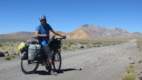
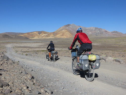
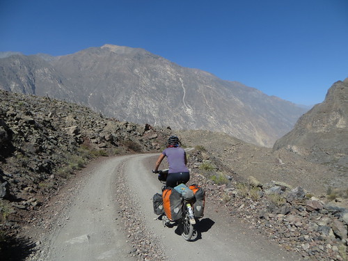
That’s more like it… lighter and balanced on the ride over to the Colca Canyon
There are settlements in the Colca Canyon but they are small and inaccessible. The possibility of a road that could negotiate both the steep slopes of the canyon and cross the Rio Colca by any route other than Chivay, was until recently just a dream. Then in 2009 the AR-106 appeared on the Peruvian Ministry of Transport and Communication (MTC) maps and the suggestion was that a route had been forged down the northern slopes of the canyon, through the Valley of the Volcanoes to the village of Ayo and beyond across the Rio Colca, along to Cango and then up the steep southern slopes to Huambo. Climbing out of the Cotahuasi canyon would be easy, a paved road switchbacks gently up to the canyon lip. Riding through the Colca canyon would offer up a whole other challenge. I set about my research, excited by what the MTC maps told me but disbelieving of their authenticity. I scoured Google Earth (a curious cycle tourists best friend) and searched the internet for information. The results were a mixed bag: Satellite images suggested two potential pathways heading up from the Rio Colca to Huambo and the main road on the southern side of the canyon but showed no way across the river. The blogosphere was completely devoid of information save for a couple of vague mutterings from hikers and no other official mention of the AR-106 road existed at all. Then I stumbled upon what I thought I needed, a YouTube video clip of a 2009 news item reporting on the Mayor of the district opening a road from Ayo (north of the Rio Colca) up to Huambo. This was the proof I needed. Attempting this potentially challenging new route straight through the guts of the Colca Canyon might just pay dividends.
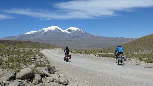
Mixing canyons with 6,000m mountains… possibly the perfect cocktail
Here is the story of mine and Cherry’s journey from the depths of the world’s deepest canyon over some terrifyingly beautiful scenery into the unrelenting clutches of the infamous Colca Canyon. Do my dreams come true with a hike and bike through the canyon or does it send us packing? You’ll have to see…
After a couple of days rest in the relaxing warmth of Cotahuasi (2,710m), Cherry and I mount the pavement and start spinning upwards
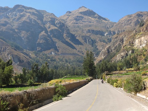
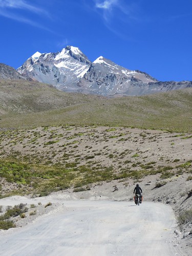
The canyon lip towers a vertical kilometer above… on the paved road we set ourselves for a slightly dull rhythm climb out
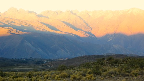
Thankfully the extraordinary views down into the world’s deepest canyon more than make up for the monotonous riding…
… and by mid afternoon we’re rewarded for our escape from the canyon with a return to a more involving road surface
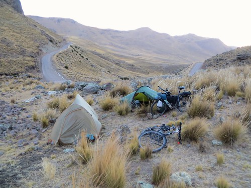
Still fatigued from our previous leg of riding over from Antabamba we pitch up earlier than expected…

… leaving plenty of climbing the next morning up to Abra de Viscos (4,695m)

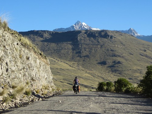
And then the rewards start… breathtaking views of Coropuna (6,425m)…
… and Solimana (6,323m)
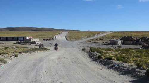
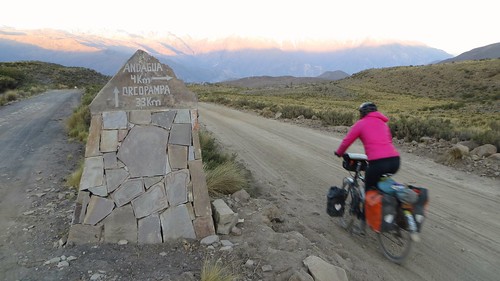
After an 18km descent from Abra de Viscos (4,695m) we eat lunch and head up to the turn towards Andagua
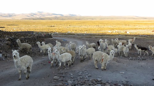
Suddenly we’re on a huge open plateau of pampas upon which perches the old Inca village of Mauco Llacta, where Alpacas and Llamas rule the roost

Before long the sun is dropping behind us…
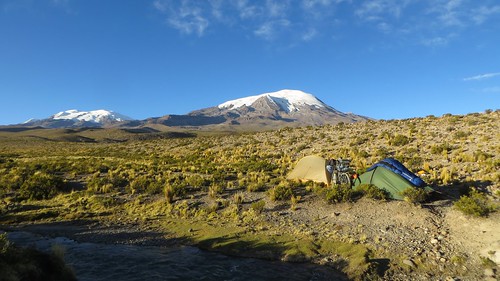
… marking the start of a cold night that leads into an inspiring morning in camp
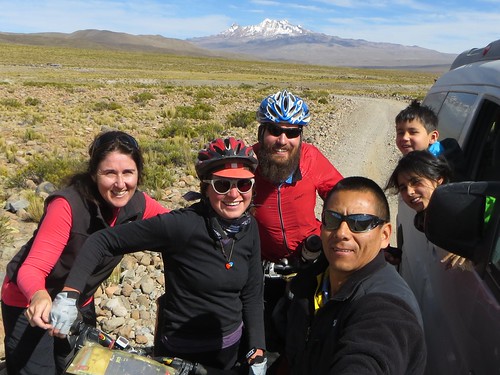
Back on the road and spinning steadily up the rocky road from Mauco Llacta we encounter only one car. This happens to be the adventurous Chavez family who we’d met a couple of days earlier on the climb out of Cotahuasi. The unexpected treat of some fresh fruit…
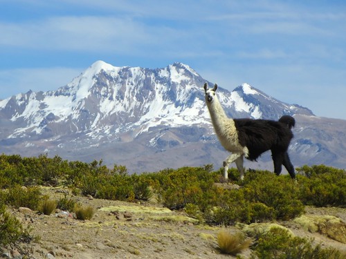
… combines with an encounter with ‘Juan the trouser Llama’…

… to buoy our spirits, spurring us on…
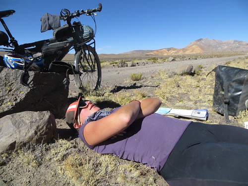
… to a lazy lunch
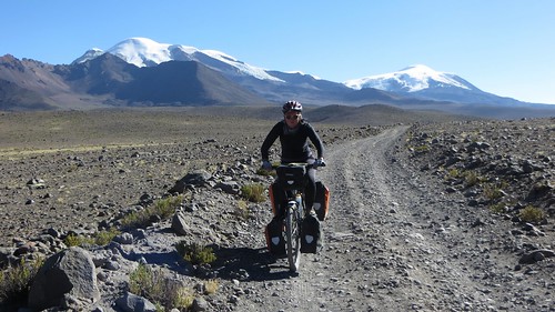
Riding above 4,800m…
… the landscape offers us…
… a variety of treats…
… before releasing us…
… onto the dramatic descent…
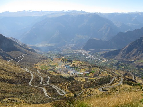
… down to Andagua on the lip of the world-famous Colca Canyon
The final few kilometers have us braced against the cold…
… but we soon thaw out in Andagua (3,587m). Conversations with Juan, the town mayor assure us that we’ll be able to cross the Rio Colca and climb up the other side of the canyon to Huambo
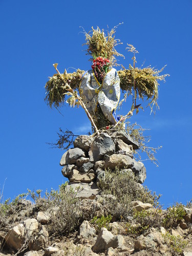
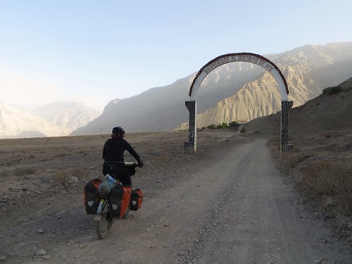
So next morning we continue on our way, past a series of haunting idols…
… and deep into the Valley of the Volcanoes…
… where we’re swallowed by the enormous lava field
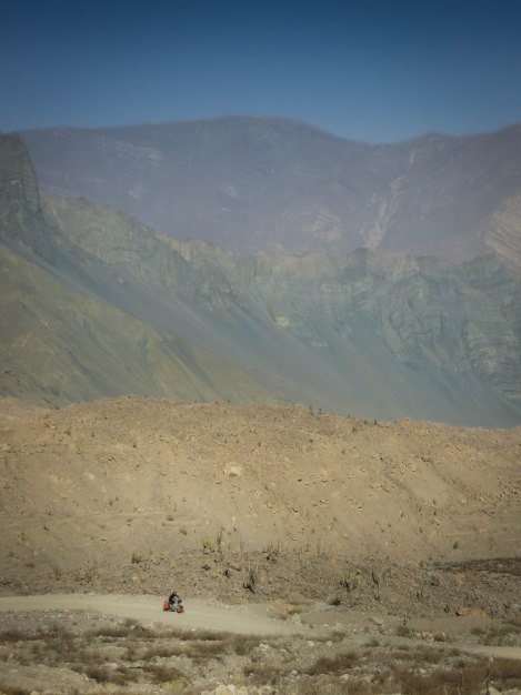
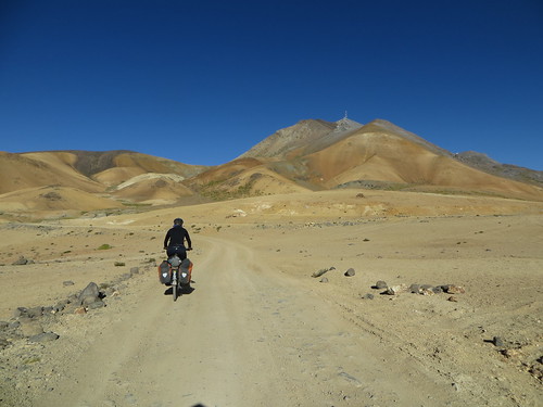
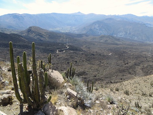
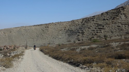
The further we descend the more arid the environment becomes…
… and the more dramatic the canyon appears
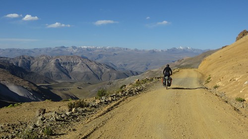
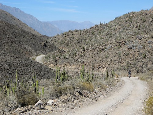
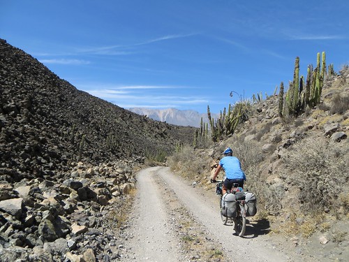
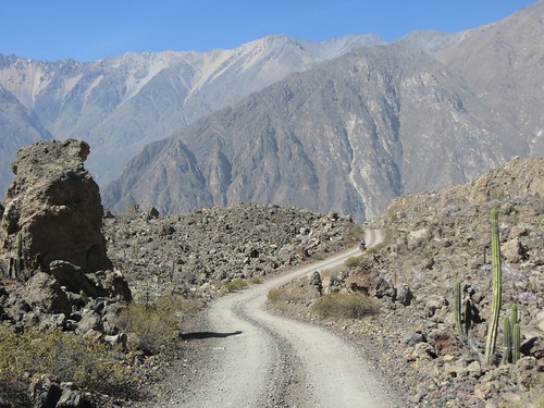
Every wind in the road…
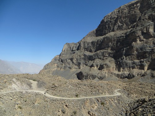
… revealing new…
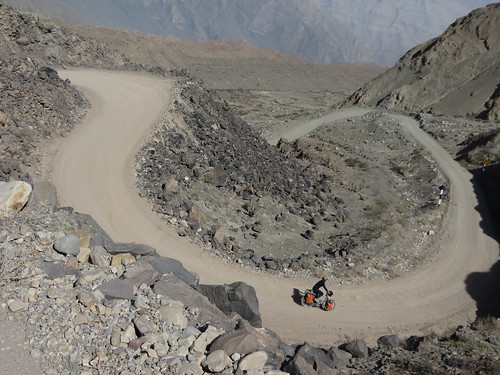
… and exciting stretches of riding…

… and every kilometer of rocky track providing unbelievable enjoyment
And it’s not just the landscape that fascinates, there are also plenty of pre-Incan ruins and extensive ancient terracing to set the mind boggling
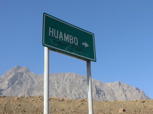
Just a few kilometers short of Ayo we come across this sign to Huambo. It seems too good to be true. We sit down and eat lunch while trying to decide whether to follow our instincts down to Ayo or our sense of adventure along this supposed road to Huambo
Experience has left us skeptical of Latin American road signs so good sense prevails and we opt to continue to Ayo…
… where we ask around about routes and bridges
It’s a small town so word soon spreads of our arrival and ambitions. As Cherry tries to squeeze reliable information out of as many people as possible I guard the bikes. As I do so I can hear people discussing our predicament, it doesn’t sound good
Inquiries reveal that there is neither a way across the Rio Colca nor a road up the other side of the canyon to Huambo. Hiking trails exist but are apparently steep and dangerous. We ask about having a guide try and take us but the endevour is deemed fool hardy with a bike. This leaves us defeated and deflated, my dream shot down. With very limited time left on my visa and commitments down the road we don’t have the time to test what we’re told. There is no practical choice other than returning back up the way we’d come. With no bus for a few days, we’re left stranded in near the bottom of the second deepest canyon in the world
Route Tips
Be aware that distances and elevations are taken from my bicycle computer and barometric altimeters, thus they are in some ways an approximation.
Cotahuasi to Ayo
4 days, 100 miles (161 km), 9,711 ft. (2,960 m) of climbing

Route from Cotahuasi over to Ayo in the Colca Canyon… click here to view the fully interactive map and elevation profile
Cotahuasi to Ayo Route elevation profile
- Cotahuasi (2,710m) – Despite being a reasonably sized town with various accommodation options, plentiful shops and a bank that changes USD, Cotahuasi sill lacks the internet and an ATM. We were also unable to find Bencina blanca.
- 27.8km – A gentle paved climb up to the lip of the canyon at 4,000m (where the pavement stops)
- Once out of the canyon water is scarce. Make use of the stream at about 33.5km (4,130m)
- 37.8km – continue left around the hairpin ignoring the road right. There is a sizeable shelter at this junction that could cater a tent.
- 44km – Abra de Viscos (4,695m)
- An undulating descent with great views of Solimana and Coropuna continues 18.3km to a bridge (4,280m) after which there is a 0.6km climb to a junction (4,310m). Take the sharp left, ignoring the two roads that fork straight (to Chuquibamba). The turning is rudamentally signed to Angagua and Orcopampa. From this point the landscape really opens up as the road gently climbs for about 34km.
- 2.4kms from the junction stay straight (not left) and continue on 5.1kms to the village of Mauco Llacta.
- Mauco Llacta – a small Inca village and designated archeological site. Take a left at the junction with the standing tap to sweep around to the only tienda (has limited stock but useful for eggs, gaseosas, snacks and toilet paper). I recommend filling up water in the village but it’s not strictly necessary as there are a couple of clean water streams still to cross. The main route continues straight at this tap.
- 22.6km from Mauco Llacta stay right at a junction and then continue towards the large hill with a mast. In 4km is another larger junction. At the junction (4,860m) 26.6km from the village take the left option towards Orcopampa. Right goes up to Abra Viraco (4,940m) and continues on to Aplao (see Pikes route). As the road gently climbs from Mauco Llacta its condition generally declines. Although all rideable some rocky sections require a bit of concentration.
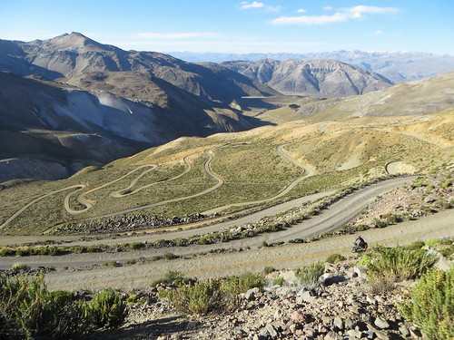
- Following the junction you’ll sweep around to the right to the head of a dramatic series of switchbacks. Take care on this descent, it’s sandy in places and generally quite rocky. After about 10km (from the junction) the switchbacks straighten out and you’ll pass some farm buildings before the road joins a stream. It’ll then continue to lose altitude following the stream down through a winding valley. 14km from the junction (4,218m) stay straight (not left). 17km from the junction the route crosses the stream (4,090m), a short climb then takes you out of the valley and into some amazing views of the Valle de Volcanes.
- The descent towards Andagua is generally sandy and very sandy in places. 4.5km from the stream (3,819m) a signed junction offers left to Orcopampa and right to Andagua. Taking the right fork leaves a further 4.4km to the topiary filled central plaza of Andagua.
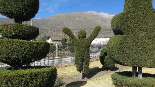
- Andagua (3,587m) – A friendly laid back little town with 3 accommodation options (I recommend Casa Grande for its friendly owners, hot shower and spacious courtyard). Although there are no banks or ATM, nor internet, the shops are well stocked. The east side of the plaza houses a good restaurant and useful shop selling (amongst many other things) petrol, bicycle rims, pedals, tires and numerous other (low quality) bike parts.
- Continuing through Andagua, 4.5km from the central plaza is a mine sponsored mirador and information point – ‘Mirador de Pequenos Volcanes y Lavas Congeladas’ (3,522m). This includes a map and can be a good place for Condor watching.
- 2.5km from the mirador the road passes through the tiny village of Soporo (3,415m) before descending another 1.8km to the Chachas junction (3,316m). The right-hand turn to Ayo is clearly signposted. Continuing straight would take you to Chachas (16km) and onto an alternative as yet unexplored high altitude route north-east up through Abandonada to Caylloma.
- The road then descends through an incredible cactus strewn lava field into the waterless and dusty Colca canyon. The going is rocky and sometimes steep. I strongly suggest checking your brake pads before leaving Andagua.
14km from the junction (2,789m) continue straight ignoring the signed left turn to Subna. From here look out for the impressive pre-Inca terraces and ruins. - About 11km later is another junction with a signed left to Laguna de Mamacocha (8km). Continue straight. Take no notice of the sign to Huambo, there is neither a way across the Rio Colca nor a passable route up to Huambo.
- 3km from the junction is Ayo. From just below Ayo the road continues left down to the Rio Colca where it stops. Despite what signage suggests, there is no route beyond the river.
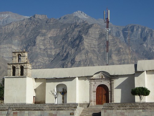
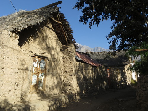
- Ayo (1,956m) – A quiet little town of narrow streets and thatched single story buildings. If you’ve been up at altitude you’ll enjoy the balmy climate. The central plaza was being rebuilt during our visit and the town had been without electricity for a few days. Ask around to find the 4 accommodation options (all universally asking 20 soles a bed). We stayed in Hospedaje Oscar for a negotiated 15 soles. There is a restaurant just up from the church and basic shops near the plaza.
NOTE: Despite what government maps may suggest there is not currently any road from a few km beyond Ayo. Take no notice of the signage to Huambo. If somehow you manage to cross the Rio Colca (there is no bridge) then it may be possible to hike with your bike to Cango. Beyond Cango a steep and narrow path can be hiked up to Huambo. Guides in Ayo refused to entertain the idea that the hike could be done with a bike. Although we didn’t have time to explore the option my research suggests that they may have a point. There is plenty to keep you occupied around Ayo if you find yourself waiting for one of the two weekly buses back up to Andagua (leaving Mondays and Thursdays). We were fortunate to snag a ride with a dump truck (two very bumpy hours).
Another account of the first couple of days of this route can be found on Neil and Harriet Pikes exceptional ‘Andes By Bike’ site HERE.
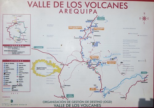
Valley of the Volcanoes Tourist Map

Pingback: In deep – a bike ride between the two deepest canyons in the world and out again | These Places In Between·
Pingback: A Bloody Big Lake and a Sizable Bolivian City… Around Lago Titicaca to La Paz | Velo Freedom - Cycling South·
Great to read this Nathan, most enjoyable! Just rode a segment of this route… and guess what… I found wifi (of the slowest kind) in Cotahuasi. Woohoo!