
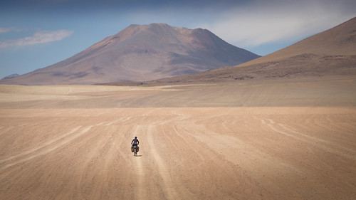
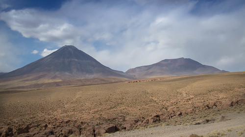
Bolivia is now gone, cemented as just another memory beneath my wheels. The grand finale to my fleeting visit being the magnificent world of the Cordillera de Lipez and altiplano desert. A stunning, beautiful and unique country, Bolivia has fallen short on only one major count, it is not Peru. My tour is littered with route come-downs; the highs of Arizona followed by the lows of Baja California, my first adventures in Guatemala bought to earth by the dull heat of Belize, the large majority of Central America being a stinking hangover from the joys of an exciting life and now Bolivia, a country that has served to break my fall from the Peruvian high Andes. So the fact I have slipped through Bolivia mostly numb to its charms should not serve as a direct reflection on the place. ‘Numb’ does not necessarily mean oblivious. I may have been detached but I’ve certainly not been blind. With landscapes like those of south-west Bolivia, I’m sure even a blind man could shoot a memory card full of outstanding photos. Bolivia is and will remain a bicycle touring jewel, unfortunately for me it shines just a little too brightly and has caught a few too many wonderer’s eyes.
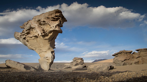
The Arbol de Piedra (Stone Tree)… one of the icons of the Lagunas route through south-west Bolivia
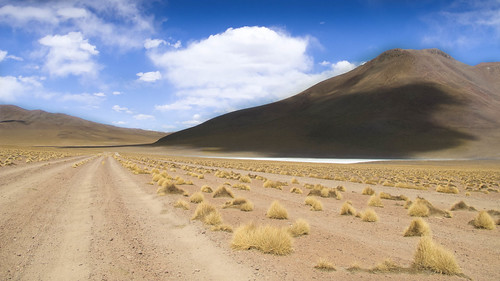
One of Bolivia’s problems is that its cycle routes are so iconic. In many ways it has become a victim of its own success. Riding the salars and lugging through the Lagunas have become a priority fixture on the South American tour wish list. Thousands of touring cyclists have pedaled and pushed these routes with many of them then injecting their thoughts into the ever-expanding biking blogosphere. As a result the positives and negatives of these experiences have been laid out and hammered into folklore by constant repetition and affirmation. And as we’re not all blessed with bottomless reserves of positivity it is the less desirable references that seem to have risen to the top. Thus my route research on this occasion acted as little more than an exercise in indoctrination, filling me with the certainty that the fabled Lagunas Route through the high deserts of south-west Bolivia was going to be a nightmare of dust throwing tourist Jeeps, shit piles and rubbish. With the riding to be a certain punishment of butt bouncing corrugations and cyclo swallowing sand.
Shades of Peru… a rare fresh water source discovered near Laguna Chulluncani
Having marinated generously in the expected downsides I had settled on trying to avoid the famed ‘classic’ Lagunas route all together. It was only an email from a friend that pushed the idea back onto the agenda. He posed the question ‘why else do we ride Bolivia?’ and I found no answer. He was right, the route is popular for a reason. Any potentially annoying factors have to be balanced with the draw to explore the show stopping landscapes that attracted people to the area in the first place. So after much deliberation I mapped a compromise, a route that would dip onto the ‘classic’ Lagunas route but then withdraw quickly into sections of more solitary adventure. I thought I would be able to hold my breath and deal with the failings of this parallel touristic universe for only a minimal amount of time. And having ingested the words of others, I also figured that avoiding the tourists would mean avoiding annoyance. This plan became known as ‘Operation Jeep avoidance’.
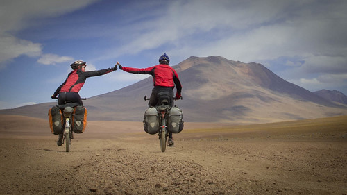
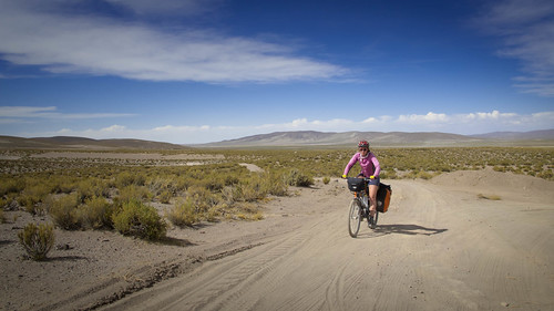
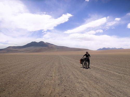
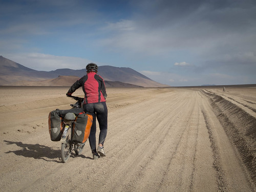
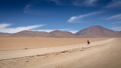
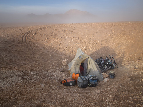
Team Lagunas… once again I’ve been joined by Ms. Cherry Fitzsimmons
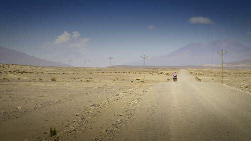
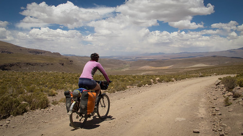
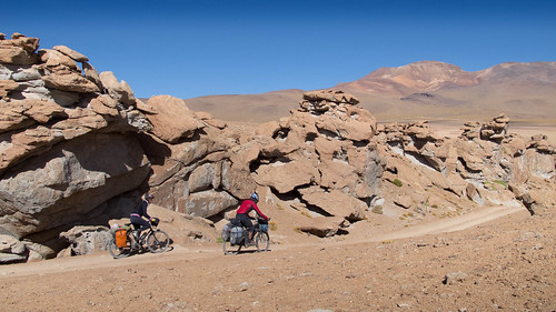
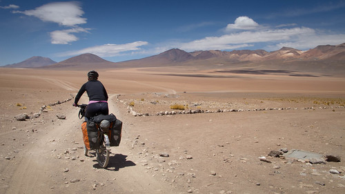
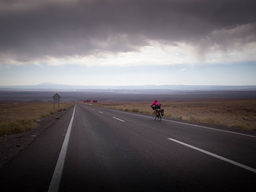
Partnered by a freshly matured Cherry (welcome to your 30’s old girl) we mounted the railway line out of Uyuni and put ‘Operation Jeep avoidance’ into effect. But as the days ticked by the plan slowly unraveled. At seemingly every junction we took the opposite turn to my plans and the route soon became a pragmatic adventure towards the dreaded ‘classic’ road. Although joining up with the main route later than I’d originally envisaged, once we did we never left. Sucked in by the elegance of the surroundings and surprisingly by the ease of the riding, the ‘classic’ route stole us. It quickly transpired that avoiding tourists would mean avoiding the ‘best bits’ of the region, so we surrendered to our fate. And strangely once we joined up with the ‘classic’ Lagunas route my world brightened immeasurably. A nagging nausea that had been getting me down dispersed and I finally lifted my head to enjoy the surroundings. The first few ‘classic’ days were great. Only sporadic convoys of tourist Jeeps passed by and when they did the roads have become so convoluted with different tracks that they were seldom close enough to really bother us. There wasn’t as much rubbish around as I had been expecting and the weather was warm and sunny. Although brutal afternoon headwinds added some spice, the low temperatures we’d been programmed to expect never materialized. And although there were short stretches where we were forced out of the saddle to push our bikes these where of negligible frequency and duration and actually added some welcome variation. With our medium weight set-ups and wide enough tyres, Cherry and I were able to ride the Laguna’s, something we could see from telltale tracks in the sand that other cyclists were unable to do.
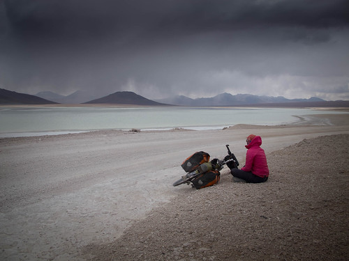
Sometimes you just get lucky with the weather. We experienced a number of close calls on this route, such as this one on our final day on the way past Laguna Blanca, but ultimately remained dry the entire time
I cannot deny that the further we rode south the more real the negativities became. However, after the sorry slant of my last post on this occasion I shall try to keep in my moans and let future riders make up their own minds. It would not be right to lump the kind German man who had tears in his eyes when presenting us with an apple and some biscuits together with those who scream, shout and shit everywhere. And it would be unjust to forget the warmth of the tour guides who slow their Jeeps and check we’re okay just to recognize the fools who speed dangerously past. My only statement on the situation is this: We are tourists and they are tourists. The only difference being that we have chosen to take responsibility for our actions while it appears that many of them have paid someone else to take that responsibility from them. Common sense aside it is therefore the fault of tour agencies and their staff that my preconceptions of this beautiful route were clouded in negativity. It is also their inability to control and verse their clients that, despite what I write here, my lasting memories will likely be clouded by anger.

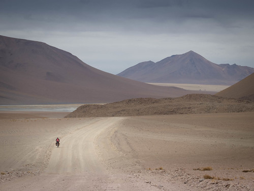
Route from Uyuni south through the Lagunas to San Pedro de Atacama, Chile… click here to view the fully interactive map, elevation profile and download the GPX track
Uyuni to San Pedro de Atacama Route elevation profile
Here is the story of mine and Cherry’s adventure through the high desert of south-west Bolivia and on down into Chile. Full route notes and useful information on the route can be found at the end of this post…
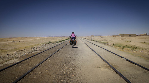
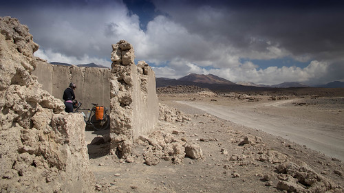
After a restful and productive break we finally mount the railway lines and extract ourselves from the tourist oasis that is Uyuni
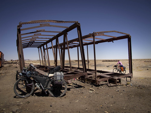
A few km’s from Uyuni we hit the famous train graveyard…
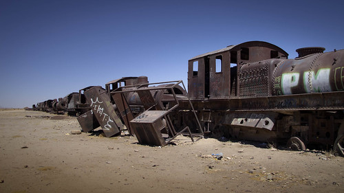
… a dubious attraction we discover crawling with Jeep tourists

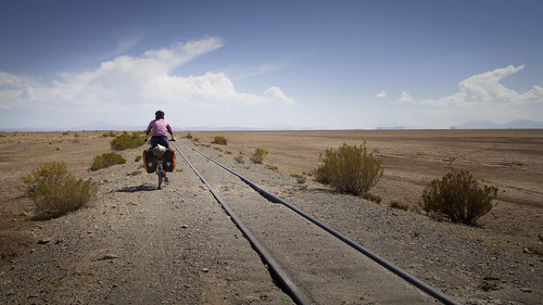
From the trains some featureless salar riding delivers us through the small sleeping village of Vinto…
… from which we continue on the railways lines…
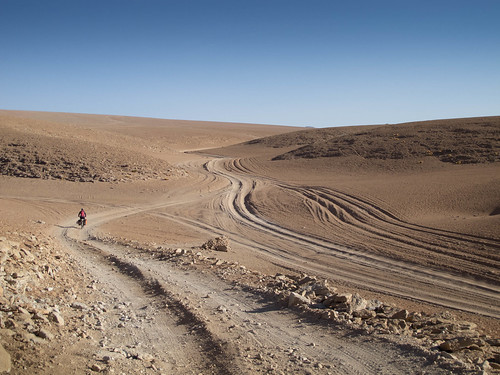
… before getting disillusioned with the energy sapping sand and departing to find the main road. Although further, this proves immeasurably quicker and we’re soon pushing through the Rio Grande…

… and onto an evening arrival in the village of Rio Grande
After a restful night it’s back onto more flat riding…
… to the old railway village of Julaca

From Julaca we decide to head south on the direct road to San Augustin
This treats us to a fun little climb…
… before delivering us down…
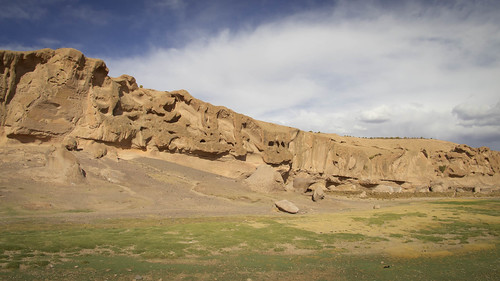
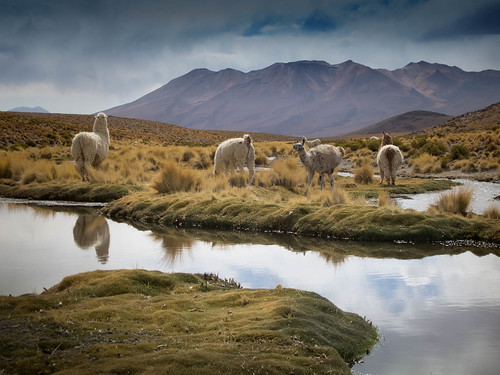
… into a picturesque world of bluffs and Llamas

Leaving San Augustin the next morning…
… we meander our way up over another pass…
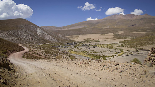
… before dropping into a beautiful vista…
… eventually winding up in Villa Alota

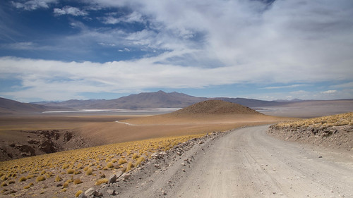
Following a leisurely resupply in Alota we find just enough impetus to carry us 14km out of town to a special little camp spot in the Valle de las Rocas
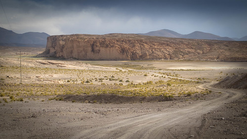
That leaves just a quick morning burst on the International highway before turning off onto a route around the east side of Cerro Caquella
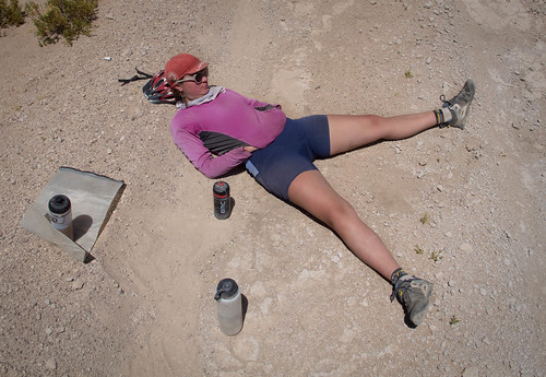
As the sun beats down relentlessly it’s not long before we’re forced into a break. Cherry loves an excuse to roll around in the dirt. On this occasion she adopts the ‘dirty biker starfish’ pose
Rejuvenated we forge on…
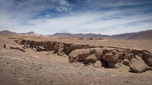
… past numerous ancient La Llareta shrubs (said to be over 2,000 years old and some of the oldest living things on the planet)…
… and onto lunch by Laguna Chulluncani
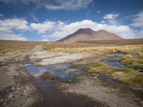
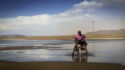
Whilst feasting on peanut butter crackers I wistfully comment on how I wish we had enough water to take the track south from Laguna Chulluncani instead of dropping east to join the ‘classic’ route. A few km’s downhill from the Laguna we chance upon an excellent water source, fill up and are able to return to ride that southerly road
By the time we arrive back at Laguna Chulluncani the weather has caught up with us…
… so we abandon the ride in favor of an early camp

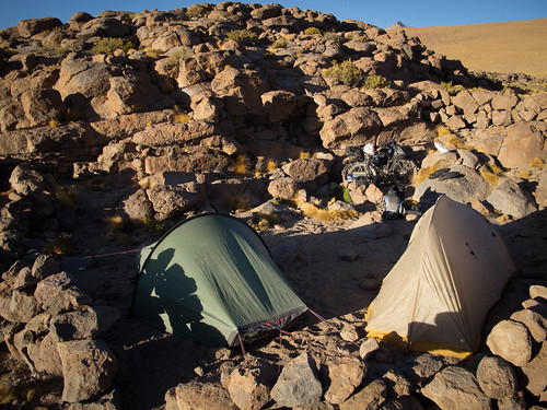
Dreams of relaxing in the waning afternoon light are rudely snatched away as Cherry’s tent gets ripped out of the ground by a freak surge of wind. One moment I’m preparing tea then the next I’m holding my tent down as Cherry runs after hers shouting ‘Oh my God, oh my God’. As the tent gathers pace and tumbles over the horizon I start working out how we’re going to survive with just my solo tent. After what turns out to be a run and hike of several km’s Cherry eventually drags herself, complete with battered tent, back into camp.

Some duct tape surgery pieces Cherry’s house back into livable condition and we enjoy a restful night before climbing over to Laguna Cachi. As we near the lake our progress is slowed by our first taste of the famous lagunas sand
Dejected by the monotony of km’s on corrugated sand it’s hard at first to appreciate the beauty of Laguna Cachi…
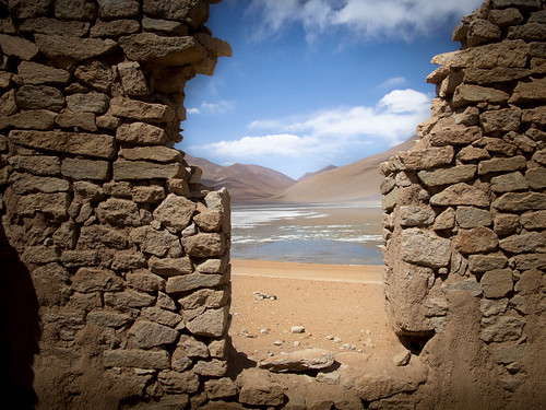
… a situation briefly corrected by an afternoon snooze amid some shady ruins
Feeling unwell and uninspired it’s a tough crawl away from Laguna Cachi. Climbing into brutal headwinds I’m soon beaten into a state of total dejection. When we finally reach the junction with the ‘classic’ route I’m in bad shape
Fortunately I have Cherry to look after me. She puts me to bed with a hot water bottle (yup, believe it) and the next morning I’m close to being back to form
Optimism restored, we set off…
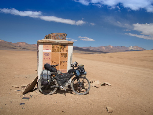
… and are relieved to find we haven’t bypassed the Hotel Desierto and the chance to restock our waning water supplies
The short detour to the hotel proves productive. Faces washed, water replenished and a very expensive bottle of Coke sloshing around in our stomachs, we get back to work
The few km’s south from the Hotel del Desierto junction quickly turn into the most challenging of the route…
… forcing us off the bikes for a short stint of pushing
Thankfully we’re soon back in the saddle and winging our way towards lunch
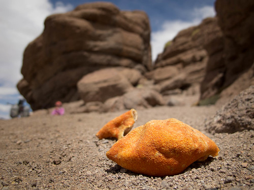
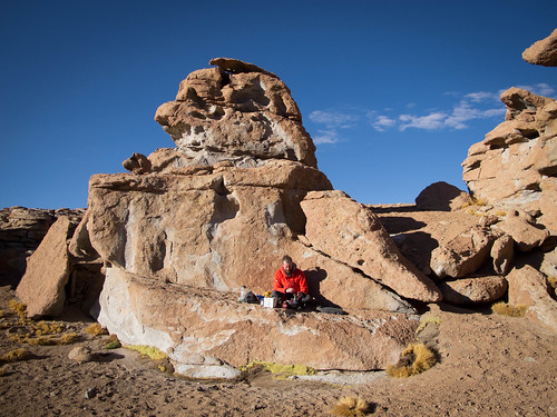
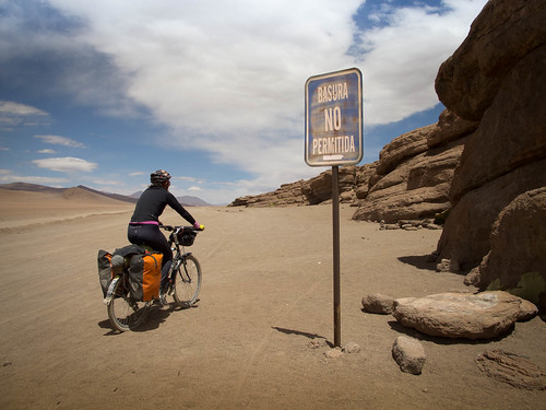
A rocky outcrop provides us a perfect sheltered spot to relax with lunch. Unfortunately we’re not the first people to break here. All sorts of rubbish and toilet related detritus litter the site
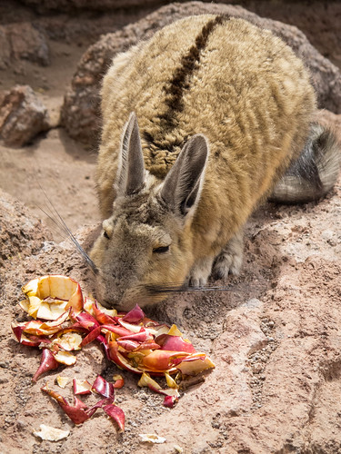
But one animals trash can be another’s tucker. As we eat we’re joined by three of these little monsters. I call them ‘rock bunnies’ but I understand they’re actually viscachas
Although we’re forced out of the saddle for the occasional meter or two, the riding from lunch is relatively easy. Despite this Cherry starts to develop a bizarre fondness for pushing. Although able to ride everything she sometimes gets bored with the washboarding and dismounts to push as a change of scene
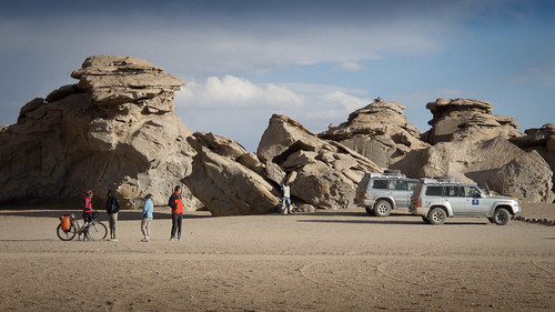
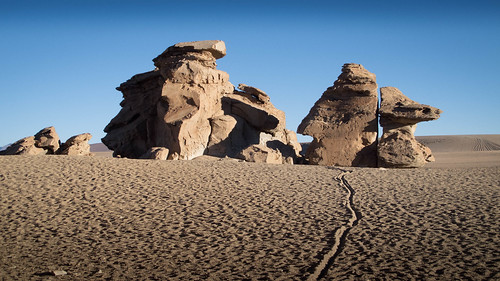
We’re soon at the famous Arbol de Piedra (Stone Tree), a magnet for the tourist Jeeps. Fearful of the risk of having to speak to curious tourists I send Cherry in to test the waters. She proves the perfect decoy, answering all the inane questions and boring the tourists into disinterest in preparation for my arrival

Whittled by the sandy winds of time by sand and wind over time… once the Jeeps have departed the Arbol de Piedra stands with great dignity in the evening light. Apparently it was formed by erosion of sand and wind… over time
As it’s nearly camp o’clock we start exploring the rocky landscape around the Arbol de Piedra for a home
It soon becomes apparent that many visitors don’t get the memo about the toilets on site. Under every rock we find toilet paper and other such dubious delights
Still, with a bit of perseverance we’re able to find a comfortable spot
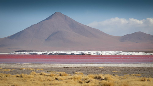
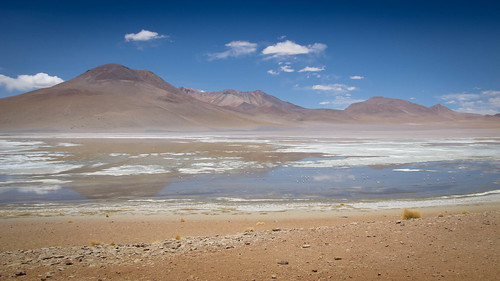
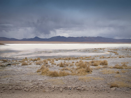
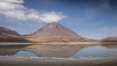
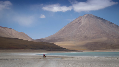
A short spin downhill the next morning takes us to Laguna Colorada. With its vibrant reds and salt-bergs, Colorada is a true natural wonder, by far the most impressive sight on route
The refugios of Laguna Colorada entice us into an afternoon relaxing and a night under roof. When we awake and resume the journey south it seems Colorada has lost its mojo, the morning reds being a pale imitation of their afternoon counterparts
From the refugios quick sandy km’s deliver us…
… onto the climb away from the lake
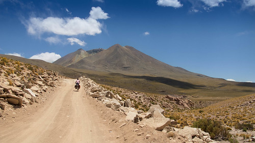
As always the climbing is a joy and we’re soon leaving Laguna Colorada behind…

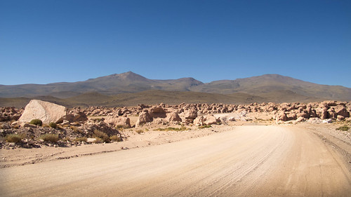
… and entering a new, more arid world
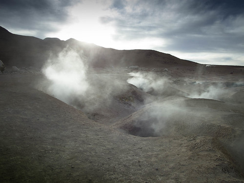
After battling frigid headwinds up to a pass we’re soon marveling at the bubbling mud and geysers of Sol de Manana. But it’s late, cold and we need to find a spot to camp…
… something that proves incredibly hard. Eventually we find a dip sheltered enough to camp away from the savage wind, but it’s only big enough for one tent. Exhausted, we both pile into Cherry’s tent and pass out after a nourishing dinner of chocolate chip cookies
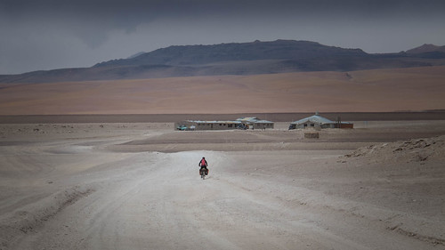
After a drawn out morning in camp trying to recharge our calorie count we speed off down hill towards the Salar de Challviri
Despite the distraction of dense Jeep traffic and some highly annoying tourists we’re able to enjoy lunch in the restaurant at Challviri before moving down the road to make coffee and take in the salar
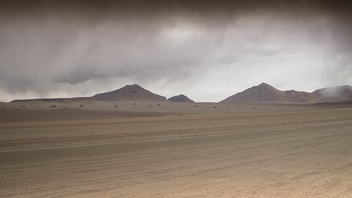
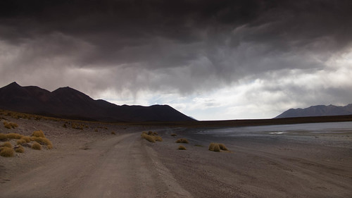
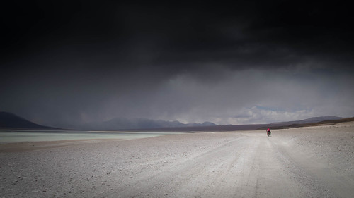
Overcast skies haunt us all morning. As the afternoon plods on they develop into something much more threatening. Our ride through the desierto Salvador Dali becomes a tense affair as snow falls on the peaks around us

In a bid to outrun the weather we power up a small pass…

… into a cold descent…
… and down to camp by Laguna Blanca
Although we escape the weather one day, it’s still waiting for us the next…
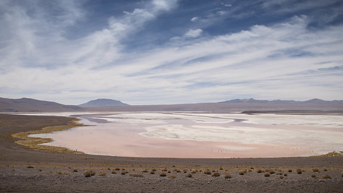
… clearing only briefly for us to watch Laguna Verde turn from mirror lake…
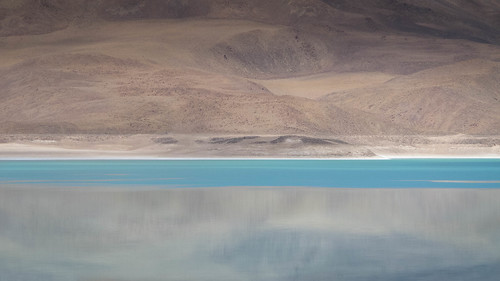
… gradually…
… to a bright emerald-green…
… before the clouds take over in dramatic style
Unbelievably we once again find ourselves dodging the bad weather and arriving at the Reserva Eduardo Avaroa park southern entrance happy and dry
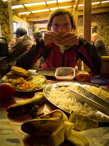
Ducking into the park entrance refugio to get some hot water for tea we’re fortunate enough to be offered some left overs. As the first fruit and veg we’ve eaten in some days it comes as a very welcome surprise
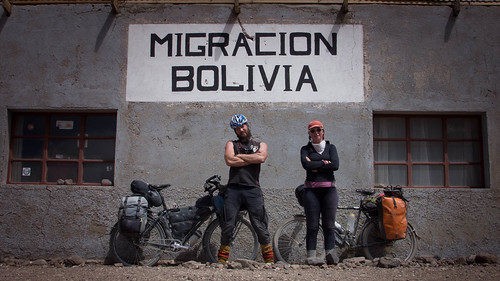
On leaving the reserve we’re left only a short bounce uphill to the end of Bolivia. Impressed that Cherry beats my up to the immigration office the border guards are distracted long enough to neglect scamming us of a departure tax. With an unemotional goodbye to Bolivia comes…
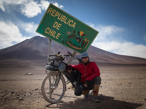
… a slightly relieved hello to Chile
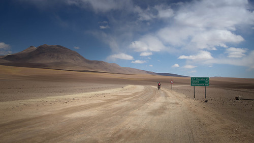
It’s still some way to San Pedro de Atacama so we don’t hang around at the border.
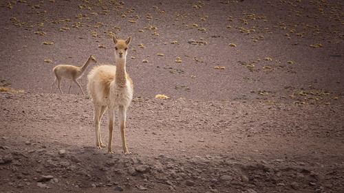
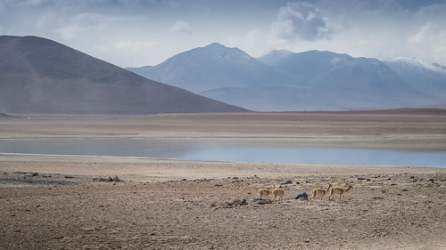
Not even inquisitive and incredibly cute baby vicuña can stop us…
… as we power over the pass by Volcans Licancabur (5,950m) and Juriques (5,704m)…
… and onto the long brooding descent down 2,500m to San Pedro de Atacama
Route Tips
10 days, 491 km (305 miles), 4,820 m (15,814 ft.) of climbing
As I said at the top of this post my original intentions for this route led to route imaginings that changed considerably on the way down. One of my top priorities when setting out on the route was to climb Uturuncu (6008 m), reportedly one of the easiest 6000ers in the world to ascend. This is in large part due to the fact it is possible to ride most of the way, one of the world’s highest rideable roads climbing to a dizzying col at 5760m. Unfortunately we had to abandon this plan on account of my poor health. Scaling Uturuncu requires a detour east away from the ‘classic’ Lagunas route to Quetena Chico. Instructions on the climb can be found on Neil and Harriet’ Andes By Bike site here. My inspiration for attempting the climb came from Cass and Mike, Cass’s account can be viewed here and Mikes here.
My original route plan can be viewed and a GPX track downloaded here. Our eventual route varied considerably from this plan as we got to know the terrain and other options opened up. Most of my information during route research came from Neil and Harriet, Tom and Sarah, Cass, Mike, Anna and from the ‘Cycling South West Bolivia’ pdf.
Here are some notes and comments:
- We had planned to ride the railway tracks all the way from Uyuni to Rio Grande. However, after the small village of Vinto we abandoned the idea and joined the road to Rio Grande instead. The swamping sand just wasn’t worth it.
- I had originally planned to take a route from Julaca through San Juan before turning south to San Augustin. Having spoken to locals we changed this in favor of taking the direct road south out of Julaca to San Augustin. This proved to be a beauty and saved us half a day.
Route Notes Rio Grande to San Augustin:
- 33km from Rio Grande is Julaca
- Turn left in Julaca on the road to San Augustin (see map board in Julaca)
- 11.3km from Julaca branch right towards climb. Straight would take you to Catcha ‘K’
- 8km of sometimes sandy climbing delivers you to the summit cairn (roughly 4,125m)
- 6km descent from the summit is a right turn to Quebrada y Laguna Turuncha. Stay straight. (Village on left)
- 69km from Rio Grande reach San Augustin central Plaza
Route Notes San Augustin to Alota:
- 12.9km climb from San Augustin (small shop and cheap accommodation sin shower) reach saddle between two volcanoes (4,195m).
- Sign points straight to Alota and left to Laguna Buena Vista y Nido de Condores (6km)
- 15km from SA is the high point (4,200m)
- 33.2km from SA take a left onto the International highway towards Alota
- 35.6km Ville Alota plaza (3,830m). Accomodation options and shops (if you can get them to open). There is a guy that sells good bread from his restaurant and makes exceptional cake too.
Route Notes Alota to Laguna Cachi:
- From Ville Alota I had originally planned to take the International highway around the north side of Volcan Caquella before turning left south towards Laguna Canapa. Instead we turned left before the volcan and ducked down its east side towards Laguna Chulluncani. A route I’d highly recommend, this allows you to leave the International highway sooner and avoid Jeep traffic.
- We filled up with water and food in Alota then camped in the rock forest about 14km up the International Highway.
- 28km (all distances from Alota) take left round east side of Volcan Caquella
- 36km reach a high point (4,415m)
- 36.3km take a left into a track more popular with Jeeps
- Upon reaching Laguna Chulluncani continue on the road around to the right. This will descend about 4km down to a fresh flowing saline free water source. We each filled our 10 litre dromedary bags and all bottles here before returning back up the hill to the laguna.
- 50.5km, having returned to Laguna Chulluncani take the right turn around the east side of the lake, heading S/SE.
- 0.5km later return to the original road that delivered you to Chuluncani and turn R.
- 56km, great little walled camp spot on the left of the road, nestled into the hillside before the main climb starts.
- 56.7km, stay right and climb up between the two small peaks. Left will take you to Laguna Pastos Grandes.
- 62.6km, toppled the pass at about 4,680m
- The descent from here to Laguna Cachi ends in a corrugated and sandy slog to the lake. But once you get there you’ll find some abandoned buildings that can make for a shady lunch stop of a good little camp.
- From Laguna Cachi follow the main track up to the right. This will take you over a high point of about 4,685m before descending down to join the ‘classic’ route (89km from Alota).
- The ride back to the classic route from Cachi was a bitch for us due to a savage headwind but when we rejoined the main route there was a great camp off a side road to the left.
- Our water from the spring near Laguna Chulluncani was plenty adequate for two camps and a days riding. The next morning we were soon at Hotel Desierto (the turning 7.5km from where you join the ‘classic’ route) and able to refill.
- See Tom’s route notes from here.
- We filled 6 or 7 litres of water each in Hotel Desierto and that did us fine for a camp by the Arbol de Piedra and ride down to Laguna Colorada.
- The tienda at Laguna Colorada had pasta, crackers, soft drinks, biscuits, toilet paper, lots of alcohol (to drink) and the such like but no oats.
- From Colorada you need an overnights supply of water to get you to the restaurant at Challviri. The guy at the restaurant was unhelpful but they will serve you a good plate of food once you tell them you’re a cyclist. Fill up an overnights supply of water there to get you to the great disused building camp spots about 2km off the road towards Laguna Verde from Laguna Blanco.
- Note that http://www.tour.tk/pdf/cycling-southwest-bolivia.pdf says there are good sheltered spots by the Sol de Manana geysers to camp. As an experienced wild camper I couldn’t find anywhere half sheltered enough to camp. We eventually found a dip on the way up to the main road at 4,900m. Our wind was very strong though. Don’t bother exploring the abandoned building for a camp by the geysers as it contains the biggest pile of human shit you will ever have the misfortune to witness.
- Water is available at the refugios by the park entrance. We managed to scam some free left overs at there too.
- On leaving Bolivia you may be asked to pay a BS.15 departure fee. This is a scam. Get your exit stamp and tell them to eff off. We didn’t get asked for the fee but our friend a couple of days behind us was.

Great photos Nate!
We need to get you on a Surly with all this Surlyness
Love to read the adventures of a kindred misanthrope to steal me away from work drudgery
It has been both torture and treat for me to see these photos and read your stories whilst I have been away on a business trip with no cycling! It’s inspired me to plan some mini-tours when I get back! Thanks!
Pingback: Puna Dreams Pt.1: The Blissful Solitude of Socompa | Velo Freedom - Cycling South·
Pingback: Thru-Hiking the High Desert of South Bolivia | Dominik Birk·