
Stranded in the small Andean town of Oyon too weak to ride the route out I’d hoped and with time ticking, I set about finding a fun alternative. My main goal was to uncover the back roads that would deliver me to Ayacucho with maximum enjoyment and minimum effort. A package waiting for me in Ayacucho dictated that I had two weeks to get south to Ayacucho. My ambition was to use those two weeks as a training ground to rebuild my health and regain some fitness. I had limitations but wasn’t about to throw away my principles, so as always, I sought to avoid the paved roads in favor of dirt or gravel (ripio) back roads. Sounds like quite a task to find a fun but not too demanding unpaved route through the Peruvian Andes, but not impossible. My route-finding efforts uncovered a series of really enjoyable ripio and dirt roads that could be painlessly laced together with small slithers of paved highway. Although undoubtedly more of a compromise than adventure this route was valuable in opening up aspects of Peru I would otherwise have missed and as you’ll see from the photos, it was by and large a beautiful track. It also gives me an opportunity to help you know how I know where to go, unlocking the secrets of route finding in the Peruvian Andes.
Lago Junin (Chinchayqucha)… A flat oasis in the central Peruvian Andes
In setting about plotting a course south from Oyon I went to my usual route finding tools; other riders blogs, maps, Google Earth and ridewithgps.com. My go-to blogs (listed on the Blogroll at the base of this site) weren’t too much help as the majority of riders I respect rode the Great Divide Route I was crying off. However riders from before the Pikes opened up the Great Divide era, Tom Walwyn (Bicycle Nomad) and Sarah and James all raved about the dirt road around the west side of Lago Junin (aka Chinchayqucha), the second largest lake in Peru. Forging across a stunningly open high plateau with promises of Flamingo’s and solitude, that road instantly became the first on my route itinerary, a chance to get easy but rewarding miles in the legs. Getting to that point from Oyon left me few options but to head over Abra Uchuc Chacua (4,737 m, 15,541 ft). Fortunately though, on Google Earth I’d uncovered a track following the pass that would allow me to avoid the industrial delights of Cerro de Pasco. Studying the excellent Peruvian Ministry of Transport and Communication (MTC) maps (available in pdf by department here) I then discovered an exciting looking road over the mountains from Junin to the delightfully named small town of Huasahuasi. That in turn would allow me to avoid the two main arteries heading south from Tarma and La Oroya and instead take the smaller unpaved road down through Tapo and Ricran to Jauja. I knew from Tom and the MTC maps that small back roads could then deliver me through the high Pampas from there to the city of Huancayo. From Huancayo things were easy, Tom having described a high ridge route via Pampas as “stunning – and a truly glorious thing” I shunned the other popular route via Huancavelica and Abra Chonta in favor of battling the dust and trucks through Churcampa to Huanta and then cruising the paved highway into Ayacucho. The story of my ride from Huasahuasi to Ayacucho can be seen in the next post ‘Dusting Down to Ayacucho‘.
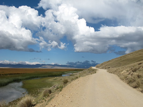
The glorious dirt road from Junin to Huasahuasi represents an easy high altitude introduction to El Silencio. Zero traffic and for me zero sunshine
I spend many many hours studying Google Earth for unmapped roads and tracks that might potentially take me where I unknowingly want to go. In the course of this study I uncovered a whole load of exciting riding opportunities heading south and west from the west shores of Lago Junin. Then I remembered what I was trying to achieve with this route and reigned myself in. Google Earth is an invaluable tool for finding and scouting less traveled routes. Once I’ve made my discoveries I then use ridewithgps.com to map them out. From this mapping I can then determine rough elevations, approximate distances and work out more of the character of the route. From ridewithgps.co it’s possible to export routes to Google Earth and to GPS devices. I choose not to use GPS, instead converting my notes, other riders route notes, elevation graphs and maps etc., to pdf and putting them on my Kindle to access on the road.

Route from Oyon south-east to Huasahuasi… click here to view the fully interactive map and elevation profile
Oyon to Huasahuasi Route elevation profile
Talking to other cycle tourists it’s clear that everyone has a different approach and different preferences when it comes to plotting routes. Some live and die by their GPS units while others might get a sniff of an idea and then freestyle it. I fall somewhere in the middle of these two extremes. My desire to find fresher less traveled routes can push me into hours of analysis, study and deliberation yet most of my navigation comes from asking people along the way. Experience has also taught me that reality is often very different from what the maps say and that life on the ground looks a lot different from the satellite view. Factor in unknowns such as mechanical mishaps and weather rebellions and you’ve got yourself a bike tour. I feel my approach leaves me prepared for exploration but open to adventure and I’m rarely disappointed. That said, how hard can it be to be unhappy cycling in the Andes? Actually not that hard… two words… Carretera Central!
Route notes and information can be found at the bottom of the post but first, here is the story of the first part of my rejuvenation journey down to Ayacucho: In this post I ride from Oyon to Huasahuasi…

After a few days recovery and recuperation in Oyon it’s a big relief to leave it behind and start a new chapter
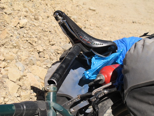
Just a few miles up the climb from Oyon my seat-post snaps leaving me two days riding beach cruiser style, with my knees up around my ears

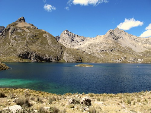
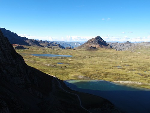
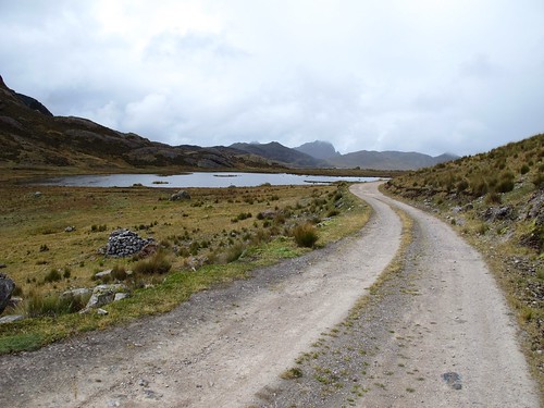
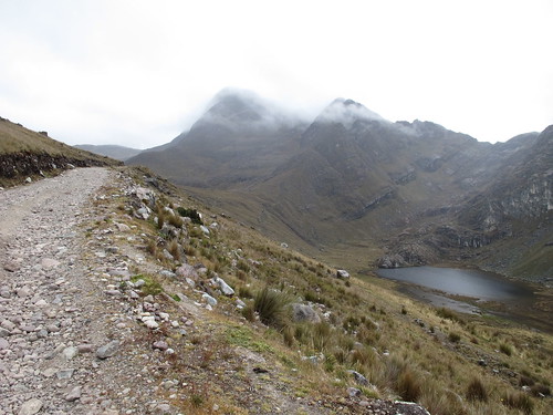
At about 4,050 m (13,290 ft) I reach the stunning spectacle of Laguna Paton…

… a refreshing gateway to a labyrinth of craggy peaks
The ride up to Abra Ucchuchacua is littered with stunning lakes, but also drab mining operations intent on polluting everything around

Stopping for lunch I’m joined by two and a half dogs… a sheep that thinks it’s a dog folds me over with laughter as it tries to chase the passing cars like its canine accomplices
The higher I climb the grayer the world becomes…
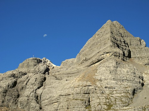
… until I finally crest the Abra Ucchuchacua pass
As always a mountain pass means a new exciting vista…

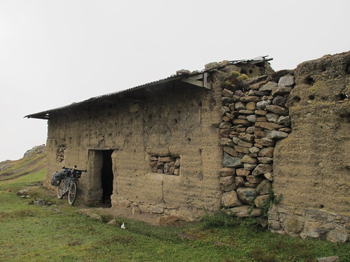
… and on this occasion a new home. Just beneath the pass I encounter Tambo, a tiny Hamlet with school buildings perfect for camping behind. To my great surprise enquiries about camping turn into a comfortable warm night in the brand new community bunk house

My morning preparations to leave Tambo are observed by Hans, an inquisitive little fella who cunningly gets me to do his homework for him. Hans cycles up the hill out of the village with me. Desperate to race I have to decline his invitations… with my low saddle stylings I wouldn’t stand a chance!
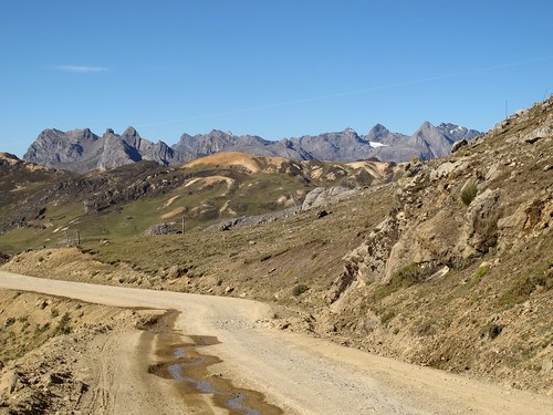
The colours and contrasts in the landscape excite as I climb over to the turn towards Cero de Pasco…
… leaving the mighty Cordillera Huayhuash behind
A fast morning descent through a series of tranquil villages…
… and I’m back on the climb, joined on this occasion by a few too many lorries
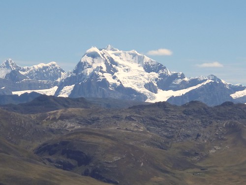
It’s undoubtedly sad to leave the Huayhuash behind…
… but the high altitude plain that opens up in front comes as a welcome relief to the claustrophobia of the mountains
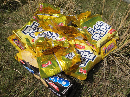
Stopping to collect some lunch supplies on the village of Pacoyan I’m approached by three ladies wanting their photos taken with me (not unusual in Peru). I joke that it’s 20 soles a picture… we all laugh and then they insist on paying me… in crisps!
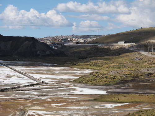
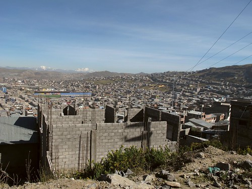
My original route plan had me bypassing the city of Cerro de Pasco, but the small matter of a broken seat-post forces me to re-route into town. Famed for its huge inner-city mine, the approach to Pasco slices through a ‘no man’s land’ of environmental destruction
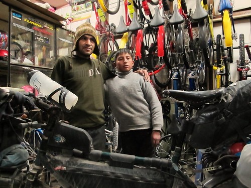
Turns out that 29.8 mm diameter seat-posts are impossible to find in Peru. Fortunately Alejandro Vasquez Zevallos and his son Frank are willing to humor me in my plan to get my riding position back. We doctor a portion of the old seat-post to create a shim into which a new considerably thinner post can be secured. The plan works and although not particularly inspired by the new thin seat-post I’m glad to have found some helpful mechanics (their shop is at 224 Calle Lima, Cerro de Pasco)
Leaving Cerro de Pasco the next morning the full weight of the cities grayness comes to bear
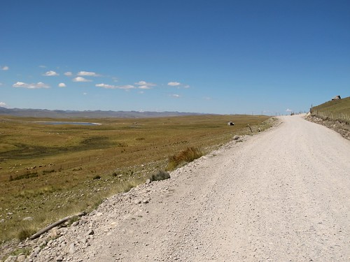
A few miles on the dreaded Carretera Central are soon over…
… and I’m crossing to the other side of the tracks…

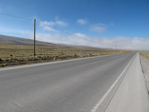
… where the morning clouds lift and pavement thankfully capitulates to blissful dirt
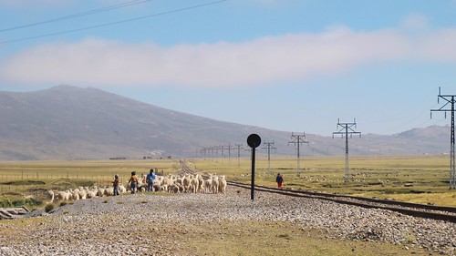
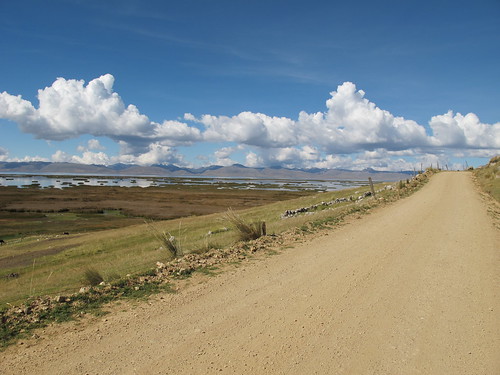
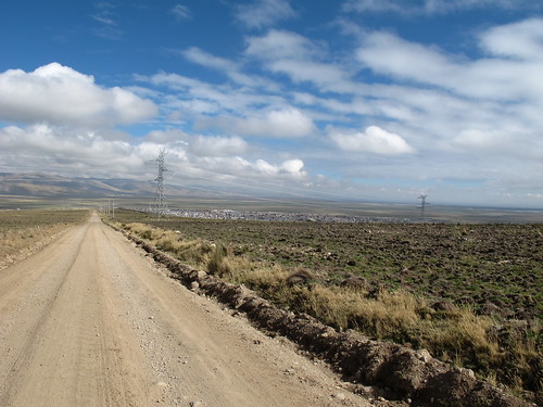
A quiet and sunny Sunday, my ride to the northern edge of Lago Junin (aka Chinchayqucha) is enjoyed traffic free, save for a few stray beasts

The unadulterated openness of Lago Junin quickly seduces, a broad smile spreading across my face as I ride
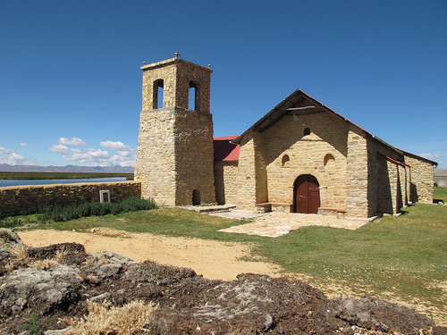
Lunch luxuriating lakeside on the grass by Iglesia Colonial del Siglo XVI sets me up for a perfect afternoon in the saddle
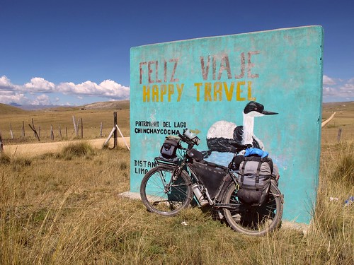
Such flat riding wouldn’t usually inspire me but after weeks of battling illness the sun, easy pedaling and gorgeous surroundings combine to fill me with the joys of ‘Happy Travel’
100% traffic free the road undulates playfully…
… before swooping back to rejoin the shores of Lago Junin…
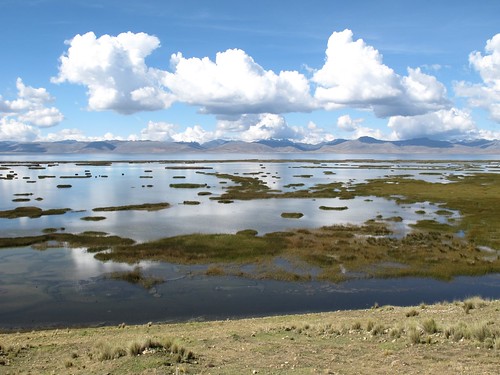
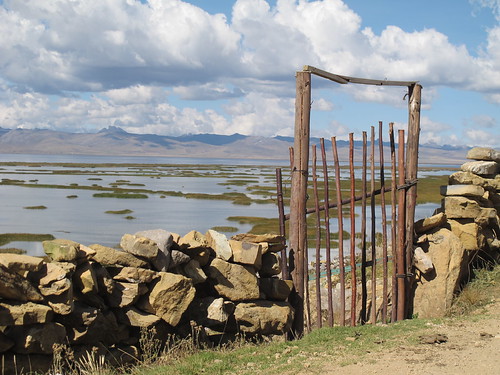
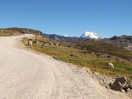
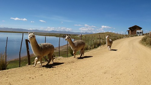
… the home of bright Flamingos, big skies and lucid reflections

Passing through the Sunday quiet of Ondores I’m reminded of hikes in the Yorkshire Dales
As the late afternoon clouds thicken and the lakes waters give way to pampas…
… I turn east into an exhausting headwind…

… for a final tough 5 mile (8 km) push into Junin…

… where a warm hostal and game three of the NBA Finals await
Asking around Junin people seem confused by the idea of a road running directly to Huasahuasi. This in turn confuses me as I find the turning to be clearly signposted
Climbing up away from Junin I say goodbye to the flatness of Lago Junin…
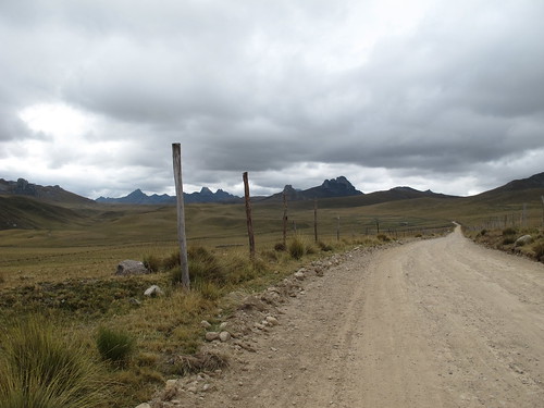
… and hello to rain
The change in weather compliments the perfect bleakness of the landscape…

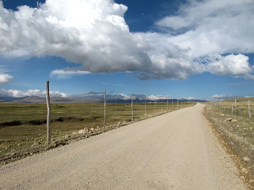
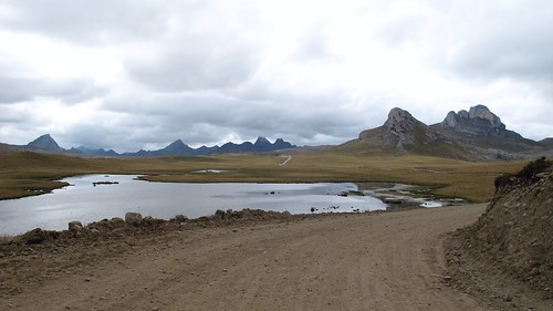
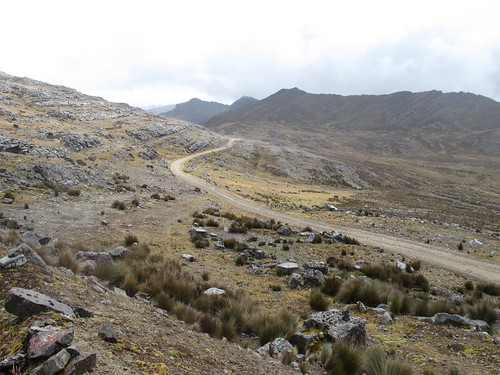
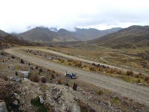
… as a glorious traffic free dirt road gently delivers me over a series of mini-passes…
… through a vast Scottishness of lakes and crags
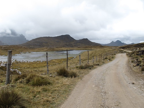
Long forgotten signs point the way…
… through the silence…
… and up to the highest pass…
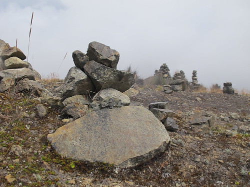
… where hundreds of small cairns bizarrely cover the hill

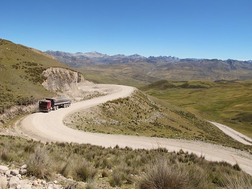
I fall head over heals in love with the road to Huasahuasi, it’s got to be some of the easiest and most rewarding high altitude remote riding in Peru
After cresting the highest of a series of mini-passes the long faltering descent towards Huasahuasi opens up…
… and the road conditions get a bit more technical
The rain gets heavier and my stomach starts to growl just as the perfect lunch spot appears

As I stuff myself with crisp sandwiches the clouds roll in, leaving me to ride into the afternoon blind…

… until I’ve descended a long way down into the heavily terraced valley…
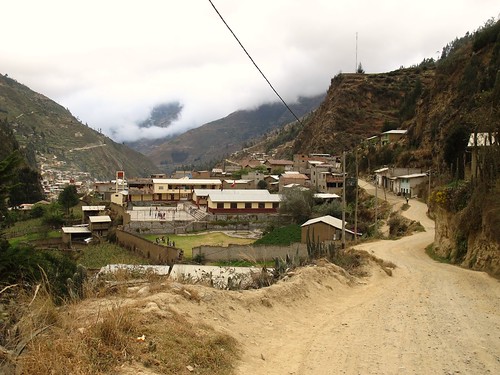
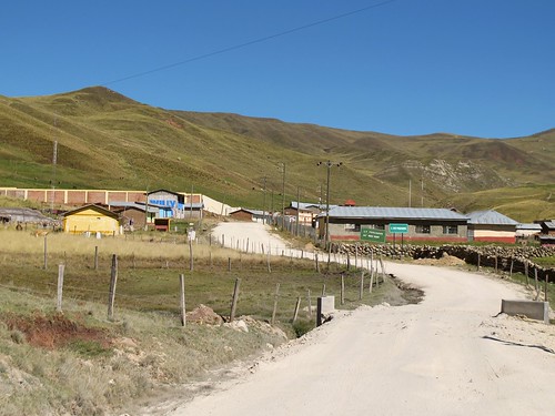
… where Huasahuasi nestles. A night in a cheap hospedaje and I’ll be ready to start the second part of my journey to Ayacucho.
Route Tips
Be aware that distances and elevations are taken from my bicycle computer and barometric altimeters, thus they are in some ways an approximation.
Oyon to Huasahuasi
4 days, 156 miles (250 km), 11,046 ft. (3,367 m) of climbing
This route represents the first 4 days and 156 miles (250 km) of an 11 day 443 mile (713 km) leg to Ayacucho (for information on the other 7 days see next post). Comprising a high mountain pass, high altitude plateaus, lakes, mountains and interesting bird life, these four days easily represent the pick of the route. With plentiful settlements along the way food and water are easy to come by and little has to be carried. Save for a few miles on the Carretera Central out of Cero de Pasco the entire route is unpaved but the road conditions generally good. For altitude acclimatized riders this route will provide few challenges although it is still in the Peruvian Andes so there are climbs and descents. In summation this is the perfect route for tourists who usually stick to the asphalt but are intrigued by the remoteness and silence of quiet unpaved back roads. It’s essentially El Silencio for beginners.
Here are my route notes:
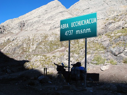
- From Oyon it’s about a 20.5 mile (33 km) ride with 3,720 ft (1,134 m) of climbing to crest Abra Ucchuchacua at 15,540 ft (4,737 m) elevation
- After the first descent from this pass you’ll reach the hamlet of Tambo with possible free accommodation, shops and a restaurant
- On my day from Oyon to Tambo I rode 23.6 miles (38 km) and climbed 3,756 ft (1,145 m)
- Roughly 8 miles (13 km) from Abra Ucchuchacua follow the obvious signposts right onto PA100 to Cerro de Pasco
- On my day from Tambo to Cerro de Pasco I rode 40.5 miles (65 km) and climbed 3,097 ft (944 m)
- Cerro de Pasco’s two bike shops are close together on Calle Lima. Both have a selection of components but nothing particularly high-end. I found Alejandro Vasquez Zevallos and his son Frank (224 Calle Lima) to be most helpful but the other shop seemed to be the favorite of the locals
- From Cerro de Pasco follow the Carretera Central predominantly downhill for about 10 miles (16 km). Take a right on the main road to Lima here or carry on another mile (1.6 km) and take a right in the small town. Both these roads converge and join just before the small town of Vicco.
- Take the left fork through the centre of Vicco (JU100). Once through town (ask for the road to Pari) the pavement ends and the traffic disappears leaving you a glorious day of very gently undulating riding around the west side of Lago Junin to Junin. Shops can be found in Pari and Ondores. Look out for Flamingos!
- I ate lunch by the church on the lake side of Pari. If you reach this point at camp o’clock then there is a perfect spot behind the church to camp.
- On my day from Cerro de Pasco to Junin I rode 54 miles (87 km) and climbed 2,000 ft (610 m)
- Junin is a large town with banks, hotels, restaurants and shops
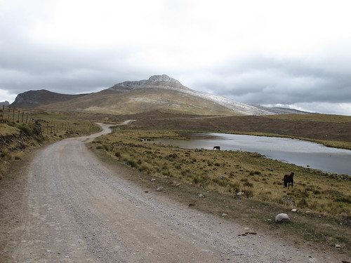
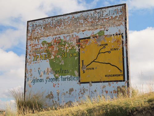
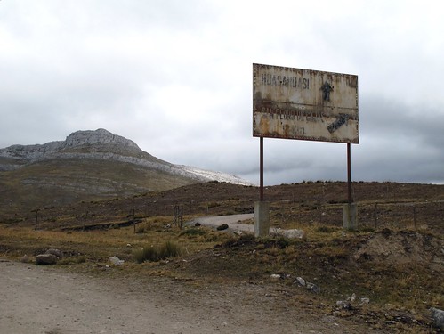
- On leaving Junin ride up to the east edge of town and onto the Carretera Central. Follow this south out of town for a short way. The petrol station will pass on your left and then soon after that you’ll see the concrete sign (see photo above) showing the route to Huasahuasi. Take the gravel road left after the sign
- The climb up from Junin is steady and weather allowing can offer great views of the Lake below
- 8.5 miles (13.7 km) from Junin take the right fork around the right side of the lake towards Huasahuasi
- 12.10 miles (19.5) from Junin continue straight
- 13.25 miles (21 km) from Junin take a left (right goes to San Pedro de Cajas)
- 15.3 miles (25 km) from Junin – top of mini pass at about 14,725 ft (4,488 m)
- 18.6 miles (30 km) from Junin – top of mini pass and start of main descent at about 14,780 ft (4,505 m) (NOTE: there are a couple more small mini passes at the start of the way down)
- 22 miles (35 km) from Junin continue straight (not left)
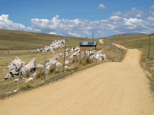
- 22.25 miles (36 km) from Junin – SHELTER – with good roof and room for possibly 3 tents. Follow the road around on the sharp right at the point. Roughly at 14,070 ft (4,290 m)
- NOTE: the road surface is rocky and not so good between miles 18.6 and 25.2 (30 km and 40km) from Junin
- The main descent down to Huasahuasi is quick and easy. Light traffic starts the closer you get to town
- Huasahuasi has all services including an ATM
- On my day from Junin to Huasahuasi I rode 38 miles (61 km) and climbed 2,165 ft (660 m)

Amazing! Love your photos! And asking the oldies for 20 soles for a photo! Lol. Good on you!
Pingback: Dusting Down to Ayacucho | Velo Freedom - Cycling South·