
It is a rare thing the feeling of being totally consumed by a landscape. The reminder of personal insignificance, the tingle of total self-reliance and the empowerment that comes from daring to embrace natures finest work is for me the embodiment of adventure. But finding these feelings can prove illusive. Despite, or perhaps because of my lifestyle it has become unusual for me to feel a true sense of adventure. Very infrequently do I feel as if I’ve pedaled into a place rarely explored and where by rights I probably shouldn’t be. But it does happen, such as in the Copper Canyon, Mexico or in Norte de Santander, Colombia, and it always will happen again. Cycling has become like a drug to me, what was adventurous is now mundane and I find myself chasing a dragon of increasingly involving routes. In the last week I fleetingly held that dragon in my hands as my sister and I fought our way around the east side of Volcan Cotopaxi. A route that marks the true dawning of my Andean cycling dreams.
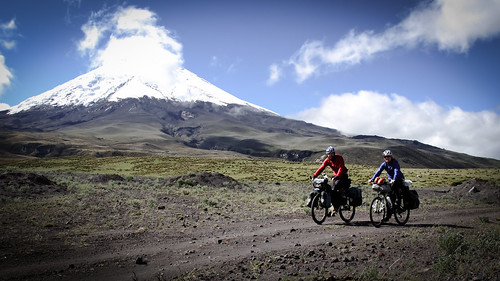
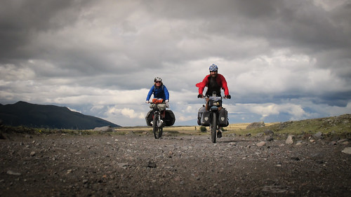
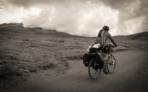
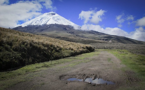
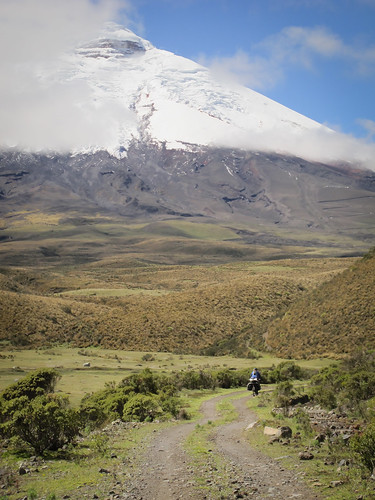
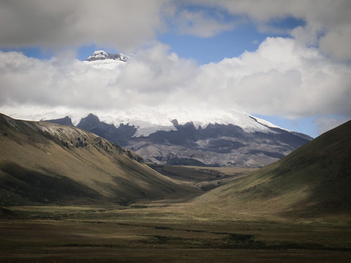
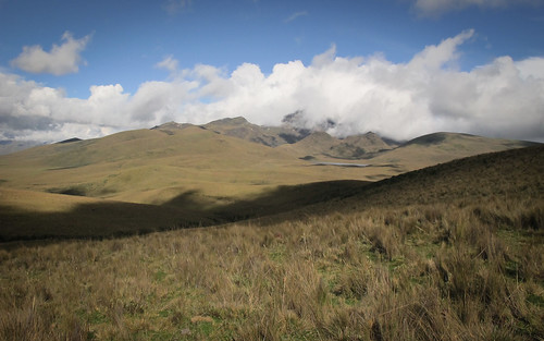
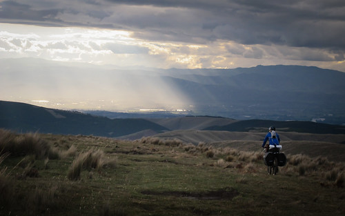
The huge bulk of Volcan Cotopaxi and two tiny insignificant little cycle tourists
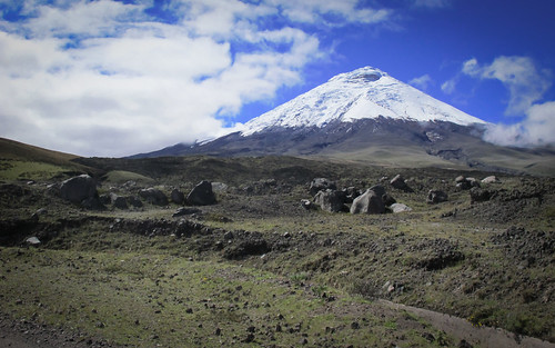
At 19,347 ft (5,897 m) Cotopaxi is one of the highest active volcanoes in the world and the second highest summit in Ecuador. It’s image is something of an Ecuadorian icon and climbing it has become a popular (if expensive) pursuit among fitter backpackers. Armed only with a 1:750,000 scale National Geographic map and a fair helping of determination we jumped whole heartedly into Cotopaxi National Park and onto a route made famous by the Vuelta al Cotopaxi mountain bike race. Undoubtedly better suited to bikepacking than loaded touring it was a route that demanded more than the average but in turn was extremely rewarding. Four days of bumping along cobbles, clunking over rocky dirt, pumping across open moorland, pulling bikes through bogs, hauling up steep mountainsides and slithering down sandy tracks define one of my favorite rides in the Americas thus far. An iconic snow-capped volcano, bright full moon, deep blue skies, a vast and humbling landscape, remote indigenous horsemen and superb riding partner define a truly memorable experience.

Route through Cotopaxi National Park from Tumbaco in the north to Latacunga in the south…
click here to view the fully interactive map and elevation profile
Cotopaxi Route elevation profile
It is hard to describe the magnificence of the area in and around Cotopaxi National Park. Fortunately I now have a working camera again so the pictures can do the talking…
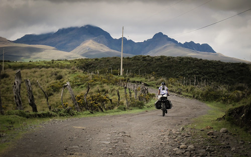
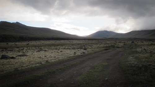
After battling our way out of Tumbaco and through the Sangolqui area we finally hit the long cobbled ascent up to Cotopaxi National Park
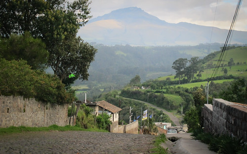
Along the way the road sweeps through a few small villages
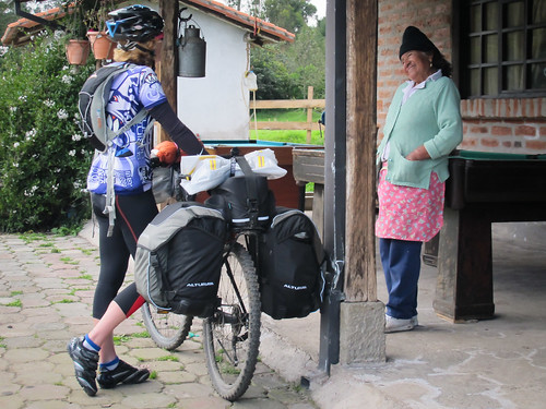
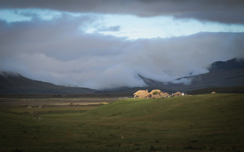
By the time we reach El Cocayo hospedaje we’re grateful for the treat of a room and piping hot shower… a really homely night was completed by smiley Sara, our amazing host

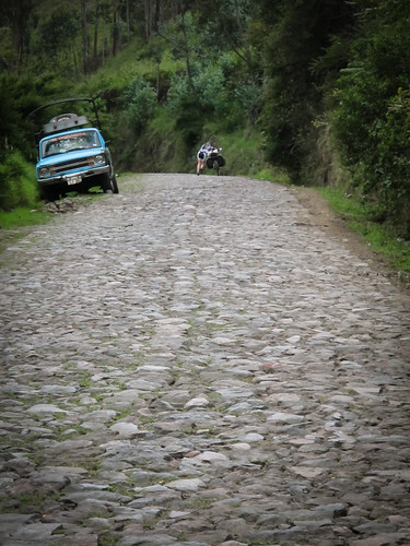
After a good nights sleep it’s back onto the cobbles…
… before a blissful transition onto dirt

By mid morning we’ve climbed up into a cold wind… Jo employs the bike huddle technique and finds a sheltered spot in which to enjoy her coffee

As we forge our way higher into the wind the landscape starts to open up

Eventually we reach the northern entrance to Cotopaxi National Park, sign in and enter without charge
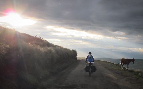
Volcan Cotopaxi has been in clouds all day but as I use the bathroom facilities at the park entrance the clouds miraculously clear and I return to a magnificent sight
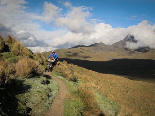
Buoyed by increasingly frequent glimpses of Cotopaxi we forge on into the park
Both suffering chocolate and biscuit deficiency we’re glad to find the luxury Hosteria Tambopaxi selling small Snickers bars and biscuits… a warm but expensive break ensues
It’s a cold return to the bikes and some aggressive looking clouds are rolling in again

Behind us it’s a different story as Sinchalagua basks in evening light
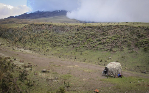
Taking the canal road west around the front of Cotopaxi we reach a deep lahar we’d spotted from a distance… a great sheltered camp spot with water available from the canal

Our night camped up at 13,000 ft under a clear sky and strong full moon leaves a layer of frost and partially frozen water
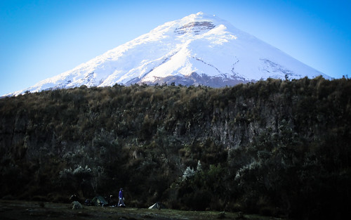
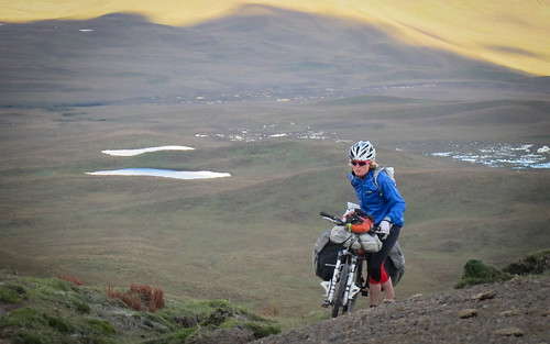
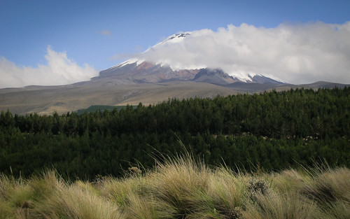
The morning brings spectacular clear views of Volcan Cotopaxi which looms invitingly over our camp spot
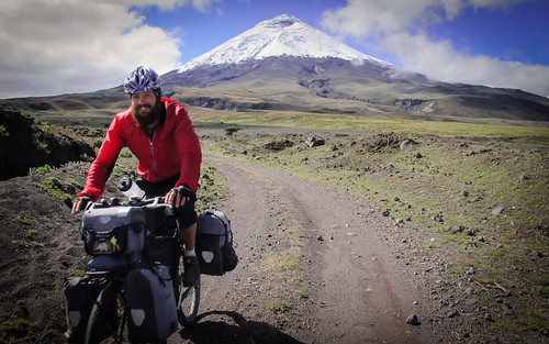
Spectacular views of Cotopaxi, a warm sun and amazing riding… I can’t stop myself grinning like an idiot
Every time the road kinks a new view reveals itself… progress grinds to a virtual halt as our camera’s fill with the stunning vistas
Having been denied any clear views of the volcano the previous day I find her irresistible
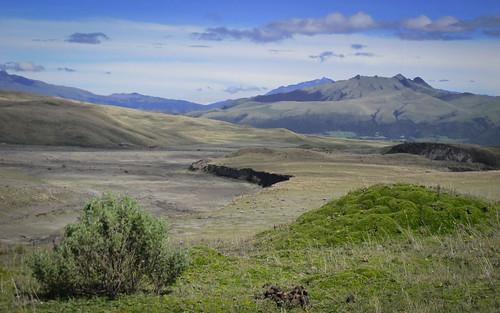
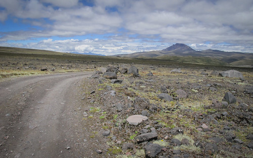
And the spectacular views aren’t confined to Volcan Cotopaxi… everywhere we look stretches miles of unadulterated beauty
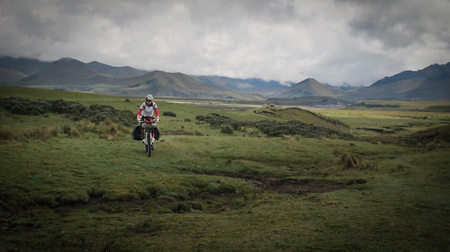
The initial slight descent around to the north-east side of the volcano brings some welcome swift riding and interesting lumpy features
The road keeps sweeping us towards new angles on Cotopaxi…
… until eventually it starts moving away from the volcano up a grinding sandy ascent into the wind
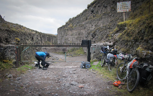
Around lunch time we hit the locked entrance gate into a protected area. Organizations such as Fundacion Paramo, FONAG, The Nature Concervancy (TNC) and USAID are fiercely working to protect the ecosystems around the Cotopaxi Volcano. A sign informs us that entering the area without permission will result in all our possessions being confiscated and being taken to the police… after a little pondering we go on anyway, without permission
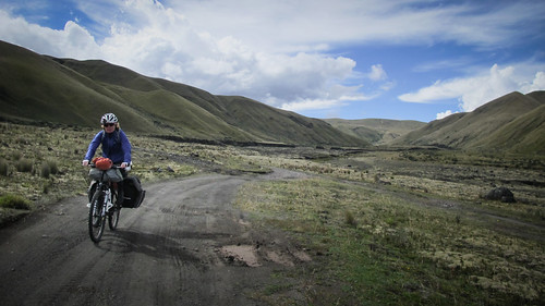
By now we’re following a river east, away from the volcano

These tricky pipe bridge carry us back and forth across the river… a horses skeleton it lodged between the central pipes on this one and I can only imagine the horrific slow death it suffered

Moving down the valley these dramatic cliffs appear… we’d probably have appreciated them more if Jo’s brakes hadn’t decided to start playing up
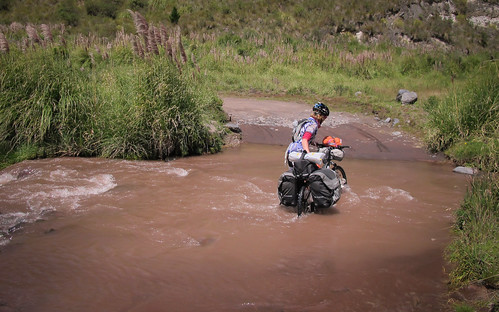
After a muddy wet wade through sticky bog the road starts moving south and then west towards the Tambo river… as thunder echoes from the west we’re all too aware of how flat and exposed the area is
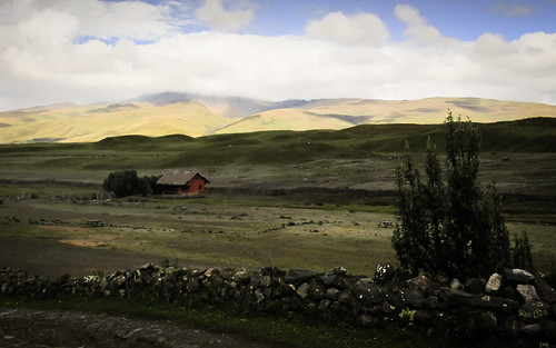
The sun is low by the time we pass through Hacienda El Tambo, a small farming community that survives out in what feels like the middle of nowhere… this is where the road ends but they direct us onto a faint grassy track
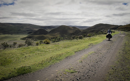
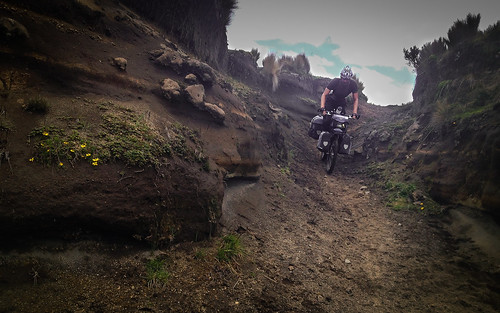
There is about a nine mile section of this Cotopaxi route, between El Tambo and the mountain El Morro where only a faint horsetrack guides the way. It’s a hard but rewarding slog uphill accompanied by views of Cotopaxi to the west and Quilindana to the east. But this short section is what spices up this route and topples it into the realms of being special. To leave the roads and venture out into a vast and potentially hostile landscape is a rare privilege for the loaded touring cyclist. Most bike touring involves lugging a weighty bike up and down roads that provide a definite direction and constant safety net. Off-road touring is usually the domain of the bikepacker, an extremely lightweight and usually short-term way of exploring remote areas by bicycle.

After a night camped up about a mile past Hacienda El Tambo we remain unconvinced as to the route… a morning return to the hacienda reaps more detailed instructions and assurances of the off-road route up to El Morro…
… so we retrace our steps and start along slow ascent up grassy moorland
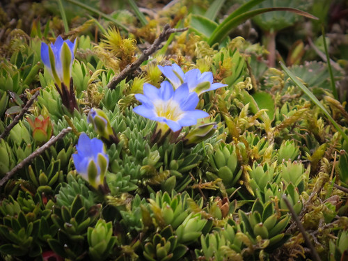
This paramos ecosystem reveals incredible layers of beauty… the ground we ride over is dotted with red, blue, yellow and white wild flowers

And of course there are the ever changing and forever present views of Volcan Cotopaxi
We pass a couple of valleys that channel west into the volcano
Progress is slowed by boggy patches, deep muddy ruts and frequent steep descents to cross streams

And after descending to the streams there’s the inevitable push back up
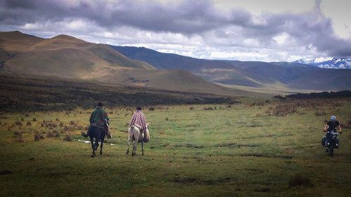
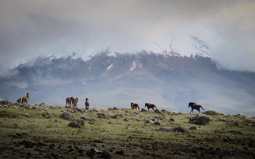
The only traffic we see all day are three toothless smiling horsemen
After a few hours of mostly riding the route crosses the Tambo river and starts a steep climb up towards El Morro
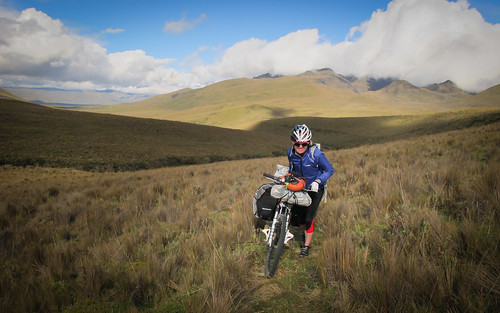
We’re reduced to pushing our bikes up the steep gradients… by now above 13,000 ft in elevation we can only manage about 15 meters before collapsing breathless… our recoveries provide ample time to enjoy the awe-inspiring landscape

Up and up we haul… as we find a rhythm things become easier and we spend our time between hauls engrossed in conversation and admiring the surroundings
With the table top form of El Morro in our sights and Quilindana towering in the background there is more than enough inspiration to draw on
One final steep push and…

… we’re at the summit, about 13,700 ft (nearly 4,200 m)
Bikepacking is like mountain biking, you just forget to leave the route and go home at the end of the day. These days I feel like a bikepacker trapped in a cycle tourists body. Shermy is screaming to ditch her panniers, grow her wheels and extra three inches and become completely absorbed into the nether reaches of South America. But it’s no easy thing to break years of habit and shed what is essentially very useful gear. Like most cycle tourists I’m plagued by dilemmas concerning load and weight. This situation only becomes further complicated when I find myself having so much fun on routes like this even with the full load.
Reaching El Morro opens up a whole new vista to the west, we can see civilization and the feeling of isolation evaporates… Jo climbs up to pick us a route down to a dirt road we can see winding west

After a bit of dexterous maneuvering…
… we’re back on open terrain and back in the saddle
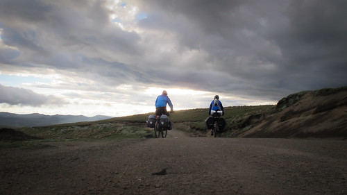
After about 9 miles of off-road thrills we join a well packed dirt road and start a glorious roll downhill
Things couldn’t be better as we cruise into the setting sun… that is before I hear panicked shout of ‘Oh shit, oh shit, OH SHIT!!!’ from behind me and see Jo diving off her accelerating bike onto the side of the road… she’d been riding with just a front brake all day and it had just failed! A complete brake fail going down hill is not good news. We have no choice but to get off the bikes and start pushing again, this time downhill
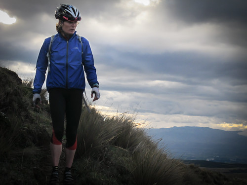
Riding the difficult way around Cotopaxi is something I’d recommend to all wider tyred tourists. Having read friends accounts of riding in the area in freezing temperatures and familiar with the vagrancies of weather at high altitude I appreciate that Jo and I were really lucky to have three out of four days warm and generally sunny. I also feel fortunate that I now have a riding partner, she has really freshened things up for me. Just a few days off the plane, new to altitude and fresh to Ecuador my sister Jo was given little time to adjust before being hit full force by the glorious realities of dirt road touring the Andes. Fortunately for me, myself emboldened by a recent decline into illness, she is one tough cookie.

It was virtually dark by the time we’d descended to the Rio Alaquez, a much needed water source and camping opportunity

The next morning after a minimal breakfast (we’d run out of food) we hit the undulating forestry tracks west towards the promise of civilization
By this point Jo was well over marveling at Cotopaxi… I was still captivated

Steep and sandy… the forestry tracks didn’t speed up our progress but were fun to ride
One final obstacle and a chance to clean the thick layer of bog grime off our bikes before a long slow sandy descent into Alasquez and the few miles of pavement to Latacunga
Having recently spent several months relaxing away from her jobs as a full-time firefighter and triathlon coach in Spain, Jo arrived in Quito to declarations of low fitness and strength. Low fitness for an Iron Man athlete is apparently on a different scale. Having never done anything but snowboard in thin air Jo settled into high altitude cycling with ease and embraced being plunged straight into a tough route. I have often wondered how someone of her general fitness and strength would cope with some of the routes I ride, now I know. Physically it’s just as challenging for her, it is her mental strength that really shows. I honestly don’t think I know anyone else who would have enjoyed and remained so positive with such a week. Even when we ran out of food and she experienced a very dangerous brake failure she managed to keep smiling. Jo thrived on being thrown in at the deep end and it’s great for me to know that she understands what touring means for me. Although I suppose I shouldn’t really be surprised, she’s my sister… she’s almost genetically perfect!

Love the split!!
It all looks wonderful and challenging, to say the least. The view from my armchair looks great!
Marilyn
Pingback: The Ups and Downs of Looping through Quilotoa | Velo Freedom - Cycling South·
Pingback: To Cuenca with a Dirty Little Diversion | Velo Freedom - Cycling South·
Pingback: Ecuadorian Dirt Road Antics Pt 1: Cotopaxi to Quilotoa | THE RIDE SOUTH·
Man, Cotopaxi! I love it! I can’t get enough of that place. Great right up.
For others who take this route, which is highly recommended.
To avoid the gate: Just over the pass, look out on the left for an extremely awesome section of singletrack that cuts down a steep side canyon, meeting the main dirt road again – at which point keep your eyes peeled for some more sweet singletrack on the other side. That way, you miss the sign too.
Last time I rode it, we added in a loop round Quilindano too, instead of turning up to El Tambo. ‘Almost’ no hike-a-bike. But only to be done in fair weather, as the path is very faint and potentially boggy.
(write up… obviously)
Amazing!! I’m trying to gather all the information I can about cycle touring around Cotopaxi and the more photos I see and blogs I read, the more excited I get. Thanks for sharing this.
So, Jo didn’t have much trouble with the altitude. It’s one thing I’m worrying about.
And congratulations for your trip, Nathan! If you end up in Brazil, please, let me know.