
As the heat of Mompos slowly melted me, my lusts fell firmly on the exciting riding and cooler climes of the mountains. Since first getting the chance to study maps of northern Colombia I’d been really turned on by the potential touring possibilities of the Norte de Santander department. I knew nothing of the area other than what the lines on my maps told me. Some internet research didn’t turn up much as other cycle tourists tend to ignore this little pocket in their rush for Medellin or Bucaramanga. What drew my attention were the tight knots of contour lines and the small tracks that flowed around and between them. On paper the landscape of Norte de Santander looked exciting and challenging.
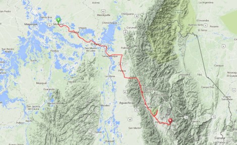
Route from Mompos to El Tarra… click here to view the fully interactive map, elevation profile and download the GPX track

Mompos to El Tarra route elevation profile
In reality my eleven day adventure through the northern Cordillera Oriental far exceeded even those high expectations. This was perfect cycle touring. I got to explore remote landscapes and communities, witness the power and beauty of mother nature and fall into the embrace of an outwardly happy and loving people. A couple of posts ago I remarked that attractions like Cartagena were not why I traveled. If that left anyone curious as to my motives then read on. This is why I travel and why I choose to do so by bicycle. In fact the experience was so rich and diverse that I have decided to split my commentary into two posts. The first will take us from Mompos to El Tarra and the second along a really exciting route through Villa Caro, Gramalote, Salazar and Cucutilla to Pamplona.

This bridge over the Rio Magdalena offered the only real climb between Mompos and El Banco
The hot flat miles from Mompos to highway 45 were predictably unremarkable. Punctuating the slog with an overnight stay in vibrant little town of El Banco, I expected nothing and got nothing from the ride. Bursts of heavy rain did their best to spice things up, churning up the road into muddy pools. As a final paved stretch swiftly carried me east the northern tip of the Andes came into view and my excitement grew.

The hot bustling streets of El Banco
A quick 30 km south on highway 45 and I found myself at the start of a muddy track leading off east towards the mountains. That track turned onto a stretch of pavement that ended where my adventure began, in the village of Ayacucha. My diary from that evening reads; ‘Since reaching Ayacucha I’ve felt like I’m adventuring again, an almost forgotten feeling. The hills have grown from nothing and my interest similarly. Ayacucha was fairly packed with military guarding the town and road. My first stark reminder that I’m travelling in a country that’s spent sixty years on its knees to terror‘.

Looking back on El Banco
Colombia’s troubles are pretty well documented although in recent times the international press have been more interested in describing the gory details of Mexico’s struggles. Accompanying me on the first part of this leg was Tom Feiling‘s well written ‘Short Walks from Bogota: Journeys in the New Colombia‘. His impressive words filled in my ignorance of the Colombian struggles, providing apt context for my journey. Colombia’s descent into decades of political and criminal lawlessness began in earnest with the 1948 assassination of populist leader Jorge Gaitan. All out civil war subsequently exploded between Liberal and Conservative factions. Known as La Violencia this brutal decade of death claimed hundreds of thousands of lives and continued an already established Colombian tradition for violent terror.

A stretch of pristine pavement carries me to the 45 and the foot of the mountains
Unrest and general dissatisfaction with oligarchy rule helped sow seeds for the growth of guerrilla groups in the 1950’s and 60’s. Attracting and recruiting thousands into their armed fight, organisations such as FARC, ELN and Movimiento 19 de Abril grew to wage insurgency against the state and it’s players. This atmosphere of danger then combined with uncertainty and an initial desire to protect lands in spawning paramilitary organisations such as the AUC. On top of all this the cocaine industry boom of the 1970’s and 80’s added a further layer of violence and terror. Mafioso players such as Pablo Escobar and the Rodriguez Orejuela brothers bought incredible wealth into the country but their brutal dealings with just about everybody stirred an already bubbling pot of discontent.
But all was not lost for Colombia. In the first decade of the 21st century the right-wing hard-liner President Alvaro Uribe has managed to stunt the reach and power of all the countries violent layers. By unleashing his own terror through the military and police, Uribe has managed to wrestle at least some control back for the state. The FARC and ELN still operate but are estimated to only possess 8,000 and 3,000 fighters respectively. The threat is gone but not entirely.

After turning off Highway 45 on a dirt track a short stretch of pavement took me up to Ayacucha
I suggest one of the reasons that cycle tourists have been inclined to avoid Norte de Santander is its reputation for harboring guerrillas. It is true that along with the Arauca, Cauca and Valle del Cauca regions, Norte de Santander is where the ELN is concentrated. And terrorism continues in the department. The last couple of months have in fact seen an intensification of guerrilla and paramilitary terrorist activity. Much of it has been directed at the oil infrastructure but there have also been car bombs, such as the one on the road I’d ride between Ocana and Abrego. Three weeks ago (October 20th) troops captured six FARC men including the head of security for one of the senior leaders. From the outside it all sounds like a no go area and that is what travel advisories from other national governments will tell you. But things always look different from the inside. Things are certainly not like they used to be in Colombia. Gone are the days of FARC roadblocks and dominance. I equate the situation to be similar to that I grew up with in the 1980’s and 90’s as the IRA regularly bombed London. The threat is real and there is danger but it’s to some degree manageable with sense and limited enough not to let rule your life.

The dirt road out of Ayacucha… climbing at last!
My safety policy was to keep asking local people about safety. A couple of times I was warned not to go in certain directions (namely through Concepcion out of El Carmen and up to Castro from Arboledas) because it is dangerous with guerrillas. But it is hard to know how much salt to pinch with what different people tell you. When I set off up the road to La Playa a motorcyclist stopped a told me the whole area was muy peligroso (very dangerous). So I turned back and asked a series of others who all told me the whole area was muy tranquilo (very quiet). It’s a case of trusting your instincts. I don’t trust the police or the military and have not wanted to be seen to be allied with them in any way. I talk to people, make friends and make my own judgments on where is safe for me and where not.

After a night in the tent a hot morning starts by spinning up this valley

A climb and a descent brings me into this flat valley bottom where Guamalito sleepily nestles

Pony Malta and baked goods… my Colombian cycling fuel
A dirt road took me out of Ayacucha and up into the mountains. Having broken the first climb with a night camped behind a school building the next day left me eleven miles to Guamalito. Still relatively low in altitude the going got pretty hot quite quickly. Guamalito is a dusty little town with a nice atmosphere and a friendly vibe. As I sat on a concrete bench under the shade of a tree sipping my cold Malta (my new beverage of choice, ironically I’m off the Coke now in Colombia) the noise of Sunday reverberated from the churches. Two young boys fought in the dirt and a couple of young sisters giggled at me from the safety of their doorway.

Jorge and the El Carmen biker boys… an appreciated welcome to town

The central square and church of El Carmen

Sunday in El Carmen is pleasurably slow

I really enjoyed the fact that although well kept there were some rough edges

95% of El Carmen’s doors and window frames are painted red and green

Cobbled streets… great look, bad cycling

From a distance it all looks very uniform…

… but no two windows or doors seemed to be the same

Those few doors not fitting the color scheme are still strikingly painted

Through this simple door was a whole other world, including my bedroom

Colombian hoes typically open out around these large open courtyards
A short stint of hot dusty climbing delivered me into El Carmen. On the outskirts I was ensnared by the hospitality of hospital worker Jorge. His sons and their friend had ridden with me to his door where hot coffee and cold water revived my flagging energy. Once I’d pushed Shermy up the insanely steep cobbled slope into the old town I knew El Carmen had won my afternoon from me. At the top of the slope was a tiny family restaurant, Cicamaya. They fed me and gave me a cheap room for the night. The remainder of the day was spent admiring this beautiful little out-of-the-way colonial gem where all the houses are washed in pristine white, their doors and windows decorated a uniform deep green and red.

From El Carmen the road climbs over 3,000 feet

Passing the sleepy town of Otare

The Gelvis Picon family… more of Colombia’s good and kind people

A man sells balloons in the main square of Ocana in front of the Catedral de Santa Ana

Another of Ocana’s churches

Some of the antique radios inside the charming El saguan de las Aguas
The next morning as my host family waved from the heights of the old town I took my new love for El Carmen back on the road. A 3,000 foot climb delivered me into cooler air and the mountainscape really opened up. Dogs sneered and chased as I descended down past the little town of Otare into Rio de Oro. A cup of coffee with the familia Gelvis Picon, some of whom I’d met the previous day, and it was back onto pavement for the short stretch into Ocana. A charming enough City, Ocana was too big for me, a reminder of what I like and the last nail in the coffin of any thoughts of heading to Bucaramanga. That said, it is a pleasant place for an evening stroll and I found a real gem in the hospedaje El saguan de las Aguas. A really charming place to stay filled with antique radio’s gramophones and all manner of other old knickknacks.

Highway 70 out of Ocana marks an unwelcome change

But soon I’m heading off on the 11 km road up to La Playa

La Playa is a charming if not slightly typical village

But it’s these beauties that have drawn me there… Los Estoraques

A large collection of brownstone pillars and pedestals of all shapes ad sizes

And visitors are free to roam and really get inside the features

There is a pathway that leads up to top of the highest pillars

From up high the church of La Playa can be made out

And there are tremendous views over the vast landscape

Of course being Latin America there is always room for some Catholic idolatry

I chose a glorious morning to ride out of the Los Estoraques area

All over the mountains there are pepper and tomato plants that have been painstakingly strung. It’s really impressive patient stuff
Out of Ocana a short day of riding took me to the little village of La Playa, dropping off point for the must see Los Estoraques. Los Estoraques are Colombia’s newest and one of its smallest national parks. Quite out of character with the surrounding landscape it houses six square kilometers of dominating brownstone pedestals and pillars. Over thousands of years forces of erosion have shaped the rocks into features more akin to Utah than Colombia. And being Colombia there is no restriction on access allowing for real exploration around a pathway that climbs up to the top of the highest pillars. A truly amazing interlude.

On the way into Abrego there is a series of murals with all sorts of informative messages. This one particularly appealed to my sens of humor

I love meeting people as excited as I am by bikes
On the way to La Playa Shermy had started talking. A recurring problem I have is that the cups securing the bottom bracket tend to loosen on rough terrain. The result is a hideous click on every pedal stroke. So having finally managed to tear myself away from the impressive rocks of the Catatumbo river basin I spun to Abrego in search of a bike mechanic. All leads eventually took me to Luis Albeiro Perez and Edward Pacheco at the Taller el Negro. Really nice guys, they took it as a privilege to quickly tighten up Shermys cups. Both keen mountain bikers they had impressive bikes that the surrounding mountains apparently offer all sorts of opportunities.

Leaving Abrego was also leaving nice weather and any semblance of flat land

Sometimes you just get lucky… as I hit the high-point of the climb out of Abrego it started to rain quite hard, hunger o’clock hit and I chanced upon this handy bit of shelter.

El Tarra is hardly an inspiring little town but it served me well for the night.
From Abrego I climbed up into rain and descended deep into the tiny settlement of El Tarra. As the rain continued to fall hard, feeding the rushing brown rapids of the Tarra River I decided to cut my day strategically short. Retreating to a cheap and even by my low standards, pretty grotty room I lost myself in a book. It had been an exciting six days within which I’d felt a genuine connection to Colombia blossom. But the best was yet to come. Norte de Santander had only yet delivered me the parts I was supposed to see.

Another fascinating installment. I especially enjoyed the pictures of Los Estoraques, and all the pictures of people. Stay safe! —Marilyn
Hello Nate! I heard about you from James (Big Sur). We left Mompos four days ago and we’re just a little ways off your track. We were considering a Norte Santander route similar to the one you describe here, so this is a poignant read for us. Just before reading it, we’d decided to head straight to Bucaramanga, but now I am envying you for your decision! Perhaps we’ll cross paths soon! You can check our location at tourintune.com.
Pingback: Cuenca to Cajamarca Pt. 1: To The End of Ecuador | Velo Freedom - Cycling South·