
It’s a fairly safe bet that if border officials have no idea what they’re doing then I’m in the right place. In this instance that place was the rustic two-track that links Chile to Argentina over Paso Las Pampas. Traversing four bridgeless rivers in the accompaniment of absolutely nothing other than wild owls and the falling rain this was picture postcard serenity and everything I expected from Patagonia. Strange then that conventional cycle touring wisdom dictates I should have been writing a very different story: according to the grey masses of bike travel you ‘can’t miss‘ riding all of the Carretera Australs iconic 1,249 kilometers through rural Patagonia. Maybe not, if you have a penchant for riding busy traffic laden highways in the accompaniment of a large proportion of the worlds other cycling lemmings.
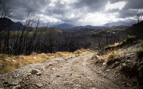
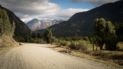
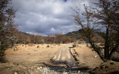
Riding through a recently burned forest on a seldom used rocky track as the sky prepares to unleash its fury having seen zero traffic all day… I’m getting tingles down my spine even writing this
Riders I respect who have toured down the Austral have universally bemoaned its formulaic lack of adventure. It may snake through beautiful and sometimes stunning scenery but the Carretera Austral is still a ‘busy’ highway and remains the only transportation artery linking the communities of Chilean Patagonia with their northern brethren. This road is the sole way to travel overland through southern Chile, a place where people live, tourists travel and consequently traffic moves. Even its reputation as a ‘Ripio Classic‘ does little to seduce me as I dislike ripio highways as much as the paved ones. Having been showered by rocks of various sizes by speeding cars on ripio roads I’ve developed a paranoia about being struck in the mouth. Now I find it as disheartening to see an enormous expanse of ripio highway as I find it exciting to trundle along traffic free dirt tracks. In some cases I even find myself wishing they’d pave the darn thing and believe me, that hurts to say.
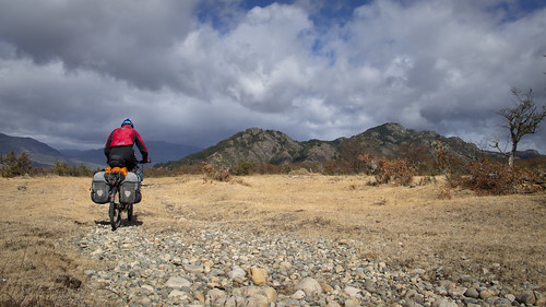
Barely even a track let alone a road… this is where I love to ride my bicycle
I should be careful not to hate on the Carretera Austral too much as karma might catch up with me on my ride down its southern section after Coyhaique. Also, I have to acknowledge that most of this supposed wisdom about the road came before I’d even seen it. However, the ‘Austral Avoidance‘ route I planned while in El Bolson seemed justified when I hitched up the northern part of the road to Puerto Montt: experiencing the dust and traffic on that featureless ride north confirmed I was correct to stick with my preferences and seek out the lesser traveled backroads of the region. My research had led me from a nagging reluctance to submit to the highway to a little boy at Christmas style excitement at finding a meandering course switching between Chile and Argentina along the international boundary. When I then discovered Skylers’ account of his ride along a similar course I was smitten and filled with romantic anticipation for the route ahead. After finally setting out from El Bolson the world at first seemed to be conspiring against me, throwing me north in search of a replacement rim before a restart from Futeulafu that was held up a day later in the Chilean border town of Palena when a mystery yet thankfully fleeting illness took hold. But once eventually released out onto the road and into my rhythm I discovered a mellow, traffic free ride through rain-soaked tranquility to the little Argentinean village of Atilo Viglione. From there started an outstanding burst of bikepacking, a stretch of riding that left my system drenched in serotonin and my camera bursting with images of all the trappings of gorgeous remote Patagonian two-track.

Route from Futaleufú (Chile) via Paso Rio Encuentro to Argentina then Paso Las Pampas back to Chile and on to La Junta… click here to view the fully interactive map, elevation profile and download the GPX track
Futaleufú to La Junta Route elevation profile
The beauty of this 340 km five and a half day route (from Futaleufu) finally ignited my affections for Argentina, I was only there for three days but it gave me exactly what I needed. I’ve been harboring a bad attitude towards Argentina ever since the first ‘Las Malvinas son Argentinas‘ signs and introductory battles with the currency up north. But here I forgot those hang-ups, happily forfeiting Chiles’ dramatic snow-capped peaks for much mellower Pampaesque landscapes: trading the tabloid images of tourism for pure uninterrupted tranquility. When I passed through the last of a vast number of gates back into Chile a barrage of signs informed me of my return. Turning around to say goodbye to Argentina I saw nothing, there were no signs and nothing proclaiming that beautiful land to be Argentina. I liked that subtlety and quiet self-confidence, but it left so many questions: What kind of country spends time and money posting signs all over its vast territory proclaiming a small and quite insignificant cluster of islands that are not and have never been legally theirs to in fact be theirs and then posts nothing at an international boundary and entrance to a gorgeous land that is without any dispute all theirs? I cannot be sure, but I do recognise a reminder that we should all be more grateful for the beauty we have in our lives and spend less energy pining for the follies we feel are absent.
Here is the story of a route that had me so high on life I could have been on drugs. Life can be equally as addictive as drugs but thankfully it’s cheaper and you generally get better photos…
Equipped with a new front rim, freshly waterproofed tent and an array of new drybags I finally leave Futaleufu eight days after arriving. I am ready for the turn to autumn and excited by the route ahead
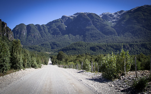
Despite having driven the road a couple of times already the first 48 km out of Futaleufu look very different from a bicycle saddle

I always acknowledge other cyclists but don’t necessarily stop to speak. But how could I not stop for Austrian Benjamin? Sporting a tri-suit and wielding a large stick he cuts an intriguing form! This particular cyclist has discovered the world of Zen and decided to cut his trip short in order to travel to the Himalaya and study Zen. More power to him

There is some exceptional scenery on show on the road from Futaleufu but after a while the traffic is getting me down. After a speeding truck propels a large rock into my shin I’m over it…
… rejoicing at the turn away from traffic and onto the X-235 towards Palena
The ride up to Palena is a relaxed and tranquil affair…

… which unfortunately goes no further when a mystery illness strikes me down necessitating a day in town to recover. When I do eventually take the asphalt out of town towards the border I’m feeling well energised

Within no time I’m signing out of sunny Chile…
… and getting stamped in under the brooding skies of Argentina
After picking up a few supplies in the border town of Carrenleufu…

… I head into rainy Argentina
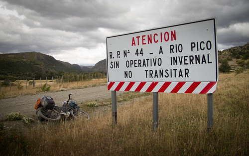
After lunch just beyond Corcovado I’m pleasantly surprised to find a sign suggesting my proposed road isn’t passable in winter

Rain comes in frequent bursts as I climb the fun switchbacks up to camp over 1,000 metres
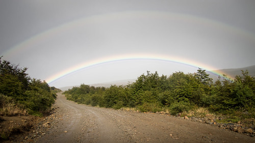
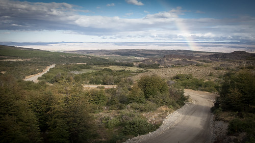
A night of rain turns into a wet morning of climbing and rainbows…
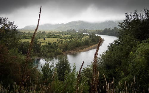
… that eventually clears as I approach Lago Vintter
The wind around Lago Vintter is unbelievable, its gusts push me all over the road. Thankfully there isn’t any traffic: by this point I’ve not seen anyone else for nearly 24 hours
An afternoon spinning into a relentless headwind and I briefly descend…
… before climbing again. Another rainbow appears which means only one thing…
… there’s more rain on the way
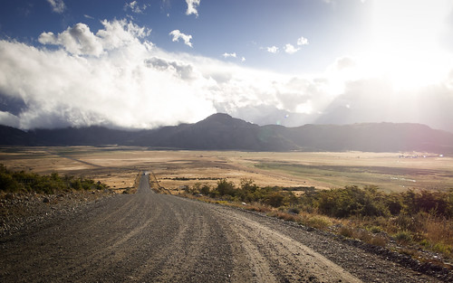
Having been drenched by a short sharp rain shower the evening sun comes out to take me into a long evenings riding

It’s almost dark and raining again when I eventually pitch up, taking advantage of one of the many disused cow paths that often parallel the road
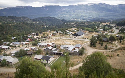
Another morning of rainbows makes for an easy little run into the tiny village of Atilo Viglione…
… complete with its rusting trucks and Sunday silence
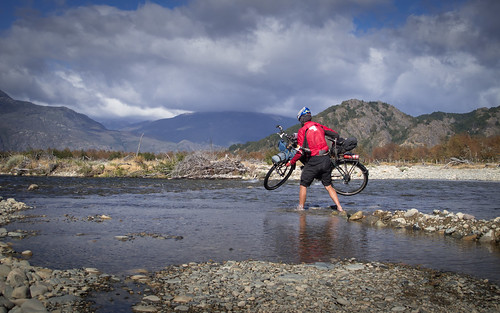
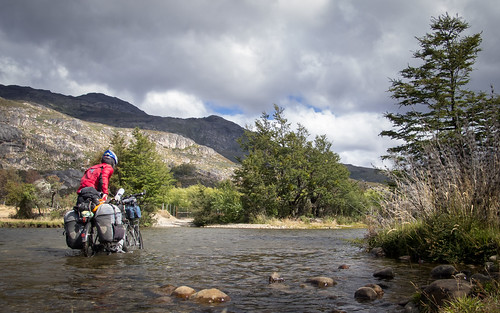
Atilo Viglione marks the end of the road and the start of the two-track over to Chile. Just out of town Rio Pico comes as the first of four river crossings
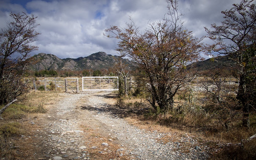
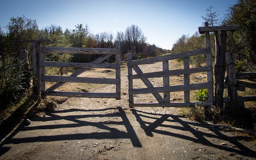
From the river crossing I’d been told to look for the white gate…
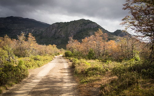
… and follow the clearly used dirt track…
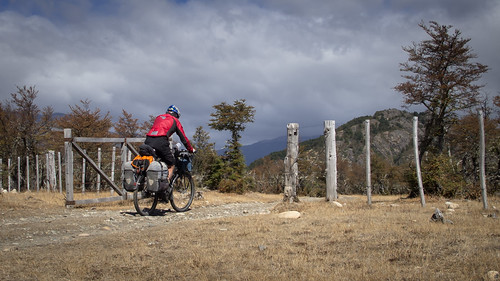
… through gate after gate…

… and through noticeably autumnal woodlands…
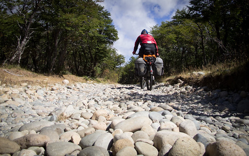
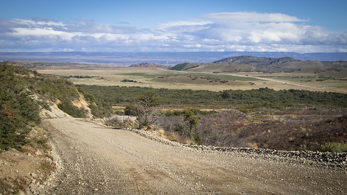
… until I turn onto the ‘main’ road. This turns out to be another two-track just this time covered in ‘eggs and baseball‘ style ripio
After a short while snaking through various states of deserted grazing land…
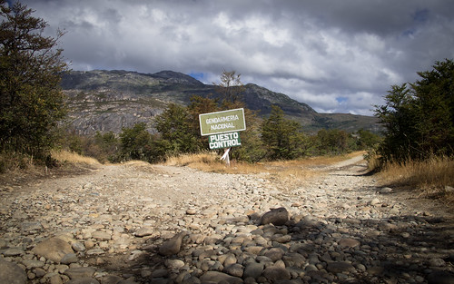
… I come to a fork in the road. The arrow pointing the way to the border control office is inconclusive. I elect to go right…
… which proves to be the correct answer

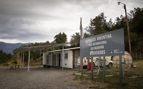
The guys in the Gendarmeria office are a bit taken aback by my arrival. The man who takes responsibility for stamping me out of Argentina leaves the room a total of five times to consult with his colleagues about what to do. Confusion abounds… is he British or English?!? I sit back and enjoy the warmth…
… before heading back out into my afternoon of riding and river crossings

Most of the river crossings are fairly benign affairs, this one however, across the Rio Pico offers a whole other challenge. Deeper, faster flowing, accompanied by a savage blustery wind…

… and undertaken in a flapping broken flip-flop, this crossing offers a test I’m relieved to pass without getting too wet
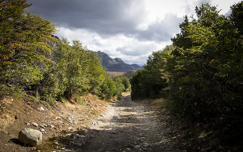
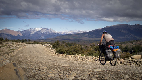
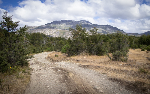
Riding up and away from the river the track really starts to display its charms…

… a recently burned forest sending me into raptures…
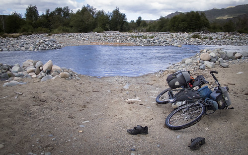
… before the shoes come off again for Rio Pildora
By this point I am buzzing so hard I could have sworn somebody had slipped something into my water. The feeling of being immersed in such remote beauty is very special indeed and mixes with the sharp air of the encroaching autumn in prompting me to pitch up early… I do not want this experience to end, it’s better than amazing
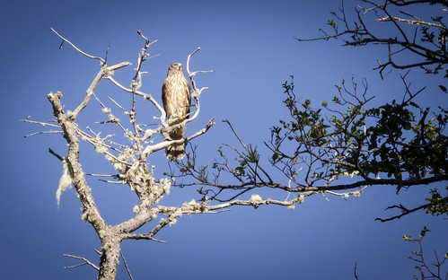
The next morning in camp drags long as a couple of owls join me in my routines. Their dexterity in flight is something to behold
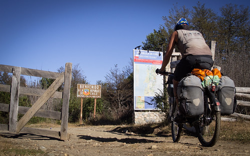
Just one kilometer from camp I come to the Chilean border which is clearly marked by Chile…
… but completely ignored by Argentina

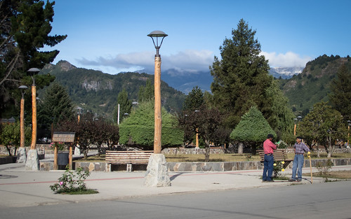
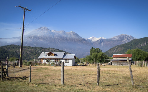
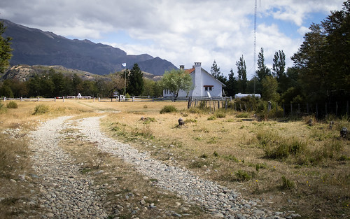
Having literally passed through the gateway to Chile I descend into the camouflaged little village of Lago Verde to once again enjoy watching a hapless border official struggle with the basics of his job
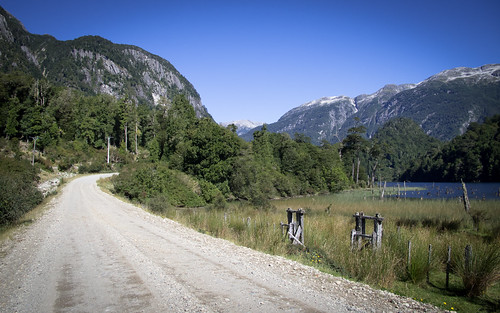
After a brief stop in the forested Lago Verde village square I get back on the road and start making my way…
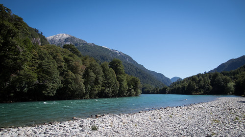
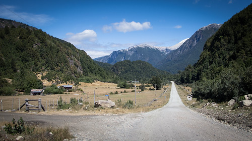
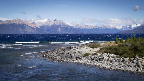
… down Rio Figueroa…
… past lakes and mountains…

… into another cow path camp
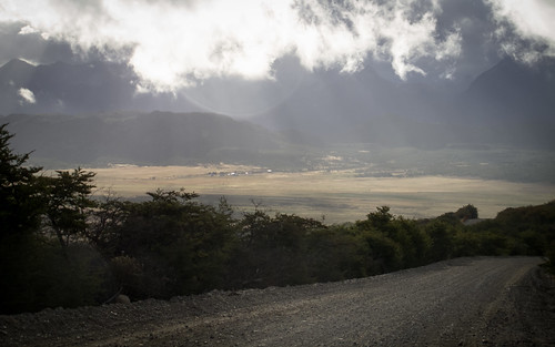
A restful night next to a field of the most vocal cows in south America leads me into a cold, grey and rainy morning…
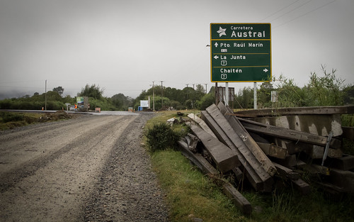
… a fitting atmosphere in which to end this incredible route, join the dreaded Carretera Austral and settle in for a couple of days of something a little different.
Route Tips
5.5 days, 343 km (213 miles), 5,000 m (16,400 ft.) of climbing
This is a beautiful and largely traffic free route that offers some high rewards for what I’d class as relatively easy mellow riding. There are a few climbs involved but they are never long and road surfaces are usually good. As always it pays to ride a light load, I think my load is as heavy as you’d want to go bearing in mind there are rivers to cross. Water is usually regularly available with only the section around the turn away from Rio Pico (the town) into Valle Solis at kilometer 206 (from Futaleufu) being dry. Food is readily available in Futaleufu, Palena, Carrenleufu, Corvocado and Lago Verde. Wild camping is easy along the entire route.
Border crossing formalities are easy at both border crossings. At the Rio Encuentro crossing both immigration offices are close to the border. At the Paso Las Pampas crossing the Argentine office is obvious on the route about 9 km short of the border. The Chilean office is the first building on the right you’ll come to as you enter the main part of Lago Verde town.
Save for the pavement that starts just before La Palena and continues all the way to the international border, the entire route is either ripio or dirt.
Here are a few notes that may help you along the fun part of the route between Atilo Viglione and Lago Verde:
- Take the track west out of the northern edge of Atilo Viglione (ask in town to be sure). All distances below are from Atilo Viglione and approximate
- Cross the Rio Pico and look to your left for the white gate you need to go through
- After the gate there will be a fork (0.8 km). Both forks take you where you want to go but the right fork is most used and what I describe here (the left fork is what I mapped by RideWithGPS above)
- 1.5 km – take a left at the farm house with the friendly dogs
- 2 km – the road from the previous left fork joins from the left
- 2.4 km – follow the signpost (‘Lago 5 & Gendarmeria’) right onto the ‘main’ road
- 8.4 km – right at the fork towards the Gendarmeria
- 9 km – Argentinean immigration services
- 10.5 km – cross river and then take an immediate right
- 11 km – the major river crossing across the Rio Pico then follow the track up the hill past the farm building
- 14.5 km – cross the Rio Pildora
- 18 km – international border
- 22 km – Lago Verde & Chilean immigration

Get some new flippys.
Pingback: The Carretera Austral, part 1. | Steeling Away·
Buen trabajo!!!
Excellent work and very useful fotos, which have helped me plan my visit. The wingeing, not so much, but we all do that at times, and the great reporting and very good photos more than make up. Many thanks. Will now read more of your stuff and recommend.