
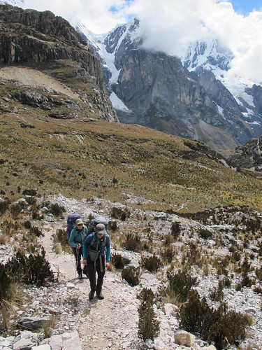
A question I’m often asked question is ‘what’s the best place you’ve been?’ It’s one that riles many cyclists but has always been easy for me to answer. Back in February 2011 I spent nine days hiking inside the Grand Canyon, Arizona, U.S.A., an experience that quickly became one of the most magical of my life. However, having recently spent eight days hiking Peru’s Cordillera Huayhuash I think I have a new winner. A relatively small range at just 30km (18.6 miles) long, the Huayhuash houses six 6,000 m (20,000 ft) peaks, twenty-eight 5,500 m (18,000 ft) summits, several 5,000 m (16,400 ft) passes and very few inhabitants; it’s the perfect adventure playground. I was lucky enough to head out into the range accompanied by three other cyclists. My hiking partner and room-mate Alex Krauss (an Austrian cyclist who is riding north from Ushuaia) and I joined British friends Neil and Harriet Pike. Team Pike have pretty much combed this area of Peru for hiking and biking trails and hiked the Huayhuash before, last September. More knowledgeable than most local guides no one should leave home in Peru without a Pike in tow.
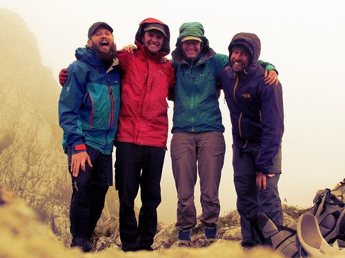
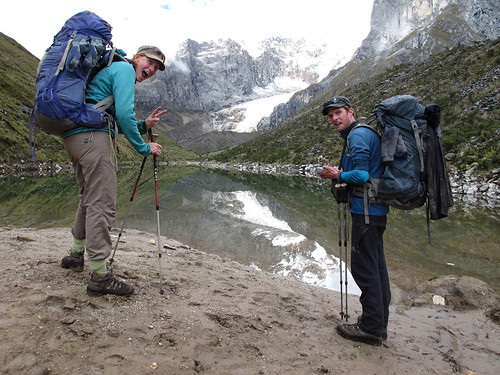
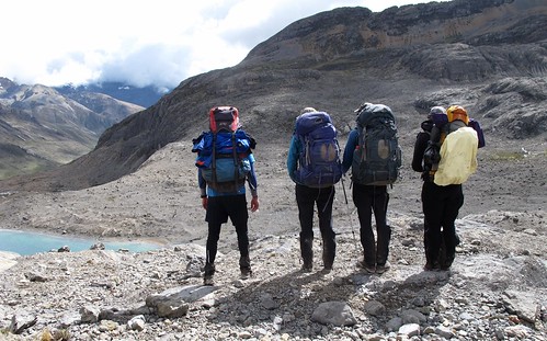
Happy Huayhuash hikers from right to left… Alex, Harriet, Neil and myself
The majority of long distance cyclists these days keep up some sort of blog or website. It’s standard practice. But how many have two? Very few. You have to either be pretty exceptional or have an enormous ego to justify two. Humble adventure heroes Neil and Harriet Pike have two websites; their exploits could justify three. Their pioneering and bold Andes by Bike routes will form the basis of my next few months travel south while their personal Pikes on Bikes blog gives invaluable tidbits on the art of lightweight bike adventure. These guys are the very definition of gnarly rough riders. Colossal figures in the minds of today’s South American dirt road adventure bicyclists. In the Puna of NW Argentina they have rejuvenated the old Alpine tradition of cycling to the base of intimidating peaks before climbing. And in the Cordillera Blanca they have completed over 140 routes in the last year alone. Their humble style adds to the mystique of a couple who through the power of the internet had already managed to win my utmost respect. Now I’ve spent weeks larking and laughing with them that respect has turned to love.
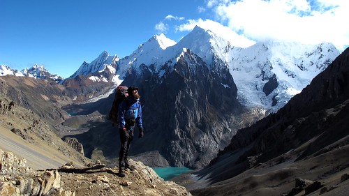
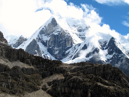
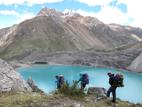
Taking in some sun on Paso Jurau (5,053 m, 16 578 ft) backed by one of the Huayhuash’s most dramatic vistas: Nevado Sarpo (6.127 m, 20,102 ft), Nevado Siula Grande (6.344 m, 20,814 ft) and Nevado Yerupaja (6.617 m, 21,709 ft)
With its sharp snow encrusted peaks, hanging glaciers, milky blue lakes and enticing valleys you’d be hard pressed to find a more beautiful place to hike than the Cordillera Huayhuash. Handicapped with a heavy pack and chest infection the hiking can at points be tough but in general it’s not really that challenging an exploration. Unfortunately however this divine gift to humanity has become a must tick box on the Israeli travelling schedule. Our journey was at times accompanied by a hideous sprawling mass of 24 Israeli’s complete with too few guides, too little experience and virtually no respect for the local people and environment. Every campsite in the range has toilets, usually porcelain, flush-able and clean. Yet these ignorant beasts insist on shitting anywhere they please; by water sources, on the trail, against people’s homes and even right next to their own tents! It’s disgusting and has to be seen to be believed. I’m just relieved we were hiking at the beginning of the season, at the end the place must be one shit storm of a mess. Neil and Harriet commented on this issue in their post from last year aptly entitled ‘Huayhuash: The Shit‘.
Despite the shittiness hiking the Huayhuash is a treat and privilege. Here is our story on the range…
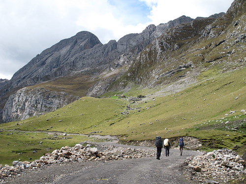
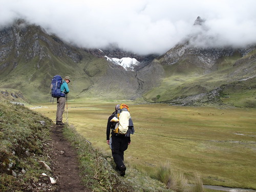
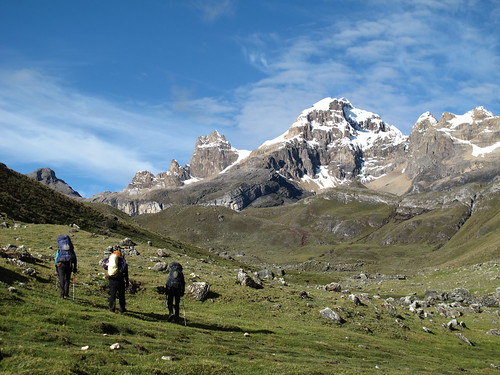
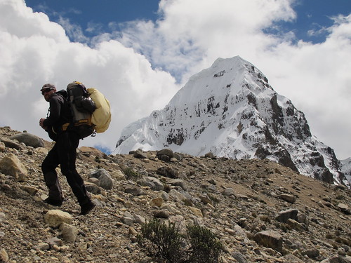
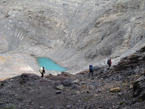
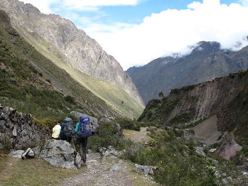
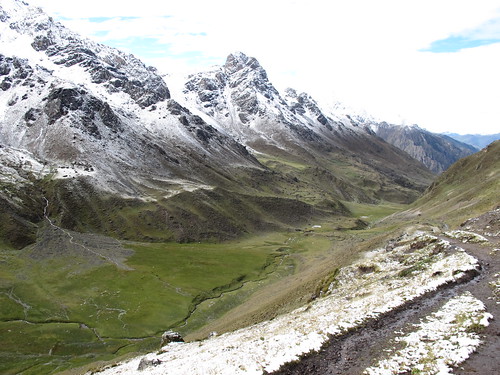
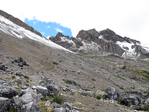
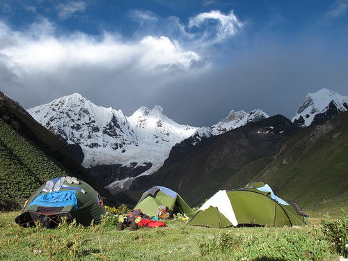
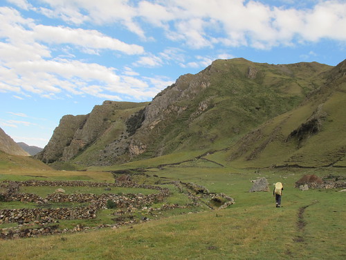
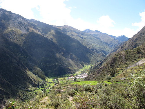
A couple of hours bus journey from the relaxing little town of Chiquián and we reach Llamac in time to snatch a lift most of the way up the mine road with some workers. That leaves only a relaxing few miles warm up to camp
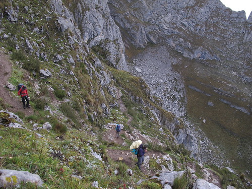
Next morning it’s straight out the traps with a trudge and clamber up to our first pass

Cold and windy, Cacananpunta Pass (4,690 m, 15,387 ft) isn’t the most comfortable place to hang out… unless maybe if you’re a dog

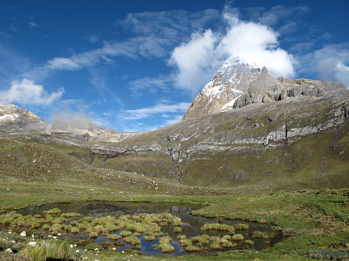
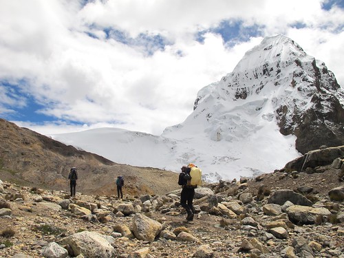
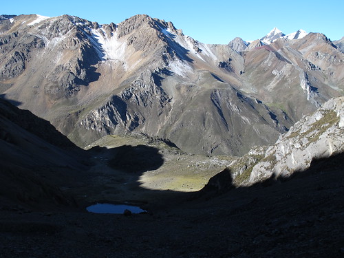
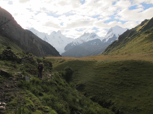
From the pass at Cacananpunta we leave the path to detour via Laguna Mitococha which nestles invitingly at the base of the Jirishanca Norte glacier. Above this tower Nevado Mituraju (5,750 m, 18,865 ft) and Nevado Jirishanca (6,094 m, 19,993 ft)
A much needed lunch stop later we rejoin the main path and start the ascent to Paso de Carhuac pass (4,650 m, 15,256 ft)
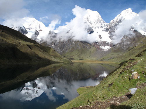
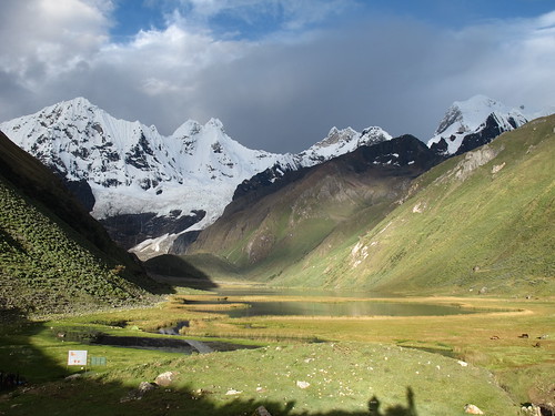
Having crested Paso de Carhuac pass we descend through cold hail to camp at Lake Carhuacocha (4.138 m, 13,576 ft). When morning comes and the clouds lift the true majesty of our camp hits hard. From left to right: Siula Grande (6,344 m, 20,814 ft), Yerupaja (6,635 m, 21,768 ft), Yerupaja Chico (6,121 m, 20,082 ft)
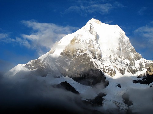
There’s nowt better than morning light on snowy peaks! Nevado Yerupaja (6,635 m, 21,768 ft)
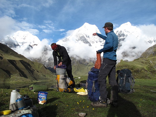
Arriving in camp the evening before Alex and I collapse into our tents exhausted. Thankfully Harriet ‘Florence Nightingale’ Pike was on hand to cook us up some noodles and we wake up the next day fully rejuvenated
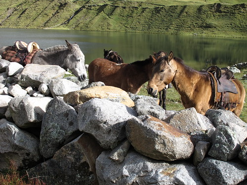
On our way out of camp we pass through Israeli city which formed the evening before across the lake from us. Their steeds wait to start work no doubt wondering how many hapless hikers they’ll be carrying that day
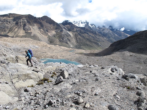
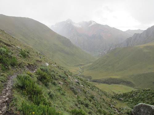
Leaving Lake Carhuacocha behind, we’re soon back into rhythm…
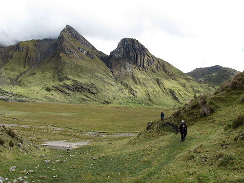
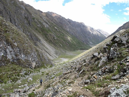
… and forging our way up the Quebrada Gangrajanca valley

The secret to good hiking is to look strong, if you look strong you’ll be strong. Make up your own mind as to whether Alex looks strong
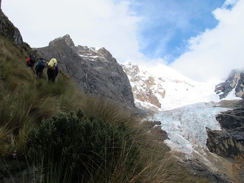
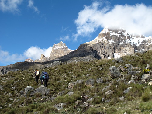
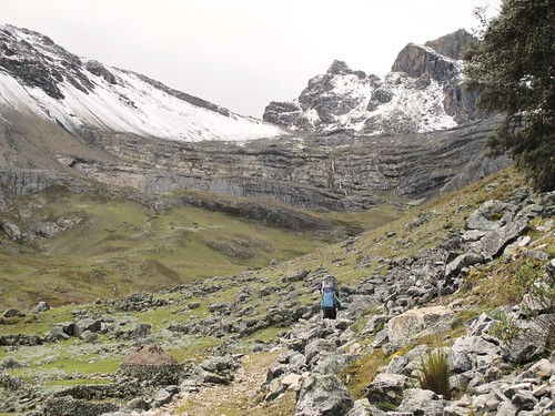
Massive and beautiful faces entice us up the valley…
… past increasingly picturesque lakes…
… until we start the steep climb up and out under the watchful eye of Siula Grande (6,344 m, 20,814 ft)
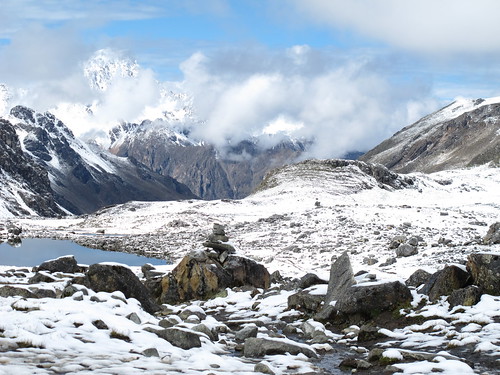
Sarapo (6.127 m, 20,102 ft) and the Sarapo glacier are a constant source of fascination on the plodding climb…
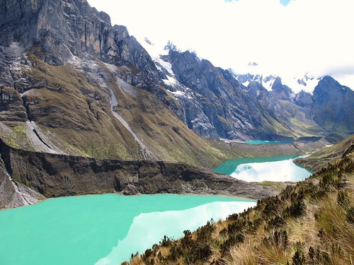
… as are the 3 Lakes; Laguna Quesillococha, Laguna Siula and Laguna Gangrajana,
After a quick lunch stop we resume our climb up to Siula Pass. Siula Grande (6,344 m, 20,814 ft) looks on
Siula Grande (6,344 m, 20,814 ft) and Siula Chico 6,265 m. 20,554 ft)
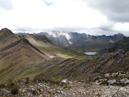
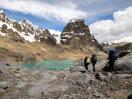
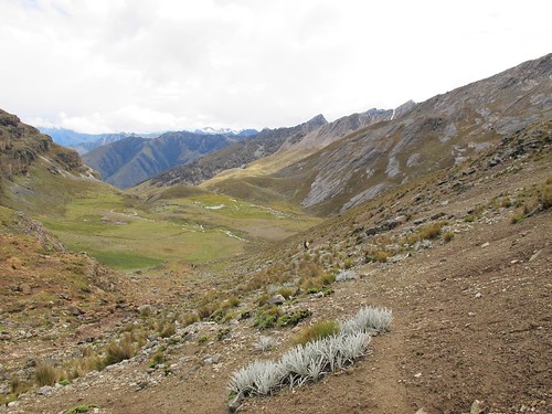
One of the things that continually draws me back to the mountains is the thrill of quickly changing views. The whole world changes with the crest of a pass and with it I experience an enormous surge of euphoria. It’s an addiction that Siula Pass (4800 m, 15,748 ft) feeds in revealing a mass of new colors and possibilities
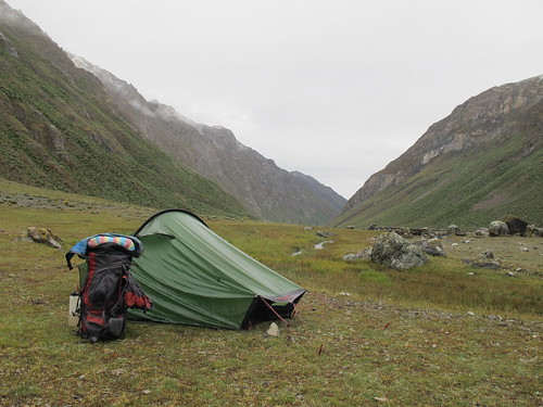
A wet and spongy descent delivers us into Huayhuash camp…
… where we wake up to a glorious morning
Trapecio (5.653 m, 18,547 ft) dominates as we hike the main route up valley for a while before…
…turning off onto a lesser trodden path for the climb towards Trapecio Punta (5,010 m, 16,400 ft)
Up and up we go…
… until Trapecio (5.653 m, 18,547 ft) seems more imposing than big…
… and the pass appears
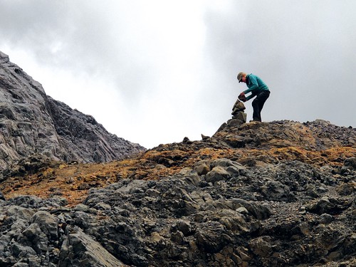
At these kind of altitudes I enjoy a rest. The Pikes on the other hand go potty, running around with camera’s and rocks in a frenzy of excitement. Here Harriet leaves her mark with a heavy-duty cairn, probably destined to sit above Trapecio Punta for many years to come

Eventually the flying Pikes reign themselves in and we enjoy a few minutes relaxation on Trapecio Punta (5,010 m, 16,400 ft) before snow comes in and we start to descend
It’s a barren scene on the other side of the pass with Puscanturpa (5,652 m, 18,543 ft) holding guard over a series of bright glacial lakes
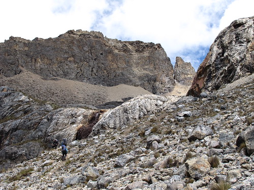
Down and down we go…
Until we’re staring Puscanturpa (5,652 m, 18,543 ft) in the face
A clamber around the corner and we’re gazing over the afternoon descent to camp
As Harriet makes light work of climbing up the valley we’re supposed to be climbing down…
… Alex takes a rest and sucks in the scenery
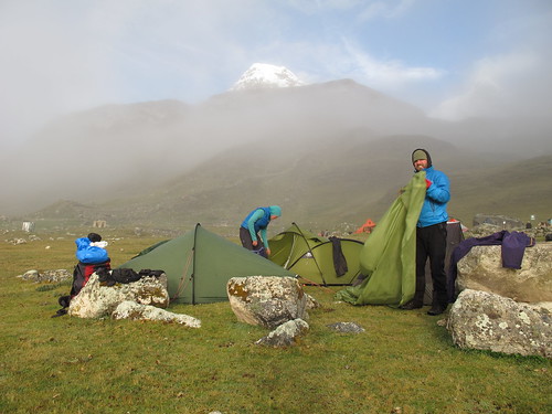
Eventually Elefante camp appears beneath us and we’re just able to get down and pitch before a terrific hail storm hits
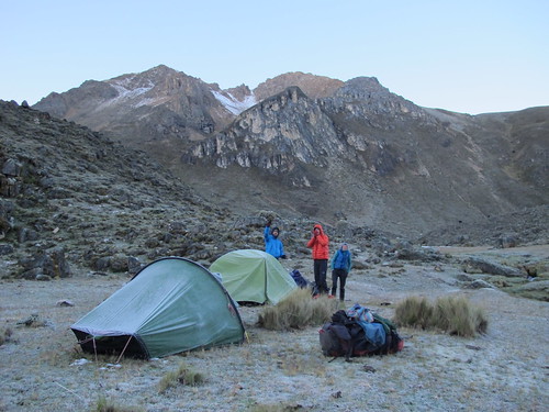
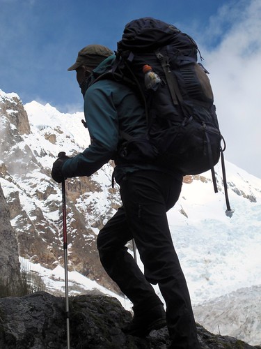
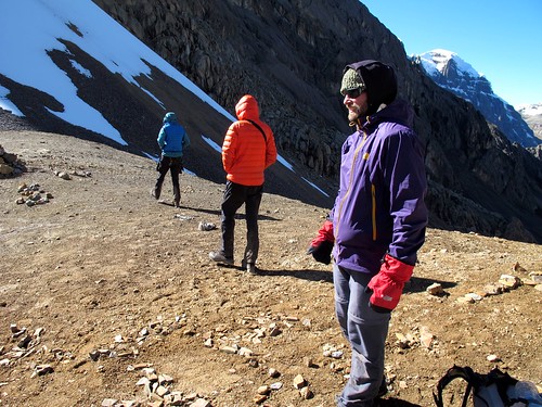
Frost bejeweled tents get packed away cold and heavy the next morning as the Pikes insist on an early start. In an awesome show of fitness they then proceed to power prance the steep slopes towards Paso Jurau (5,053 m, 16,578 ft)
Alex and I take things a bit slower stalling to take photos back down the way we’ve climbed
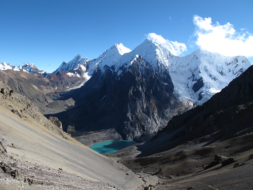
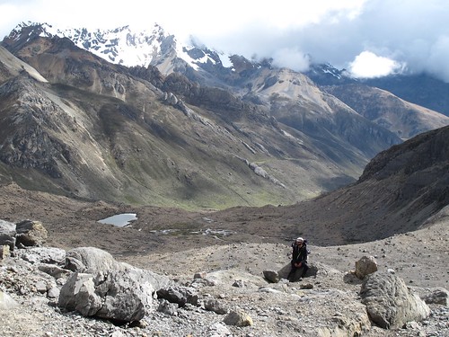
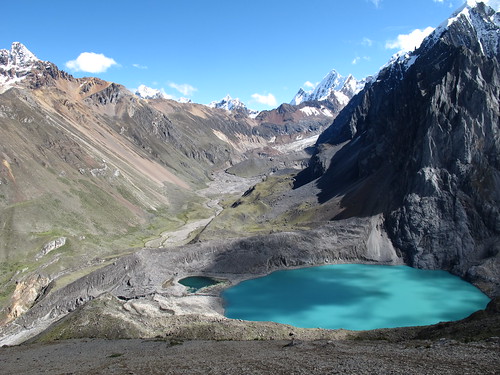
A good half hour after the Pikes we arrive on Paso Jurau (5,053 m, 16,578 ft) and everything becomes clear. Chest heaving, I stand and stare at the most incredible mountain vista I can remember. Nevado’s Sarapo (6,127 m, 20,102 ft) Siula Grande (6,344 m, 20,814 ft) and Yerupaja (6,617 m, 21,709 ft) dominate the vibrant Laguna Juraucocha

Life doesn’t get much better than this!
Paso Jurau (5,053 m, 16,578 ft) has an otherworldly feel. Standing proud in one of the most beautiful locations imaginable, its gravel is mysteriously groomed and there is undoubtedly something spiritual in the air
After a while of marveling the chill starts to bite and it’s time to go down

Descending towards Laguna Juraucocha feels like walking towards the light
Siula Grande is famous as the mountain on which Simon Yates cut climbing partner Joe Simpson free to fall into mountaineering folklore. ‘Touching the Void’ tells of Joe’s dramatic escape from certain death. The two climbers hiked up this valley back in 1985 to set their base camp behind a giant bolder that can be seen here at the top left of the valley

Our story isn’t quite as dramatic as Joe Simpsons. The most frightening thing that happened to us was that Alex once thought he’d lost his hat… he hadn’t
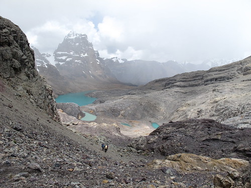
Where’s Harriet? The closer we get to Laguna Juraucocha the brighter it becomes
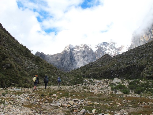
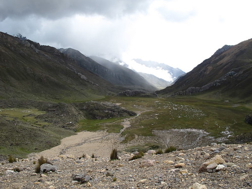
From Laguna Juraucocha we drop into the head of the valley we’ll descend the next day. It’s only a short walk down to Cutatambo camp where the weather keeps us pinned for the afternoon
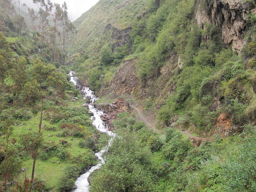
Leaving a sodden Cutatambo camp the next morning we start a relaxing descent down the Rio Calinca valley
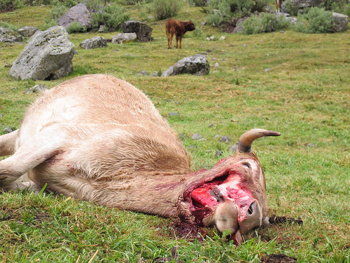
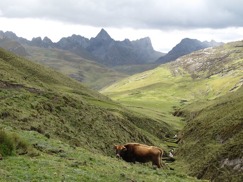
Save for Condors it’s rare to see much wildlife around these parts so chancing upon three foxes devouring this poor cow was quite something. Sadly her calves have to fend for themselves now
Years on a bike in Latin America is the perfect way to desensitize a vegetarian against animal dismemberment and decay to we continue on our merry way down the Rio Calinca valley

The path leads to Huayllapa (3,490 m, 11,450 ft), the only resupply point on route
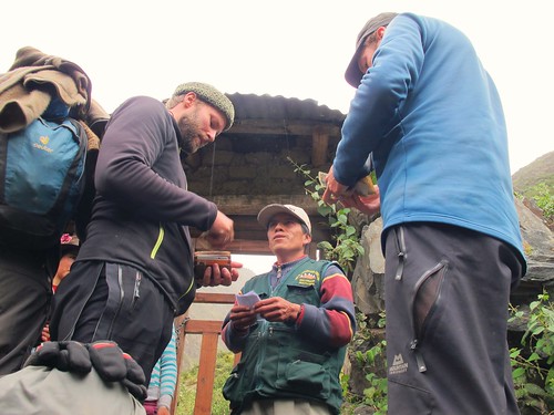
Before entering Huayllapa we have to pay our community tax. Tourists have to pay each of the communities whose lands we cross in the Huayhuash. This money contributes to the upkeep of the trails and campsites and ensures our security while in the area. It’s a slightly ad hoc system which is open to abuse but if you know what you’re doing it’s fine. In all it costs about £50 ($80) to do the circuit, which strikes me as a pretty good deal
Striding into Huayllapa we only have one thing on our minds… egg and chips!

Gorging on egg and chips morphs into watching Real Madrid destroy Bayern Munich in the Champions League semi final on a fuzzy TV in a dark tienda (Photo © Alex Krauss)
Reality eventually bites back and we endure a dull climb in sometimes heavy rain to Incahuain Camp

The rain persists through the night at Incahuain Camp. When we rise the next morning everything above us is white, we we’re pretty much riding the snow-line

So it’s into a wintry wonderland we hike…
… temporarily leaving the green behind in the valley below…
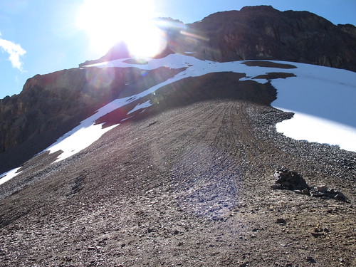
… as we stride up to Tapush Punta (4,770 m, 15,650 ft)
The snowy pass is soon a memory as we drop quickly down to Gashpampa…
… and turn to face our second challenge of the day, Punta Yaucha (4,840 m, 15,879 ft)

Before long we’re back into plodding mode…
… until things flatten out slightly just below the pass. A barrage of large hailstones greet our arrival at the top.
After a brief period hunkered down against the hail we decide to shelve more adventurous plans in favor of taking the conventional way down the other side into the waiting valley
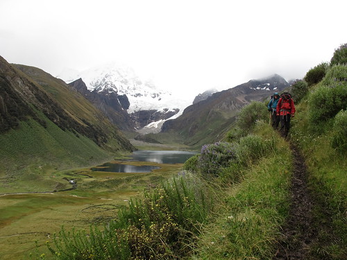
The rain follows us all the way down to camp at Laguna Jahuacocha (4,050 m, 13,287 ft)
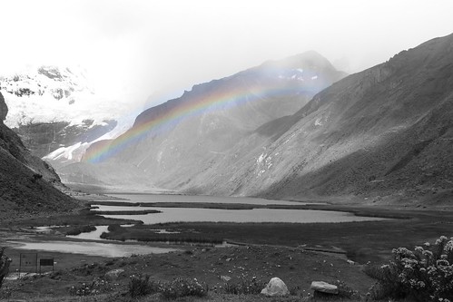
But then the sun fights back. After a brief rainbow war the rain backs down and…
… we’re treated to a gorgeous evening in camp as light riots off Rondoy (5,970 m, 19,587 ft), Jirishanca (6,126 m, 20,098 ft), Yerupaja Chico (6,121 m, 20,082 ft) and Yerupaja (6,635 m, 21,768 ft)
These are the kind of mountains you could stare at for a lifetime, they evolve as the light changes…
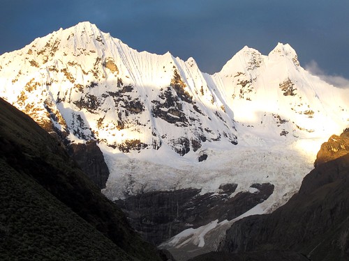
… afternoon turning to evening on Nevados Rondoy and Jirishanca

Once the light shows over it’s time to refuel in preparation for… photo © Alex Krauss
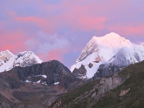
… another episode in the morning. Yerupaja (6,635 m, 21,768 ft) the ranges highest peak
By the time Alex and I leave our tents the Pike are already long gone up an alternative route. So we head off down the valley as a duo…
… leaving the high peaks of the Huayhuash behind…

… we traverse up out of the valley

One last look back…
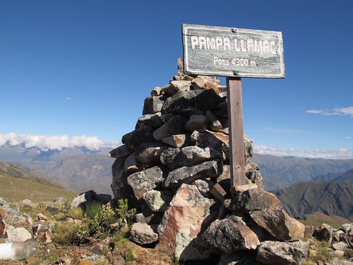
… before cresting the Pampa Llamac pass (4,300 m, 14,108 ft)
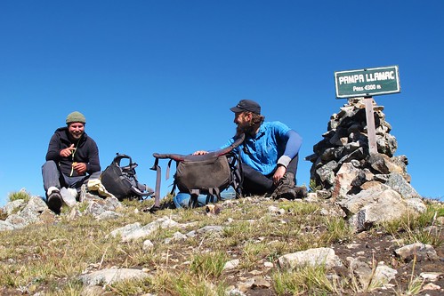
After treating ourselves to a short break…

… we take on the long descent down into the heat…
… of Llamac. Despite arriving slightly late we still manage to get the once daily bus out of town to Chiquian. From there we bus back to Huaraz to be reunited with Neil and Harriet who somehow manage to beat us home

Hi Nathan, I’ve been following your blog for a while in preparation for my own journey from Alaska heading south. Great story and pics. I hiked there 17 years ago and was the first gringo the locals had seen for 8 months. How quickly things change. Still an amazing place.
Thanks Brad. 17 years ago… mmm… I suspect you didn’t have to climb over mounds of tourist shit then! I’ve been keeping tabs on you too. Have a great time in Alaska. I landed there 4 years ago today.
No tourist shit at all, it was not known about back then. The only source of info prior to the boom of the internet was Bradt Guidebooks. And yes enjoying Alaska so far.
This hike is the stuff of my dreams! Your photos are just stunning! What an epic adventure! Thanks for sharing for us humble folk around the world sitting on our asses!
I’d forgotten about Alex losing his hat. Indeed a terrible moment.
Power prancing?! That was sky running mate!
Love you too, despite your insistence on including imperials.
x
‘Sky running’… that’s why you’re writing the book buddy!
Those pics are sick. Gorgeous!!! I am however a little offended… Are u telling me 6f doesn’t make the list as one of the most amazing places you’ve ever been?!? Lane and I are quite hurt… I mean the haircut alone!! PFFT! 😉
Pingback: Huaraz to Oyon: Weak, Wobbly and a little Woeful | Velo Freedom - Cycling South·
Pingback: Cordillera Huayhuash circuit trek·